Elkins Township, Washington County, Arkansas
| Township of Elkins | |
|---|---|
| Township | |
 Location of Elkins Township in Washington County | |
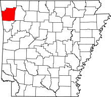 Location of Washington County in Arkansas | |
| Coordinates: 36°01′00.8″N 94°01′32.4″W / 36.016889°N 94.025667°WCoordinates: 36°01′00.8″N 94°01′32.4″W / 36.016889°N 94.025667°W | |
| Country |
|
| State |
|
| County | Washington |
| Area | |
| • Total | 2.6 sq mi (7 km2) |
| • Land | 2.6 sq mi (7 km2) |
| • Water | 0.0 sq mi (0 km2) 0% |
| Elevation | 1,234 ft (376 m) |
| Population (2000)[1] | |
| • Total | 1,251 |
| • Density | 480/sq mi (190/km2) |
| Time zone | CST (UTC-6) |
| • Summer (DST) | CDT (UTC-5) |
| Area code(s) | 479 |
| GNIS feature ID | 2406950 |
| U.S. Geological Survey Geographic Names Information System: Elkins Township, Washington County, Arkansas | |
The Township of Elkins is one of thirty-seven townships in Washington County, Arkansas, USA.[1] As of the 2000 census, its total population was 1,251.
Geography
According to the United States Census Bureau, Elkins Township covers an area of 2.6 square miles (6.7 km2); all land.[1]
Cities, towns, villages
Cemeteries
The township contains Stokenbury Cemetery.
Major routes
References
- United States Census Bureau 2008 TIGER/Line Shapefiles
- United States Board on Geographic Names (GNIS)
- United States National Atlas
- 1 2 3 "Township of Elkins, Washington County, Arkansas." U.S. Census Bureau. Breakdown. Retrieved January 24, 2011.
External links
 |
Richland Township | Fayetteville Township | Richland Township | |
| Richland Township | |
Richland Township | ||
| ||||
| | ||||
| Richland Township | Durham Township | Richland Township |
This article is issued from Wikipedia - version of the 9/10/2013. The text is available under the Creative Commons Attribution/Share Alike but additional terms may apply for the media files.