Summers, Arkansas
| Summers, Arkansas | |
|---|---|
| Unincorporated community | |
|
A local church building built by Independent Baptists | |
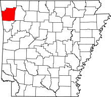
 Summers, Arkansas Summers' position in Arkansas. | |
| Coordinates: 35°58′52″N 94°29′30″W / 35.98111°N 94.49167°WCoordinates: 35°58′52″N 94°29′30″W / 35.98111°N 94.49167°W | |
| Country |
|
| State |
|
| County | Washington |
| Elevation | 362 m (1,188 ft) |
| Time zone | Central (CST) (UTC-6) |
| • Summer (DST) | CDT (UTC-5) |
| Zip code | 72769 |
| Area code(s) | 479 |
| GNIS feature ID | 78496 |
| U.S. Geological Survey Geographic Names Information System: Summers, Arkansas | |

Summers is an unincorporated community in far western Washington County, Arkansas, United States. Considered a postal designation (ZIP code 72769). the population of the Summers ZCTA was 942[1] at the 2000 census. It is part of the Fayetteville–Springdale–Rogers, AR-MO Metropolitan Statistical Area.
Geography
Summers is in the Ozarks on the southern edge of the Springfield Plateau near the Boston Mountains. At the intersection with ![]() Arkansas Highway 59 about 2.5 miles (4.0 km) east of the Oklahoma border, Summers is the first postal stop on
Arkansas Highway 59 about 2.5 miles (4.0 km) east of the Oklahoma border, Summers is the first postal stop on ![]() U.S. Route 62 after entering Arkansas.
U.S. Route 62 after entering Arkansas.
History
- The town of Summers has a building that was once a hotel and is now a private residence that has been featured in many Route 66 and Americana architectural forums.
- Its name comes from John T. Summers, one of the original postmasters for the community. The community was earlier named Coon Creek.[2]
Notable people
- George W. Bond, educator born in Summers in 1891, president of Louisiana Tech University from 1928 to 1936[3]
References
- ↑ U.S. Census Bureau Fact Finder Fact Sheet for Zip Code Tabulation Area 72769
- ↑ "History of Washington County, Arkansas." Shiloh Museum, Springdale, Arkansas. pp. 754.
- ↑ Ruston Daily Leader, June 17, 1936, pp. 1, 4
This article is issued from Wikipedia - version of the 2/11/2014. The text is available under the Creative Commons Attribution/Share Alike but additional terms may apply for the media files.