Tadepalle mandal, Guntur district
| Tadepalle mandal తాడేపల్లి మండలం | |
|---|---|
| Mandal | |
|
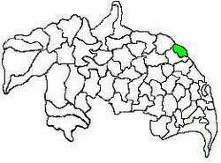
Mandal map of Guntur district showing Tadepalle mandal (in green) | |
 Tadepalle mandal Location in Andhra Pradesh, India | |
| Coordinates: 16°28′49″N 80°37′07″E / 16.48028°N 80.61861°ECoordinates: 16°28′49″N 80°37′07″E / 16.48028°N 80.61861°E | |
| Country | India |
| State | Andhra Pradesh |
| District | Guntur |
| Headquarters | Tadepalle |
| Government | |
| • Body | Mandal Parishad |
| • Tehsildar | M.Sivaramakrishna |
| Population (2011)[1] | |
| • Total | 99,428 |
| Languages | |
| • Official | Telugu |
| Time zone | IST (UTC+5:30) |
| Vehicle registration | AP |
Tadepalle mandal is one of the 57 mandals in Guntur district of the Indian state of Andhra Pradesh. It is under the administration of Guntur Revenue Division and the headquarters are located at Tadepalle town.[2][3] The mandal is situated on the banks of Krishna River, bounded by Thullur and Mangalagiri mandals.[4] from the mandal are under the jurisdiction of Andhra Pradesh Capital City.[5]
Demographics
As of 2011 census, the mandal had a population of 99,428. The total population constitute, 49,662 males and 49,766 females —a sex ratio of 1002 females per 1000 males. 10,456 children are in the age group of 0–6 years, of which 5,336 are boys and 5,120 are girls. The average literacy rate stands at 75.06% with 66,781 literates.[1]
Administration
The three villages namely, Undavalli, Penumaka, a portion of Tadepalle municipality covering Nulakapet, Dolas Nagar etc. forms part of the new Amaravati and the mandal is a part of Andhra Pradesh capital region, under the jurisdiction of APCRDA.[6] The mandal is under the control of a tahsildar and the present tahsildar is M.Sivaramakrishna.[7] Tadepalle mandals one of the 3 mandals under Mangalagiri (Assembly constituency), which in turn represents Guntur (Lok Sabha constituency) of Andhra Pradesh.[8]
Towns and villages
As of 2011 census, the mandal has 9 settlements, which includes 2 towns, 1 out growth and 6 villages. Tadepalle (M) and Vaddeswaram (CT) are the two towns and Undavalli (OG) is the out growth to Tadepalle (M). Tadepalle (OG) is fully included in Tadepalle (M), while Vaddeswaram village is included in Vaddeswaram (CT). Undavalli (Rural) is fully included in Undavalli (OG).[2][9]
The settlements in the mandal are listed below:
- Chirravuru
- Gundimeda
- Ippatam
- Kolanukonda
- Kunchanapalle
- Penumaka
- Tadepalle (M)
- Undavalli (OG)
- Vaddeswaram (CT)
- Notes
- (M) denotes a Municipality
- (CT) denotes a Census town
- (OG) denotes an Out Growth[10]
Education
The mandal plays a major role in education for the rural students of the nearby villages.The primary and secondary school education is imparted by government, aided and private schools, under the School Education Department of the state.[11] As per the school information report for the academic year 2015–16, the mandal has more than 11,466 students enrolled in over 71 schools.[12][13]
See also
References
- 1 2 "Census 2011". The Registrar General & Census Commissioner, India. Retrieved 8 August 2014.
- 1 2 "Guntur District Mandals" (PDF). Census of India. pp. 63,107. Retrieved 11 February 2015.
- ↑ "Adminsistrative divisions of Guntur district" (PDF). guntur.nic.in. Retrieved 8 August 2014.
- ↑ "Mandals in Guntur district". aponline.gov.in. Retrieved 8 August 2014.
- ↑ "Jurisdiction of Andhra Pradesh Capital City" (PDF). Andhra Nation. Municipal Administration & Urban Development Department. Retrieved 9 February 2015.
- ↑ "District wise mandals and villages covered in Krishna and Guntur districts" (PDF). Andhra Pradesh Capital Region Development Authority. Government of Andhra Pradesh. Retrieved 23 September 2015.
- ↑ "List of Tahsildars working in Guntur District as on 19.06.2014" (PDF). Guntur District Official Website. National Informatics Centre. p. 1. Retrieved 8 September 2014.
- ↑ "Delimitation of Parliamentary and Assembly Constituencies Order, 2008" (PDF). Election Commission of India. p. 22. Retrieved 22 October 2014.
- ↑ "Sub-District Details of Guntur District". The Registrar General & Census Commissioner, India. Retrieved 8 August 2014.
- ↑ "Abbreviations used". censusindia.gov.in. Retrieved 26 May 2014.
- ↑ "School Education Department" (PDF). School Education Department, Government of Andhra Pradesh. Retrieved 7 November 2016.
- ↑ "R1.1 SCHOOL INFORMATION".
- ↑ "Student Information Report". Commissionerate of School Education. Child info 2015-16, District School Education - Andhra Pradesh. Retrieved 8 November 2016.
 |
Thullur mandal | Krishna River | Krishna River | |
| Mangalagiri mandal | |
Krishna River | ||
| ||||
| | ||||
| Mangalagiri mandal | Mangalagiri mandal | Krishna River |