Teikhang
| Teikhang | |
|---|---|
| village | |
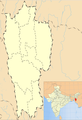 Teikhang  Teikhang Location in Mizoram, India | |
| Coordinates: 23°56′58″N 93°18′09″E / 23.9495253°N 93.3023856°ECoordinates: 23°56′58″N 93°18′09″E / 23.9495253°N 93.3023856°E | |
| Country | India |
| State | Mizoram |
| District | Champhai |
| Block | Ngopa |
| Elevation | 1,531 m (5,023 ft) |
| Population (2011) | |
| • Total | 1,744 |
| Time zone | IST (UTC+5:30) |
| PIN | 796290 |
| 2011 census code | 271294 |
Teikhang is a village in the Champhai district of Mizoram, India. It is located in the Ngopa R.D. Block.< PRECIPITATION AT TEIKHANG IN SIALKAL RANGE, MIZORMA INDIA In the year 2015, at Teikhang Village, the amount of rainfall is measured by the students of Govt. Teikhang High School. One of the students, Vanlalmuanpuia had completed to take complete data for rainfall in the locality. In his data, the rainfall is approximately correct to as it was believed and estimated by the other agents like accuweather.com.
The data collected by him was as below: SN Date Ini. reading Final reading Amount of rainfall:
1 12/06/2015 0 300 300 ml 2 19/06/2015 300 600 300 ml 3 26/06/2015 600 1100 500 ml 4 03/07/2015 1100 1300 200 ml 5 10/07/2015 1300 2160 860 ml 6 17/07/2015 2160 2280 120 ml 7 24/07/2015 2280 2305 25 ml 8 31/07/2015 2305 2320 15 ml 9 07/08/2015 2320 2530 210 ml 10 14/08/2015 2530 2730 200 ml 11 21/08/2015 2730 2985 255 ml 12 28/08/2015 2985 3035 50 ml 13 04/09/2015 3035 3085 50 ml 14 11/09/2015 3085 3165 80 ml 15 18/09/2015 3165 3600 435 ml 16 25/09/2015 3600 3865 265 ml 17 02/10/2015 3865 4225 360 ml 18 09/10/2015 4225 4975 750 ml 19 16/10/2015 4975 5475 500 ml 20 23/10/2015 5475 5475 0 ml 21 30/11/2015 5475 5690 215 ml 22 06/11/2015 5690 5890 200 ml
5890 ml
Note: Before the starting date and after Nov 6, 2015, no rainfall had been recorded. So, during this year, the rainfall can be estimated from the above data only. Calculation: Average rainfall per month = = 490.83 ml per month[1]
Demographics
According to the 2011 census of India, Teikhang has 325 households. The effective literacy rate (i.e. the literacy rate of population excluding children aged 6 and below) is 87.35%.[2]
| Total | Male | Female | |
|---|---|---|---|
| Population | 1744 | 868 | 876 |
| Children aged below 6 years | 337 | 180 | 157 |
| Scheduled caste | 0 | 0 | 0 |
| Scheduled tribe | 1725 | 859 | 866 |
| Literates | 1229 | 629 | 600 |
| Workers (all) | 893 | 455 | 438 |
| Main workers (total) | 850 | 434 | 416 |
| Main workers: Cultivators | 750 | 382 | 368 |
| Main workers: Agricultural labourers | 11 | 4 | 7 |
| Main workers: Household industry workers | 20 | 6 | 14 |
| Main workers: Other | 69 | 42 | 27 |
| Marginal workers (total) | 43 | 21 | 22 |
| Marginal workers: Cultivators | 23 | 16 | 7 |
| Marginal workers: Agricultural labourers | 1 | 0 | 1 |
| Marginal workers: Household industry workers | 6 | 0 | 6 |
| Marginal workers: Others | 13 | 5 | 8 |
| Non-workers | 851 | 413 | 438 |
References
- ↑ "Mizoram villages" (PDF). Land Records Information Systems Division, NIC. Retrieved 2015-08-22.
- 1 2 "District Census Handbook - Champhai" (PDF). 2011 Census of India. Directorate of Census Operations, Mizoram. Retrieved 2015-08-22.