Sumter County, Florida
| Sumter County, Florida | ||
|---|---|---|
 | ||
| ||
 Location in the U.S. state of Florida | ||
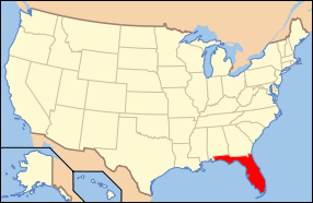 Florida's location in the U.S. | ||
| Founded | January 8, 1853 | |
| Named for | Thomas Sumter | |
| Seat | Bushnell | |
| Largest community | The Villages | |
| Area | ||
| • Total | 580 sq mi (1,502 km2) | |
| • Land | 547 sq mi (1,417 km2) | |
| • Water | 33 sq mi (85 km2), 5.7% | |
| Population (est.) | ||
| • (2015) | 118,891 | |
| • Density | 170.8/sq mi (66/km²) | |
| Congressional district | 11th | |
| Time zone | Eastern: UTC-5/-4 | |
| Website |
www | |

Sumter County is a county located in the state of Florida, United States. As of September 2016, the population according to county officials is 118,577.[1] It has the oldest median age (62.7 years) of any US county.[2] Its county seat is Bushnell,[3] and the largest community is The Villages.
Sumter County comprises Metropolitan Statistical Area of The Villages, which is included in the Orlando-Deltona-Daytona Beach, FL Combined Statistical Area.
Sumter County was affected by the massive Florida tornado outbreak of February 2, 2007, and declared a state of emergency.
History
Sumter County was created in 1853.[4] It was named for General Thomas Sumter, a general in the American Revolutionary War.[5] The county in the past, and to this day by some, is nicknamed "Hog County" most likely because it is home to a large population of wild hogs. Hog hunting is still a favorite pastime of locals in the more rural portions of the county.
Although long extremely rural, in recent years Sumter County has sustained an exceptionally large increase in population, almost solely due to the expansion of The Villages retirement complex, a significant portion of which is in the county. This has dramatically changed the demographics of the county and has brought in significant income.
Geography
According to the U.S. Census Bureau, the county has a total area of 580 square miles (1,500 km2), of which 547 square miles (1,420 km2) is land and 33 square miles (85 km2) (5.7%) is water.[6]
Adjacent counties
- Marion County - north
- Lake County - east
- Polk County - southeast
- Pasco County - southwest
- Citrus County - west
- Hernando County - west
Demographics
| Historical population | |||
|---|---|---|---|
| Census | Pop. | %± | |
| 1860 | 1,549 | — | |
| 1870 | 2,952 | 90.6% | |
| 1880 | 4,686 | 58.7% | |
| 1890 | 5,363 | 14.4% | |
| 1900 | 6,187 | 15.4% | |
| 1910 | 6,696 | 8.2% | |
| 1920 | 7,851 | 17.2% | |
| 1930 | 10,644 | 35.6% | |
| 1940 | 11,041 | 3.7% | |
| 1950 | 11,330 | 2.6% | |
| 1960 | 11,869 | 4.8% | |
| 1970 | 14,839 | 25.0% | |
| 1980 | 24,272 | 63.6% | |
| 1990 | 31,577 | 30.1% | |
| 2000 | 53,345 | 68.9% | |
| 2010 | 93,420 | 75.1% | |
| Est. 2015 | 118,891 | [7] | 27.3% |
| U.S. Decennial Census[8] 1790-1960[9] 1900-1990[10] 1990-2000[11] 2010-2015[12] | |||
As of the census[13] of 2000, there were 53,345 people, 20,779 households, and 15,043 families residing in the county. The population density was 98 people per square mile (38/km²). There were 25,195 housing units at an average density of 46 per square mile (18/km²). The racial makeup of the county was 82.60% White, 13.78% Black or African American, 0.51% Native American, 0.41% Asian, 0.05% Pacific Islander, 1.16% from other races, and 1.49% from two or more races. 6.29% of the population were Hispanic or Latino of any race.
There were 20,779 households out of which 18.80% had children under the age of 18 living with them, 60.90% were married couples living together, 8.40% had a female householder with no husband present, and 27.60% were non-families. 23.50% of all households were made up of individuals and 13.80% had someone living alone who was 65 years of age or older. The average household size was 2.27 and the average family size was 2.62. According to U. S. News & World Report over half the population of Sumter County are now senior citizens.[14]
In the county the population was spread out with 16.10% under the age of 18, 5.90% from 18 to 24, 23.30% from 25 to 44, 27.30% from 45 to 64, and 27.40% who were 65 years of age or older. The median age was 49 years. For every 100 females there were 113.10 males. For every 100 females age 18 and over, there were 113.90 males.
The median income for a household in the county was $32,073, and the median income for a family was $36,999. Males had a median income of $27,346 versus $21,145 for females. The per capita income for the county was $16,830. About 9.60% of families and 13.70% of the population were below the poverty line, including 26.00% of those under age 18 and 7.70% of those age 65 or over. According to The Daily Commercial, Sumter County's unemployment rate as of March 2009 is 13.2 percent.
In March 2016, the county's unemployment rate was 6.7%.
Government and infrastructure
Federal Correctional Complex, Coleman of the Federal Bureau of Prisons (BOP) is located in the county.
It includes:
- Federal Correctional Institution, Coleman Low (FCI Coleman Low)
- Federal Correctional Institution, Coleman Medium (FCI Coleman Medium)
- United States Penitentiary I, Coleman (USP Coleman I)
- United States Penitentiary II, Coleman (USP Coleman II)
Transportation
Railroads
CSX operates one rail line within the county. Amtrak formerly provided passenger rail service to Wildwood, but the stop was terminated in late 2004.[15] Other lines have existed in the past, most notably one from Coleman southeast towards Auburndale in Polk County, part of which includes the General James A. Van Fleet State Trail in Mabel. Amtrak ran along this line until 1988. Another line ran from Croom in Hernando County to Center Hill. Today, part of it is a Forest Road in Withlacoochee State Forest north of the Sumter Rest Area on I-75. A fourth one was part of the Orange Belt Railway, which ran from Trilby in Pasco County to Sylvan Lake in Seminole County. This runs along the south side of State Road 50 east of Tarrytown.
Major roads
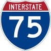 Interstate 75 runs north and south across the western and northern part of the county, with interchanges at County Roads 476B & 673(Exit 309), SR 48 (Exit 314) CR 470(Exit 321), Florida's Turnpike(Exit 328), and SR 44(Exit 329).
 Florida's Turnpike runs north and south from Southeastern and Central Florida. Only two interechanges exist in the county; US 301(Exit 304) and at the northern terminus at I-75(unmarked Exit 309), in Wildwood. Plans are currently under way to reconstruct the interchange, by combining it with I-75 & SR 44.
 U.S. Route 301 is the main local road through Sumter County, running southwest to northeast.
 State Road 44 runs east and west through the northern part of the county from Rutland into Lake County.
 County Road 470: runs east and west from SR 44 near the Sumter-Citrus County Line along the west side of Lake Panasoffkee, then briefly joins US 301 in Sumterville before heading east again towards Lake County.
 State and County Road 48 runs mostly east and west through Central Sumter County. It spans from Floral City in Citrus County to Howey-in-the Hills in Lake County as a county road, while the segment in Bushnell between I-75(Exit 314) and US 301 remains a state road. Between the western terminus and US 301, it is also shared by the DeSoto Trail.
 County Road 476: East-West Bi-County road running from Nobleton in Hernando County to Webster. The road spans as far west as US 19 along the Chassahowitzka National Wildlife Refuge.
 State Road 50 runs east and west across the southern part of the county from Withlacoochee State Forest in Hernando County through Tarrytown and Mabel before entering Lake County.
 State Road 471 runs north and south from Polk County north of US 98 into US 301 in Sumterville.
 County Road 475: Two north-south roads that were previously one until Interstate 75 was built. One section spans from SR 48 in Bushnell to CR 470 on the southeast corner of Exit 321 on I-75 in Lake Panasoffkee. The other starts at SR 44 in Wildwood west of Exit 329 on I-75 and crosses the Marion County line towards Ocala.
- County Road 466-A:
 County Road 466:
 County Road 462:
 County Road 476-B:
Scenic Sumter Heritage Byway
The Sumter County Chamber of Commerce, the cities of Webster and Bushnell, the Sumter County government, businesses, community leaders, veterans’ groups, and individuals worked to have 62 miles of road in Sumter County designated by the state of Florida as a Florida Scenic Byway.[16] On September 1, 2010, the Scenic Sumter Heritage Byway was designated a candidate for the Florida Scenic Highway Program.[17] The Scenic Sumter Heritage Byway became the 24th highway to be designated a Florida Scenic Highway by the Florida Department of Transportation in June 2013.[16] Points of interest along the route include the Dade Battlefield State Historic Site, the Sumter County Farmer’s Market, Lake Panasoffkee, the Florida National Cemetery.[18] On January 25, 2014, community leaders, supporters of the byway, and Assistant Secretary of the Florida Department of Transportation Brian Blanchard cut the ribbon to the highway at the Dade Battlefield State Historic Site in Bushnell.[19]
Public Transportation
Sumter County operates Sumter County Transit, which operates three fixed-route services, as well as paratransit service.[20]
Education
Sumter District Schools operates district public schools in Sumter County.
The Villages Charter Schools is a K-12 charter school in unincorporated northern Sumter County in The Villages CDP.[21] Children are eligible to attend the charter school if one or both of their parents work for The Villages.[22]
Among other schools in the county is South Sumter Middle School, a junior high school for students in grades 6-8, and Lake-Sumter State College has a campus in Sumterville that serves the community.
Libraries
Sumter County has 5 branches serving its community as well as a Lake-Sumter State College campus library that is open to the public.
- Bushnell Public Library
- E.C. Rowell Public Library
- Panasoffkee Community Library
- Villages Public Library (Belvedere)
- Villages Public Library (Pinellas Plaza)
- Lake-Sumter State College Library (Sumterville)
The Sumter County Library Services began servicing the Wahoo, Center Hill, Linden, Croom-A-Coochee areas through the county’s Library on Wheels program in 2008.[23]
Communities
Cities
Unincorporated communities
See also
References
- ↑ "Sumter County expected to welcome 3,000 new residents next year". Villages-News. September 28, 2016. Retrieved October 18, 2016.
- ↑ "Age and Sex Composition: 2010" (PDF). United States Census Bureau. Retrieved October 20, 2014.
- ↑ "Find a County". National Association of Counties. Retrieved 2011-06-07.
- ↑ Publications of the Florida Historical Society. Florida Historical Society. 1908. p. 34.
- ↑ Frisaro, Freida Ratliff (Feb 21, 1988). "Indian heritage runs deep throughout Central Florida". Ocala Star-Banner. p. 63. Retrieved 6 June 2015.
- ↑ "US Gazetteer files: 2010, 2000, and 1990". United States Census Bureau. 2011-02-12. Retrieved 2011-04-23.
- ↑ "County Totals Dataset: Population, Population Change and Estimated Components of Population Change: April 1, 2010 to July 1, 2015". Retrieved July 2, 2016.
- ↑ "U.S. Decennial Census". United States Census Bureau. Retrieved June 16, 2014.
- ↑ "Historical Census Browser". University of Virginia Library. Retrieved June 16, 2014.
- ↑ "Population of Counties by Decennial Census: 1900 to 1990". United States Census Bureau. Retrieved June 16, 2014.
- ↑ "Census 2000 PHC-T-4. Ranking Tables for Counties: 1990 and 2000" (PDF). United States Census Bureau. Retrieved June 16, 2014.
- ↑ "State & County QuickFacts". United States Census Bureau. Retrieved June 16, 2014.
- ↑ "American FactFinder". United States Census Bureau. Retrieved 2011-05-14.
- ↑ http://realestate.msn.com/blogs/post--7-states-that-are-getting-younger
- ↑ "St. Petersburg Times". Loss of Amtrak service shouldn't derail Dade City. Retrieved 2004-10-29.
- 1 2 South Lake Press Staff (Jun 21, 2013). "Sumter wins Florida Scenic Byway recognition". South Lake Press. Retrieved Mar 9, 2014.
- ↑ Florida Scenic Highway Program (Jun 2010). "FSHP Designated and Eligible Scenic Highway Information" (PDF). Florida Scenic Highway Program. Retrieved Mar 9, 2014.
- ↑ Locklear, Brenda (Feb 4, 2014). "Byways to benefit businesses, communities". Sumter County Times. Retrieved Mar 9, 2014.
- ↑ Sumter County Times Staff (Jan 22, 2014). "Out and About". Sumter County Times. Retrieved Mar 9, 2014.
- ↑ http://sumtercountyfl.gov/index.aspx?NID=184
- ↑ "Welcome." The Villages Charter Schools. Retrieved on December 11, 2008.
- ↑ "Charter-in-the-Workplace." The Villages Charter Schools. Retrieved on December 11, 2008.
- ↑ Sumter County Board of County Commissioners (2008). "Annual Report 2008" (PDF). Sumter County Board of County Commissioners. Retrieved Mar 9, 2014.
External links
| Wikimedia Commons has media related to Sumter County, Florida. |
| Wikisource has the text of an 1879 American Cyclopædia article about Sumter County, Florida. |
Government links/Constitutional offices
- Sumter County Board of County Commissioners
- Sumter County Supervisor of Elections
- Sumter County Property Appraiser
- Sumter County Sheriff's Office
- Sumter County Tax Collector
Special districts
Judicial branch
- Public Defender, 5th Judicial Circuit of Florida serving Citrus, Hernando, Lake, Marion, and Sumter counties
- Office of the State Attorney, 5th Judicial Circuit of Florida
- Circuit and County Court for the 5th Judicial Circuit of Florida
Museum and Library Resources
- Photographs From the State Library & Archives of Florida.
- The Sumter County Times, the local newspaper for Sumter County, Florida fully and openly available in the Florida Digital Newspaper Library
Business and Visitor Information
 |
Marion County | | ||
| Citrus County and Hernando County | |
Lake County | ||
| ||||
| | ||||
| Pasco County | Polk County |
Municipalities and communities of Sumter County, Florida, United States | ||
|---|---|---|
| Cities | | |
| CDPs | ||
| Unincorporated communities |
| |
Coordinates: 28°43′N 82°05′W / 28.71°N 82.08°W