Tionesta, California
| Tionesta | |
|---|---|
| Unincorporated community | |
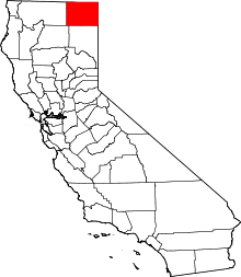
 Tionesta  Tionesta Location in California | |
| Coordinates: 41°38′46″N 121°19′41″W / 41.64611°N 121.32806°WCoordinates: 41°38′46″N 121°19′41″W / 41.64611°N 121.32806°W | |
| Country | United States |
| State | California |
| County | Modoc County |
| Elevation[1] | 4,278 ft (1,304 m) |
Tionesta is an unincorporated community in Modoc County, California.[1] It is located on the former Great Northern Railway Bieber Line, 2 miles (3.2 km) northwest of Timber Mountain,[2] at an elevation of 4278 feet (1304 m).[1]
Tionesta has feature ID 1660004 in the U.S. Geological Survey, National Geographic Names database. The latitude and longitude for the development are 41°38′46″N 121°19′41″W / 41.64611°N 121.32806°W on the Perez, California 7.5-minute quadrangle. The area is part of ZIP Code 96134, which includes other nearby locales such as Tulelake, Newell, and Lava Beds National Monument, and area code 530. The BNSF Railway Gateway Subdivision track runs through this area.
Tionesta is the southern gateway to Lava Beds National Monument. Nearby is the Eagle's Nest R.V. Park for motor home, trailer and tent camping. Next door is the Hawks Nest Cabins & RV Park. The Timber Mountain Store sells provisions and serves cold beverages. Tionesta also provides access to the Medicine Lakes highlands and Glass Mountain. Numerous outdoor activities are available, including camping, hiking, exploring the area and the over 300 caves at Lava Beds. Tule Lake Segregation Center and Captain Jack's Stronghold are two of the many historical attractions also to be found in the surrounding area.
Modoc County Air Pollution Control District records show a facility named PG&E Tionesta Compressor Station, (permit #97-01) located at 41°38′57″N 121°19′06″W / 41.64917°N 121.31833°W on State Route 139. In public filings, the facility is also identified as Compressor Station Number 14B. This is a major geographic feature of the area.
History
The name, which comes from the Tionesta Forest in Pennsylvania, was bestowed by a lumber company executive.[2]
Nearby
The Tionesta post office, located 2 miles (3.2 km) east of Tionesta, operated from 1939 to 1955.[2]
Politics
In the state legislature, Tionesta is in the 1st Senate District, represented by Republican Dave Cox, and in the 2nd Assembly District, represented by Republican Jim Nielsen.
Federally, Tionesta is in California's 1st congressional district, represented by Republican Doug LaMalfa.[3]
References
- 1 2 3 U.S. Geological Survey Geographic Names Information System: Tionesta, California
- 1 2 3 Durham, David L. (1998). California's Geographic Names: A Gazetteer of Historic and Modern Names of the State. Clovis, Calif.: Word Dancer Press. p. 425. ISBN 1-884995-14-4.
- ↑ "California's 1st Congressional District - Representatives & District Map". Civic Impulse, LLC. Retrieved March 3, 2013.