Mullinavat
| Mullinavat Muileann an Bhata | |
|---|---|
| Town | |
 Mullinavat Location in Ireland | |
| Coordinates: 52°22′00″N 7°10′00″W / 52.366667°N 7.166667°WCoordinates: 52°22′00″N 7°10′00″W / 52.366667°N 7.166667°W | |
| Country | Ireland |
| Province | Leinster |
| County | County Kilkenny |
| Area | |
| • Town | 78.6 km2 (30.3 sq mi) |
| Population (2006) | |
| • Urban | 1,533 |
| Time zone | WET (UTC+0) |
| • Summer (DST) | IST (WEST) (UTC-1) |
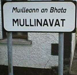
Mullinavat (Irish: Muileann an Bhata, meaning "the Mill of the Stick") is a town in south County Kilkenny, Ireland. Its main industries are tourism and agriculture. It has a renowned sporting history, particularly in hurling.
Location and access
The village is located centrally on the former N9 national primary road from Waterford to Dublin. The town was by-passed in July 2010 when the Kilkenny–Waterford section of the M9 opened. There are link roads to New Ross and Piltown from the town centre. The town is bounded by Killahy in the upper end of the parish to Fahee (Fahy) in the lower end, a distance of 7.4 miles (11.9 km). In the west lies Rathnasmolagh with Listrolin at the eastern extremity, a distance of 6.6 miles (10.6 km). The town measures 48.84 square miles (78.6 kilometres).
Rail
Mullinavat railway station opened on 21 May 1853 and finally closed on 1 January 1963.[1]
Bus
The town is served by Bus Éireann, thanks to its location on the main Dublin - Waterford route 4. Bus Éireann's services run from 07:10 and finish at 18.10 on the Dublin Route, and 00.40 until 22.10 on the Waterford route, but are subject to change. Online timetable.[2] Despite campaigns, there is no commuter service to Waterford from Mullinavat, as it is located in the Kilkenny county area.
History
Name
The town's name in Irish translates as 'The Mill of the Stick'. Tradition has it that the name was derives from a mill which could only be approached by means of a rough stick over the Glendonnel River, where the bridge on the main road is now, beside the Garda Barracks.
Historical parishes
Mullinavat originally comprised the civil parishes of Kilbecan, Kilahy and Rossinan, all located in the barony of Knocktopher. Prior to 1842, Mullinavat formed one Ecclesiastical parish with Kilmacow. In the middle of the 18th century, Mullinavat consisted of only a few houses. In 1801, the number of houses was 35, with 158 inhabitants. The erection of a church here in 1805 had a decided influence on the general improvement of the village, which in 1841 had 110 inhabited houses. In 1871, the population of Mullinavat was 531. The parish church of Kilbecan was in use up to 1830, then used as a Protestant church. It was dedicated to St. Becan, Bishop and confessor whose feast day is set down as May 27.
The first chapel built in the Mullinavat district since the reformation, stood in the townland of Deerpark. It was called the 'Chapel of Scart' as it was situated close to the townsland of Scart. Its site is on the west side of the Waterford Road, near the Blackwater River. It is handed down that whenever the river became so swollen as to be impassable, the people at the Clonassey and Ballyda side used to assemble on Sunday mornings on the western bank, opposite the chapel. They would kneel and pray while the people on the other side had mass within the chapel walls. This chapel was in use for a long period and was abandoned in 1772. The next chapel called 'The Chapel of Park' stood at the village of Park. It was closed in 1805, having been used as the district chapel for '33 years, the term of our Lord's life on Earth'. The present chapel of Mullinavat was built in 1805, during the pastoral term of rev. Marum p.p., of Kilmacow. It stands in the townsland of Garrandarragh ('oak grove'). It was renovated in 1960. The first chapel in Bigwood was in use from about 1787 to 1824. Another chapel was built in 1842 by the contributions of the people of neighbouring townlands in the parishes of Mullinavat, Kilmacow, Glenmore and Slieverue. This chapel was in use until 1966 when the present church was erected during the pastoral term of Very Rev. Canon D. Hughes.
Killahy
The parish of Killahy was mentioned at the time of the suppression of the religious houses in 1540. The parish church of Killahy was about 33 ft (10 m). long, and 19½ ft. wide. It was dedicated to the exaltation of the Holy Cross on September 14. About two or three hundred yards to the southeast, in the townland of Red Acres, there was a holy well known as the 'Well of the Holy Cross'. It was frequented for devotional purposes until about 1850, when it was destroyed by its owner. An annual graveyard Mass is celebrated in June every year at the site.
Rossinan
The parish of Rossinan was also mentioned at the suppression of the religious houses. The original Irish name Rois Seanain meaning 'The point or Wood of St. Synan or Senanus'. Whether this saint in identical with his namesake, the patron of the adjoining parish of Kilmacow is unknown. The parish church of St. Synan was situated in Rossinan, close to the left bank of the Blackwater River. No trace of the church now remains as the railway line from Waterford to Kilkenny was constructed over it around 1850. The graveyard met the same fate, as the road from Waterford to Mullinavat runs through the centre of it.
Mullinavat today
Notable features
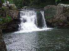
- Tory Hill (Ir. Sliabh gCruinn, 'Round Mountain') rising to a height of 966 ft (294 m). above sea level, is said to have derived its name from an outlaw named Edmund Den, who flourished in this locality around the year 1700. There is a pattern held each year on Tory Hill on the second Sunday of July. This is locally called 'Tory Hill Sunday' and 'Frocchans Sunday'. It never was a religious celebration, but merely consisted of the people of the neighbourhood gathering to pick the wild berries called 'Frocchans'. In the Holy Year of 1950 a large cross was erected on the summit of the hill, and since then the rosary had been said by the people who gather beneath the cross.
- Listrolin, Clonassey and Ballinacooley. Named after 'Fort of the Wren', Listrolin is situated in the heart of the Walsh Mountains, overlooking Mullinavat, Mooncoin, Kilmacow and Tempelorum. The mountains were acquired by the Walsh family when they landed in Ireland with Strongbow. This vast area was controlled by the family until Oliver Cromwell invaded the area. The Mountains were full of castles owned by the family's descendants. See Inchicarron Castle, Clonassey Castle and Ballinacooley Castle. In 1946 the townslands of Clonassy, Listrolin and Rochestown were annexed from Mooncoin, becoming part of Mullinavat district parish. The ancient church of this district stood in Listrrolin, in the laneway leading over the Assy River to Ballinacoaley. Around the year 1850, the remains of the old church and graveyard were uprooted and tilled.
- Clonassey Castle is located in the second field from the road under John Murphy's house. The remains of the foundations are to be seen in what is still known as 'The Castle Field'. Its last occupant was Robert Walsh, Member of Parliament for County Kilkenny in the parliament of 1689. He was slain at the siege of Limerick in 1691.
- Inchicarron Castle is located where Simon Dwyer now lives and was occupied by John Mac Walter Walsh, a poet of considerable merit. He was known as 'Tatter Jack Walsh', Tatter meaning father or head of the clan. Unfortunately only one of his poems survives, but the name of the best-known Walsh dance tune is still 'Tatter Jack Walsh'. In his old age, his property was confiscated, and he betook himself to friends in Lismatigue. He is believed to have lived on the moat where R. Dalton now lives. There he died in 1660 and was buried in Kilbeacon cemetery.
Sport:GAA club history
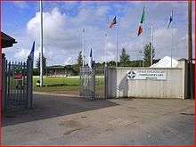
Mullinavat Football Club was formed in 1887, the first year of official Gaelic Athletic Association. championships. Gaelic football was the dominant sport in the parish until around 1913 when a hurling team from Mullinavat entered the Junior championship for the first time. The present pitch was bought in 1953 for £590. Fr. Joseph Gallavan C.C. was the driving force behind the purchase and development of the field.
Economy
The main economic activities are services (hardware and machinery hire), tourism, construction and agriculture. Public services include health centres and the Teagasc centre which provides agricultural training and advice. Local authority planning rulings forbid large-scale development in the town.
Mulinavat is in an area of productive land, which has been exploited for agriculture and forestry. The main tillage crops are barley, oats, wheat, miscanthus and maize. Production of sugarbeet stopped with the closure of the Carlow sugar plant. Dairy farming is also important with most milk being supplied to the Glanbia group. There is also beef or livestock farming. Minority forms of farming include bull breeding (Hereford) and poultry. Many farmers in the area work in a mixture of all the above areas in typical mixed farms. Some farmers in Mullinavat are active participants in the EU's Rural environmental protection scheme REPS[3] scheme to maintain and improve the rural environment for both commercial farming and the natural habitats.
Large scale afforestation is undertaken by Coillte, the national forestry company. Forestry has been important in Mullinavat since the 1960s, mainly conifer plantations. In recent years, Government policy has promoted the development of deciduous woodland using species such as oak, beech and ash.
See also
- List of towns and villages in Ireland
- Ireland, Slavery & Anti Slavery: 1612–1865 by Nini Rodgers. ISBN 978-0-333-77099-3
References
- ↑ "Mullinavat station" (PDF). Railscot - Irish Railways. Retrieved 2007-11-19.
- ↑
- ↑ "Dept of Agriculture & Food- Rural Environment Protection Scheme - Basics and Contacts". Agriculture.gov.ie. Archived from the original on November 24, 2007. Retrieved 2008-10-27.
Places in County Kilkenny | ||
|---|---|---|
| Towns | 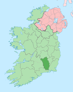 | |
| Villages |
| |
| Townlands | ||
| ||