Toulon–Hyères Airport
| Toulon–Hyères Airport Aéroport de Toulon – Hyères | |||||||||||||||
|---|---|---|---|---|---|---|---|---|---|---|---|---|---|---|---|
 | |||||||||||||||
| IATA: TLN – ICAO: LFTH | |||||||||||||||
| Summary | |||||||||||||||
| Airport type | Public / Military | ||||||||||||||
| Operator | CCI Du Var | ||||||||||||||
| Serves | Toulon, France | ||||||||||||||
| Location | Hyères | ||||||||||||||
| Elevation AMSL | 13 ft / 4 m | ||||||||||||||
| Coordinates | 43°05′50″N 006°08′46″E / 43.09722°N 6.14611°ECoordinates: 43°05′50″N 006°08′46″E / 43.09722°N 6.14611°E | ||||||||||||||
| Website |
toulon-hyeres | ||||||||||||||
| Maps | |||||||||||||||
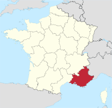 Provence-Alpes-Côte d'Azur in France | |||||||||||||||
 LFTH Location in Provence-Alpes-Côte d'Azur region | |||||||||||||||
| Runways | |||||||||||||||
| |||||||||||||||
| Statistics (2014) | |||||||||||||||
| |||||||||||||||
Toulon–Hyères Airport (French: Aéroport de Toulon – Hyères, IATA: TLN[2], ICAO: LFTH) is an airport serving Toulon, a commune in the Var department of the Provence-Alpes-Côte d'Azur region in France. The airport is located 3 kilometres (2 mi) southeast of Hyères,[1] and 19 kilometres (12 mi) east of Toulon.[3] It is also known as Hyères Le Palyvestre Airport. In 2010, the airport served 502,974 passengers.. The airport opened in 1966.[4]
Facilities
The airport resides at an elevation of 13 feet (4 m) above mean sea level. It has two paved runways: 05/23 measures 2,120 by 45 metres (6,955 ft × 148 ft) and 13/31 is 1,902 by 46 metres (6,240 ft × 151 ft).[1]
Military use
This airport is shared with the French Naval Aviation (Aéronautique navale), as Hyeres Naval Air Base (la base d'aviation navale d'Hyères). Several squadrons of helicopters and fixed-wing aircraft are based on the south-western side of the airport.
Airlines and destinations
| Airlines | Destinations |
|---|---|
| Air France | Paris–Orly |
| Corendon Dutch Airlines | Charter: Amsterdam |
| Flybe | Seasonal: Southampton[5] |
| HOP! | Seasonal: Lyon |
| Nouvelair | Seasonal charter: Tunis |
| Transavia | Seasonal: Rotterdam |
| TUIfly Belgium | Brest, Charleroi |
| Tunisair Express | Tunis |
| Volotea | Seasonal: Bordeaux |
References
- 1 2 3 LFTH – HYÈRES LE PALYVESTRE. AIP from French Service d'information aéronautique, effective 8 December 2016.
- ↑ "IATA Location Code Search (TLN – City: Toulon/Hyeres, Airport: La Palyvestre)". International Air Transport Association. Retrieved 22 December 2012.
- ↑ "Distance and heading from Toulon (43°08'00"N 05°55'00"E) to LFTH (43°05'50"N 06°08'46"E)". Great Circle Mapper. 22 December 2012.
- ↑ Hyères#Transportation
- ↑ http://airlineroute.net/2016/01/21/be-france-s16/
External links
![]() Media related to Toulon–Hyères Airport at Wikimedia Commons
Media related to Toulon–Hyères Airport at Wikimedia Commons
- Toulon–Hyères Airport (official site) (English)
- Aéroport de Toulon – Hyères (Union des Aéroports Français) (French)
- Aeronautical chart for LFTH at SkyVector
- Current weather for LFTH at NOAA/NWS
- Accident history for TLN at Aviation Safety Network