Grand Traverse County, Michigan
| Grand Traverse County, Michigan | |||
|---|---|---|---|
| |||
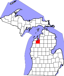 Location in the U.S. state of Michigan | |||
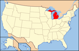 Michigan's location in the U.S. | |||
| Founded | 1851[1] | ||
| Named for | Grand Traverse Bay | ||
| Seat | Traverse City | ||
| Largest city | Traverse City | ||
| Area | |||
| • Total | 601 sq mi (1,557 km2) | ||
| • Land | 464 sq mi (1,202 km2) | ||
| • Water | 137 sq mi (355 km2), 23% | ||
| Population | |||
| • (2010) | 86,986 | ||
| • Density | 187/sq mi (72/km²) | ||
| Congressional district | 1st | ||
| Time zone | Eastern: UTC-5/-4 | ||
| Website |
www | ||

Grand Traverse County is a county located in the U.S. state of Michigan. As of the 2010 census, the population was 86,986.[2] The county seat is Traverse City.[3]
According to the United States Census Bureau, it is estimated that the population of Grand Traverse County in July 2015 was 91,636
Grand Traverse County is part of the Traverse City, MI Micropolitan Statistical Area, which also includes Benzie, Kalkaska, and Leelanau counties.
Interlochen, home of the Interlochen Center for the Arts is located in Green Lake Township.
History
In 1840 it was separated and originally named Omeena County. Grand Traverse County was organized by an act of the state legislature on April 7, 1851.[1] Grand Traverse is derived from a French phrase meaning "long crossing" and the county is so named because it is situated at the Grand Traverse Bay.[1][4] The first permanent settlement in the county was the mission now known as Old Mission.
Historical markers
There are twelve recognized Michigan historical markers in the county:[5] They are:
- City Opera House
- Congregation Beth El
- Fife Lake Union District No. 1 Schoolhouse
- Grand Traverse Bay
- Grand Traverse County Courthouse
- Hesler Log House
- Interlochen
- Ladies Library Association
- Novotny's Saloon[6]
- Park Place Hotel
- Traverse City Regional Psychiatric Hospital
- Friends of the Light (the former Traverse City Friends Church)
Geography
According to the U.S. Census Bureau, the county has a total area of 601 square miles (1,560 km2), of which 464 square miles (1,200 km2) is land and 137 square miles (350 km2) (23%) is water.[7] Grand Traverse County is considered to be part of Northern Michigan.
Adjacent counties
- Antrim County (northeast)
- Kalkaska County (east)
- Wexford County (south)
- Benzie County (west)
- Leelanau County (northwest)
- Manistee County (southwest)
Lakes
- Arbutus Lake
- Bass Lake
- Cedar Hedge Lake
- Christmas Tree Lake
- Coffield Lake
- Duck Lake (Wahbekaness)
- Dyer Lake
- Elk Lake (Largest in more than one county including Grand Traverse)
- Ellis Lake
- Fife Lake
- Fish Lake
- Green Lake (Wahbekanetta)
- High Lake
- Huellmantel Lake
- Long Lake (Largest in County)
- Lost Lake
- Mirror Lake
- Mud Lake
- Muncie Lake
- Pickerel Lake
- Rennie Lake
- Rush Pond
- Silver Lake (Deepest in County)
- Lake Skegemog
- Strombolis Lake
- Truax Lake
- Twin Lake
- Vandervoight Lake
Creeks
- Acme Creek
- Angell Creek
- Beitner Creek
- Campbell Creek
- Cedar Run
- Coleys Creek
- Desmond Creek
- Fife Outlet
- Fourmile Creek
- Gens Creek
- Harris Creek
- Headquarters Creek
- Kids Creek
- Kingsley Creek
- Mitchell Creek
- Neal Creek
- Orchard Valley Creek
- Rudhardt Creek
- Swainston Creek
- Vanderali (West) Creek
- Vanderlip (East) Creek
- Williamsburg Creek
- Woodland Creek
- Yuba Creek
Rivers
- Betsie River
- Boardman River (North and South branches)
- Little Betsie River
- Platte River
- South Skegemog River
Transportation
Air service
Grand Traverse County is served by Cherry Capital Airport, which is located near Traverse City. Grand Traverse County also has three smaller unpaved airports: Yuba Airport, Green Lake Airport, and the Acme Skyport
Major highways
County Roads
- CR 137
- CR 602
- CR 604
- CR 605
- CR 610
- CR 611
- CR 620
- CR 633
- CR 637
- CR 641
- CR 660
- CR 672
- CR 700
Demographics
| Historical population | |||
|---|---|---|---|
| Census | Pop. | %± | |
| 1860 | 1,286 | — | |
| 1870 | 4,443 | 245.5% | |
| 1880 | 8,422 | 89.6% | |
| 1890 | 13,355 | 58.6% | |
| 1900 | 20,479 | 53.3% | |
| 1910 | 23,784 | 16.1% | |
| 1920 | 19,518 | −17.9% | |
| 1930 | 20,011 | 2.5% | |
| 1940 | 23,390 | 16.9% | |
| 1950 | 28,598 | 22.3% | |
| 1960 | 33,490 | 17.1% | |
| 1970 | 39,175 | 17.0% | |
| 1980 | 54,899 | 40.1% | |
| 1990 | 64,273 | 17.1% | |
| 2000 | 77,654 | 20.8% | |
| 2010 | 86,986 | 12.0% | |
| Est. 2015 | 91,636 | [8] | 5.3% |
| U.S. Decennial Census[9] 1790-1960[10] 1900-1990[11] 1990-2000[12] 2010-2013[2] | |||
As of the census[13] of 2000, there were 77,654 people, 30,396 households, and 20,730 families residing in the county. The population density was 167 people per square mile (64/km²). There were 34,842 housing units at an average density of 75 per square mile (29/km²). The racial makeup of the county was 96.51% White, 0.40% Black or African American, 0.93% Native American, 0.49% Asian, 0.03% Pacific Islander, 0.54% from other races, and 1.09% from two or more races. 1.49% of the population were Hispanic or Latino of any race. 25.1% were of German, 11.3% English, 10.7% Irish, 8.4% American and 7.4% Polish ancestry according to Census 2000. 96.4% spoke English and 1.6% Spanish as their first language.
There were 30,396 households out of which 32.80% had children under the age of 18 living with them, 55.70% were married couples living together, 9.20% had a female householder with no husband present, and 31.80% were non-families. 25.00% of all households were made up of individuals and 9.00% had someone living alone who was 65 years of age or older. The average household size was 2.49 and the average family size was 2.99.
In the county the population was spread out with 25.40% under the age of 18, 7.90% from 18 to 24, 29.70% from 25 to 44, 24.00% from 45 to 64, and 13.10% who were 65 years of age or older. The median age was 38 years. For every 100 females there were 95.20 males. For every 100 females age 18 and over, there were 92.10 males.
The median income for a household in the county was $43,169, and the median income for a family was $51,211. Males had a median income of $34,796 versus $24,139 for females. The per capita income for the county was $22,111. About 3.80% of families and 5.90% of the population were below the poverty line, including 5.30% of those under age 18 and 5.90% of those age 65 or over.
Religion
Grand Traverse County is part of the Roman Catholic Diocese of Gaylord.[14]
Government
The county government operates the jail, maintains rural roads, operates the major local courts, keeps files of deeds and mortgages, maintains vital records, administers public health regulations, and participates with the state in the provision of welfare and other social services. The county board of commissioners controls the budget but has only limited authority to make laws or ordinances. In Michigan, most local government functions — police and fire, building and zoning, tax assessment, street maintenance, etc. — are the responsibility of individual cities and townships.
Elected officials
- Prosecuting Attorney: Bob Cooney
- Sheriff: Thomas Bensley
- County Clerk: Bonnie Scheele
- County Treasurer: Heidi Scheppe
- Register of Deeds: Peggy Haines
- Drain Commissioner: Kevin McElyea
- County Surveyor: Robert Mitchell
- Chancellor of Mental Health: Graph McCain
(information as of November 2008)
Politics
Grand Traverse County predominantly supports the Republican Party, particularly at the federal level.
In the 2008 presidential election, Republican candidate John McCain received 24,716 votes in the county (50.60% of the total) to Democrat Barack Obama's 23,258 (47.62%), even as Obama carried the state of Michigan by a double-digit margin.[15] McCain's margin of victory in the county was narrower than usual for a Republican candidate.
In 2004, Republican president George W. Bush received 27,446 votes in the county (59.42%) to Democrat John Kerry's 18,256 (39.52%).[16]
In 2000, Bush received 22,358 votes in the county (58.48%) to Democrat Al Gore's 14,371 (37.59%).[17]
Education
Grand Traverse county has five school districts:
- Forest Area Schools
- Elk Rapids Area
- Kingsley Public Schools
- The Children's House Montessori
- TCAPS, or Traverse City Area Public Schools
TCAPS is by far the largest district in the county, with 19 total schools, whereas Kingsley has 3, Woodland has 2, and Elk Rapids and the Children's House have 1 (Elk Rapids Area are mostly in Antrim County, and Forest Area is based in Kalkaska County). Below is a list of schools
List
| School Name | District | Address | Grades | Mascot |
|---|---|---|---|---|
| The Woodland | Forest Area | 7224 Supply Road | K-8 | Warriors |
| Fife Lake Elementary | Forest Area | 108 Pierce Street | K-5 | Warriors |
| The Children's House | The Children's House | 5365 N Long Lake Road | PreK-6 | N/A |
| Mill Creek Elementary | Elk Rapids Area | 9032 Old M-72 | PreK-5 | Elks |
| Kingsley Elementary School | Kingsley Public Schools | 402 Fenton Street | K-4 | Stags |
| Kingsley Middle School | Kingsley Public Schools | 403 Blair Street | 5-8 | Stags |
| Kingsley High School | Kingsley Public Schools | 7475 Kingsley Road | 9-12 | Stags |
| Silver Lake Elementary | TCAPS | 5858 Culver Road | PreK-5 | Seahawks |
| Westwoods Elementary | TCAPS | 1500 Fisher Road | PreK-5 | Wings |
| Courtade Elementary | TCAPS | 1111 Rasho Road | PreK-5 | Cougars |
| Blair Elementary | TCAPS | 1625 Sawyer Road | PreK-5 | Bobcats |
| Central Grade School | TCAPS | 301 7th Street | K-5 | Superstars |
| Eastern Elementary | TCAPS | 1600 Eastern Avenue | PreK-5 | |
| Old Mission Peninsula Elementary | TCAPS | 2699 Island View Road | PreK-5 | Panthers |
| Second Long Lake Elementary | TCAPS | 7600 N Long Lake Road | PreK-5 | Panthers |
| Willow Hill Elementary | TCAPS | 1250 Hill Street | PreK-5 | Hawks |
| Traverse Heights Elementary | TCAPS | 933 Rose Street | PreK-5 | Roadrunners |
| Cherry Knoll Elementary | TCAPS | 1800 3 Mile Road | PreK-5 | Wildcats |
| TCAPS Glenn Loomis Montessori | TCAPS | 1009 Oak Street | Toddler - 6 | Mercury |
| TCWMS (West Middle) | TCAPS | 3950 Silver Lake Road | 6-8 | Titans |
| TCEMS (East Middle) | TCAPS | 1776 3 Mile Road | 6-8 | Trojans |
| TCWHS (West High) | TCAPS | 5376 N Long Lake Road | 9-12 | Titans |
| TCCHS (Central High) | TCAPS | 1150 Milliken Drive | 9-12 | Trojans |
| TCH (Traverse City High - New Campus) | TCAPS | 3962 3 Mile Road | 6-12 | Mavericks |
Defunct TCAPS Schools
| School Name | Address |
|---|---|
| Sabin Elementary | 2075 Cass Road |
| Norris Elementary | 16540 Cherry Bend Road |
| Bertha Vos Elementary | 3723 Shore Road |
| Bertha Vos International School | 3723 Shore Road |
| First Long Lake Elementary | 7600 N Long Lake Road |
| Oak Park Elementary | 312 S Garfield Ave |
| Boardman School | 400 Webster Street |
| Interlochen Community School | 3113 M-137 |
Communities
See Also: List of communities in Grand Traverse County.
City
- Traverse City (county seat) (partially in Leelanau County)
Villages
- Buckley (mostly in Wexford County)
- Fife Lake
- Kingsley
Unincorporated Communities and Census-designated Places
- Acme
- Brookside
- Chums Corner
- Interlochen
- Karlin
- Monroe Center
- Summit City
- Traverse Heights
- Williamsburg
Ghost Towns
- Angell
- Bates
- Garfield
- Grawn
- Hardwood Acres
- Hodge
- Mayfield
- Mitchell
- Neahtawanta
- Old Mission Point
- Schell
- Tunk
- Westminster
- Wylie
Charter Townships
Townships
See also
- Omeena County, Michigan
- List of Michigan State Historic Sites in Grand Traverse County, Michigan
- National Register of Historic Places listings in Grand Traverse County, Michigan
References
- 1 2 3 "Bibliography on Grand Traverse County". Clarke Historical Library, Central Michigan University. Retrieved January 19, 2013.
- 1 2 "State & County QuickFacts". United States Census Bureau. Retrieved August 27, 2013.
- ↑ "Find a County". National Association of Counties. Retrieved 2011-06-07.
- ↑ Gannett, Henry (1905). The Origin of Certain Place Names in the United States. Govt. Print. Off. p. 141.
- ↑ "Michigan Historical Markers". michmarkers.com.
- ↑ "Old restaurant may take on new owners". Traverse City Record-Eagle. record-eagle.com.
- ↑ "2010 Census Gazetteer Files". United States Census Bureau. August 22, 2012. Retrieved September 21, 2014.
- ↑ "County Totals Dataset: Population, Population Change and Estimated Components of Population Change: April 1, 2010 to July 1, 2015". Retrieved July 2, 2016.
- ↑ "U.S. Decennial Census". United States Census Bureau. Retrieved September 21, 2014.
- ↑ "Historical Census Browser". University of Virginia Library. Retrieved September 21, 2014.
- ↑ "Population of Counties by Decennial Census: 1900 to 1990". United States Census Bureau. Retrieved September 21, 2014.
- ↑ "Census 2000 PHC-T-4. Ranking Tables for Counties: 1990 and 2000" (PDF). United States Census Bureau. Retrieved September 21, 2014.
- ↑ "American FactFinder". United States Census Bureau. Retrieved 2008-01-31.
- ↑ "The Diocese of Gaylord, Michigan : A Diocese of the Roman Catholic Church - Diocese of Gaylord". dioceseofgaylord.org.
- ↑ "Dave Leip's Atlas of U.S. Presidential Elections - State Data". uselectionatlas.org.
- ↑ "Dave Leip's Atlas of U.S. Presidential Elections - State Data". uselectionatlas.org.
- ↑ "Dave Leip's Atlas of U.S. Presidential Elections - State Data". uselectionatlas.org.
External links
| Wikimedia Commons has media related to Grand Traverse County, Michigan. |
- Grand Traverse County Website
- Grand Traverse County Amateur Radio Public Service Corps Website
- "Bibliography on Grand Traverse County". Clarke Historical Library, Central Michigan University. Retrieved January 19, 2013.
 |
Leelanau County | Grand Traverse Bay | Antrim County | |
| Benzie County | |
Kalkaska County | ||
| ||||
| | ||||
| Manistee County | Wexford County | Missaukee County |
Municipalities and communities of Grand Traverse County, Michigan, United States | ||
|---|---|---|
| City | | |
| Villages | ||
| Charter townships | ||
| General law townships | ||
| CDPs | ||
| Other unincorporated community | ||
| Footnotes | ‡This populated place also has portions in an adjacent county or counties | |
| Central cities | |
|---|---|
| Counties | |
| Geography | |
| Transportation | |
| Economy | |
Coordinates: 44°44′N 85°33′W / 44.73°N 85.55°W