U.S. Route 169
| |
|---|---|
|
U.S. 169 highlighted in red | |
| Route information | |
| Length: | 966 mi (1,555 km) |
| Existed: | 1930[1] – present |
| Major junctions | |
| South end: |
|
| |
| North end: |
|
| Location | |
| States: | Oklahoma, Kansas, Missouri, Iowa, Minnesota |
| Highway system | |


U.S. Route 169 (US 169) currently runs for 966 miles (1,555 km) from the city of Virginia, Minnesota to Tulsa, Oklahoma at Memorial Drive.
Route description
Oklahoma
U.S. Highway 169 is a major south–north highway spanning 75.1 miles (120.9 km) in Oklahoma. The southern terminus for US-169 is Memorial Drive. The highway connects Tulsa, Oklahoma to the south with the Kansas state border to the north at South Coffeyville, Oklahoma. US-169 travels through Tulsa, Rogers, and Nowata counties.
US-169 has undergone several widening projects that have brought US-169 to freeway and expressway standards. The highway is two lanes between Talala, Oklahoma and South Coffeyville except for a short four lane portion north of Nowata, Oklahoma and ending at State Highway 28.
An Alternate US-169 passes through Nowata following the original path of US-169. The alternate route begins at the intersection of Choctaw Avenue and reconnects with US-169 south of Nowata at its intersection with Maple Street.
In January 2005, Oklahoma Department of Transportation began a $16.8 million widening project on a mile-long stretch of US-169 (officially named 'Pearl Harbor Memorial Expressway', although this name is rarely used by Tulsans) from Interstate 244 to Interstate 44. The project widened the highway from four to six lanes, adding one lane in each direction. The project was completed in April 2006. This stretch of US-169 is traveled by approximately 106,000 vehicles per day.
Kansas
US-169 enters the state at Coffeyville as a two-lane road. A segment between Chanute and Iola is a freeway with fully controlled access with center concrete barrier, with two lanes in each direction. US-169 runs concurrently with US-59 and K-31 starting about four miles (6 km) south of Garnett and diverges northeast again immediately south of Garnett. The intersection immediately south of Garnett used to be a "braided" intersection with Stop and Yield signs. It was identified as a high crash location in 2001, and was rebuilt as a roundabout that opened in April 2006.[2] The Kansas Department of Transportation is rebuilding or planning to rebuild several other rural intersections as roundabouts for increased safety. In Garnett, 6th Avenue (from US-169 to US-59 is also known as Business US 169. Going south, it veers off from US-169 about a mile and a half north of the US-169/US-59/K-31 roundabout intersection and travels west and south on 6th Avenue from US-169 to US-59/K-31 (Maple St.) before turning south onto US-59/K-31 and running concurrent with them, ending at the US-169/US-59/K-31 roundabout intersection.[3][4] At Osawatomie the road becomes a full freeway; as well as, running concurrent with K-7. In southern Johnson County 169 becomes an expressway until its junction with Interstate 35 in Olathe.
From this point to the Missouri state line, US-169 alternates between freeways and surface streets. It follows Interstate 35 to Shawnee Mission Parkway in Overland Park, then travels east to Rainbow Blvd. US-169 then follows surface streets to its junction with Interstate 70 near downtown Kansas City. US-169 and I-70 enter Missouri together just after crossing the Kansas River.[5]
Missouri

US 169 exits Interstate 70 shortly after both roads enter Missouri via the Lewis and Clark Viaduct. It crosses the Missouri River by the Buck O'Neil Bridge and serves Kansas City Downtown Airport. Northbound, US 169 becomes a freeway at 5th St south of the Missouri River, however southbound it ceases being a freeway north of the airport. An at grade private driveway exists just south of the intersection with Route 9 as well as for airport access. At the northern end of the city an intersection is being reconstructed at NE 108th street with completion in November 2013. Once this is completed it will be a freeway through Interstate 435. This segment is also known as Arrowhead Trafficway, although this road neither passes nor approaches Arrowhead Stadium.
Until Smithville it's a 4 lane rural expressway. Through Smithville US 169 reverts to a two-lane rural highway. In St. Joseph, it forms most of the Belt Highway, a major commercial strip on the eastern edge of town, paralleling just inside Interstate 29. 169 angles northeastward out of St. Joseph, passing through many rural communities before exiting Missouri north of Grant City.
US 169 intersects Interstate 29 three times in Missouri: once in Gladstone, and twice in St. Joseph.
Iowa
U.S. 169 enters Iowa just south of Redding. It junctions Interstate 80 near De Soto. It becomes an expressway at U.S. Route 20 south of Fort Dodge. At Iowa Highway 7 on the northwest side of Fort Dodge it becomes a 2-lane highway again. This is changing, however, as a two-phase, $11 million project began in the spring of 2010 to widen the route to four lanes from Fort Dodge to Humboldt.[6] U.S. 169 passes through Humboldt and Algona before it leaves Iowa north of Lakota.
Minnesota
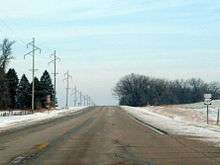
U.S. 169 is a major north–south highway in Minnesota. It enters the state at Elmore. Shortly after, it junctions Interstate 90 at Blue Earth. It passes Mankato, crossing the Minnesota River. Between Mankato and the Twin Cities, U.S. 169 is largely a rural highway. At Shakopee, U.S. 169 becomes a freeway, again crossing the Minnesota River. The freeway ends in Brooklyn Park. The rest of the route in Minnesota is largely rural. The route passes the western side of Mille Lacs Lake. It terminates at U.S. 53 in Virginia, in the Iron Range.
History
In Missouri, US 169 replaced Route 1 from Kansas City to St. Joseph, Route 4 from St. Joseph to Stanberry, and all of Route 29 from Stanberry to Iowa. The part of Route 1 north of Kansas City had been Route 33 south of, and Route 50 north of, Grayson from 1922 to 1926.
Prior to 2008, US 169 traveled east on I-435 in Lenexa and Overland Park, Kansas, and then it traveled north on Metcalf Avenue.
Prior to 1981, US 169 entered Minneapolis, Minnesota.
Major intersections
- Oklahoma
-
 US 64 in Tulsa. The highways travel concurrently through Tulsa.
 -
 I‑44 in Tulsa
 -

 I‑244 / US 412 in Tulsa
 -
 US 60 in Nowata
 - Kansas
-
 US 166 in Coffeyville. The highways travel concurrently to east-northeast of Coffeyville.
 -
 US 160 south-southwest of Cherryvale. The highways travel concurrently for approximately 0.9 miles (1.4 km).
 -
 US 400 north-northeast of Cherryvale
 -
 US 54 east of Iola
 -
 US 59 northeast of Welda. The highways travel concurrently to south of Garnett.
 -


 I‑35 / US 50 / US 56 in Olathe. I-35/US 169 travels concurrently to Merriam. US 50/US 169 travels concurrently to Lenexa. US 56/US 169 travels concurrently to the Westwood–Mission Woods city line.
 -
 I‑435 / US 50 in Lenexa
 -
 US 69 in Lenexa. The highways travel concurrently to Overland Park.
 - I‑35 in Kansas City
-


 I‑70 / US 24 / US 40 / US 69 in Kansas City. I-70/US 24/US 40/US 169 travels concurrently to Kansas City, Missouri.
 - Missouri
- I‑35 in Kansas City. The highways travel concurrently through Kansas City.
- US 69 southeast of Northmoor
-

 I‑29 / US 71 in Gladstone
 - I‑435 in Kansas City
- I‑29 / US 71 in St. Joseph
-
 US 36 in St. Joseph
 - I‑29 / US 71 in St. Joseph
-
 US 136 in Stanberry. The highways travel concurrently to north-northwest of Darlington.
 - Iowa
-
 US 34 in Afton. The highways travel concurrently to west of Thayer.
 -

 I‑80 / US 6 in De Soto. US 6/US 169 travels concurrently to Adel.
 -
 US 30 in Ogden. The highways travel concurrently to east-southeast of Beaver.
 -
 US 20 south of Fort Dodge
 -
 US 18 in Algona
 - Minnesota
-
 I‑90 in Blue Earth
 -
 US 14 on the North Mankato–Mankato city line
 -
 I‑494 in Bloomington
 -
 US 212 on the Eden Prairie–Edina city line
 -

 I‑394 / US 12 on the St. Louis Park–Golden Valley city line
 -


 I‑94 / I‑694 / US 52 on the Maple Grove–Brooklyn Park city line
 -
 US 10 in Anoka. The highways travel concurrently to Elk River.
 -
 US 2 in Grand Rapids. The highways travel concurrently through Grand Rapids.
 -
 US 53 in Virginia
Bannered routes
Four bannered routes of U.S. Route 169 exist, one each in Oklahoma, in Kansas, in Missouri, and in Iowa.
Nowata alternate route
| |
|---|---|
| Location: | Nowata, Oklahoma |
| Length: | 2.70 mi[7] (4.35 km) |
U.S. 169 has one banner route while in Oklahoma, US 169 Alternate. The alternate route travels through Nowata while the main highway bypasses the town. The alternate route is approximately 2.70 miles (4.35 km) long.[7]
Junction list
The entire route is in Nowata, Nowata County.
| mi | km | Destinations | Notes | ||
|---|---|---|---|---|---|
| 1.000 mi = 1.609 km; 1.000 km = 0.621 mi | |||||
Garnett Business Route
U.S. 169 has one banner route while in Kansas, Business Route 169. The business route northern terminus is the junction of U.S. 169 & 6th Street in Garnett, KS. The main highway bypass the town to the Southeast. The business route travels along 6th Street until reaching Maple St. where it intersects with U.S. 59 and Kansas 31 until it reconnects with U.S. 169 at a roundabout South of Garnett in Anderson County, Kansas.
Smithville spur
| |
|---|---|
| Location: | Smithville, Missouri |
| Length: | 0.536 mi[8] (0.863 km) |
U.S. Route 169 Spur is a one-half-mile-long (800 m) route in Smithville, Missouri. The spur route follows an old alignment of US 169 into the city center of Smithville ending at Main Street. The entire route is in Smithville, Clay County.
| mi[8] | km | Destinations | Notes | ||
|---|---|---|---|---|---|
| 0.000 | 0.000 | ||||
| 0.298 | 0.480 | ||||
| 0.536 | 0.863 | ||||
| 1.000 mi = 1.609 km; 1.000 km = 0.621 mi | |||||
Fort Dodge business loop
| |
|---|---|
| Location: | Fort Dodge, Iowa |
| Length: | 3.147 mi[9] (5.065 km) |
| Existed: | 1990[10]–present |
U.S. Route 169 Business is a 3-mile-long (4.8 km) business route in Fort Dodge, Iowa. The route was established in 1990 along former sections of Iowa Highway 7 (Iowa 7) and U.S. Route 20. Iowa 7 had recently been truncated to its current eastern end at U.S. Route 169 and US 20 had been rerouted onto a new freeway south of Fort Dodge. Since both routes had viaducts over the Des Moines River, officials in Fort Dodge wanted the Iowa Department of Transportation to maintain the bridges.[10] From its creation until 2014, the route was officially known as Iowa Highway 926, but it was only signed as Business US 169.[11] The entire route is in Fort Dodge, Webster County.
| mi[9] | km | Destinations | Notes | ||
|---|---|---|---|---|---|
| 0.000 | 0.000 | South end of US 20 Bus. overlap | |||
| 1.625 | 2.615 | North end of US 20 Bus. overlap. | |||
| 3.147 | 5.065 | ||||
1.000 mi = 1.609 km; 1.000 km = 0.621 mi
| |||||
References
- ↑ Droz, Robert V. U.S. Highways : From US 1 to (US 830). URL accessed 15 June 2006 (UTC).
- ↑ Slide 1
- ↑ http://www.ksdot.org/burtrafficeng/Roundabouts/Roundabout_Guide/Appendix_C.pdf
- ↑ Slide 1
- ↑ Vaughn, Don W. (October 17, 2008). "Special Committee on U.S. Route Numbering Meeting Minutes" (DOC) (Report). Hartford, CT: American Association of State Highway and Transportation Officials.
- ↑ Helling, Jesse (February 19, 2009). "U.S. 169 upgrade unveiled". The Messenger. Retrieved May 28, 2010.
- 1 2 Oklahoma Department of Transportation (2010-01-01). Control Section Maps: Nowata County (PDF) (Map) (2010–2011 ed.). Scale not given. Oklahoma City: Oklahoma Department of Transportation.
- 1 2 Missouri Department of Transportation (February 2, 2013). Flex Map Viewer (Map). Missouri Department of Transportation. Retrieved February 2, 2013.
- 1 2 "2009 Volume of Traffic on the Primary Road System of Iowa" (PDF). Iowa Department of Transportation. January 1, 2009. Retrieved October 2, 2010.
- 1 2 Helling, Jesse (May 3, 2009). "Retro road trips still available for today's driver". The Messenger. Fort Dodge. Retrieved October 2, 2010.
- ↑ "Actions taken by the Iowa Transportation Commission at its Nov. 4 meeting in Ames". Iowa Department of Transportation. November 4, 2014. Retrieved November 18, 2014.
External links
| Browse numbered routes | ||||
|---|---|---|---|---|
| ← | KS | K-170 | ||
| ← | MO | I-170 | ||
| ← | IA | Iowa 173 | ||
| ← | Iowa 926 | Iowa 930 | ||