Interstate 29 in Missouri
| ||||
|---|---|---|---|---|
_map.svg.png) | ||||
| Route information | ||||
| Maintained by MoDOT | ||||
| Length: | 128.710 mi[1] (207.139 km) | |||
| Existed: | 1963 – present | |||
| Major junctions | ||||
| South end: | Downtown freeway loop in Kansas City | |||
| North end: |
| |||
| Highway system | ||||
| ||||
.svg.png)
Interstate 29 (I-29) is a north–south Interstate Highway in the Midwestern United States that begins in Missouri. It travels through the Kansas City and St. Joseph metropolitan areas before exiting the state and entering Iowa. Almost all of I-29 in Missouri lies in an area called the Platte Purchase that was not originally part of Missouri when it entered the union.
Route description
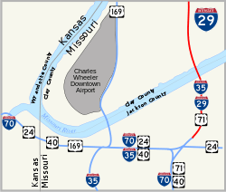
Interstate 29 begins at Interstate 70 in Kansas City in a concurrency with Interstate 35 and U.S. Route 71. It crosses over the Missouri River via the Bond Bridge. I-29 and I-35 separate in northern Kansas City, with I-29 turning northwest with US 71 running concurrent with it. It passes near Kansas City International Airport, and near there is concurrent with Interstate 435. I-29 then exits the Kansas City area. It enters the eastern portion of St. Joseph while downtown St. Joseph is served by I-229, a loop of I-29. After exiting St. Joseph, US 71 separates from I-29. Interstate 29 then passes through rural areas of northwestern Missouri on a southeast-to-northwest alignment, then crosses into Iowa north of Rock Port, approximately 55 miles south of Council Bluffs.
Exit list
| County | Location | mi[1] | km | Exit[1] | Destinations | Notes |
|---|---|---|---|---|---|---|
| Jackson | Kansas City | 0.000– 0.185 | 0.000– 0.298 | 2G 3 | Downtown freeway loop; south end of I-35 and US 71 overlaps; to I-49 | |
| 0.530 | 0.853 | 4A | Southbound exit and northbound entrance only | |||
| 1.077 | 1.733 | 4 4B | Front Street | |||
| Missouri River | 1.282– 1.569 | 2.063– 2.525 | Christopher S. Bond Bridge | |||
| Clay | North Kansas City | 1.616 | 2.601 | 5 | Levee Road, Bedford Avenue | Northbound signed exit 5A |
| 2.418 | 3.891 | 5B | 16th Avenue | Northbound exit and southbound entrance only | ||
| 2.996– 3.015 | 4.822– 4.852 | 6 | Signed as exits 6A (east) and 6B (west) | |||
| Kansas City | 4.546 | 7.316 | 8A | NE Parvin Road | ||
| 4.614– 5.040 | 7.426– 8.111 | 1B | North end of I-35 overlap; I-29 northbound exits I-35 via exit 8B | |||
| 5.094 | 8.198 | 1A | NE Davidson Road | |||
| 6.112 | 9.836 | 1C-D | Signed as exits 1C (north) and 1D (south); no exit 1D northbound | |||
| 6.584 | 10.596 | 1E | ||||
| 6.986– 7.080 | 11.243– 11.394 | 2 | ||||
| Platte | 7.890 | 12.698 | 3A | Northbound exit and southbound entrance only | ||
| 8.284 | 13.332 | 3C | Southbound exit and northbound entrance only | |||
| 8.264– 8.494 | 13.300– 13.670 | 3B | I-635 exits 12A-B | |||
| 8.847 | 14.238 | 4 | NW 56th Street | Northbound exit and southbound entrance only | ||
| 10.226 | 16.457 | 5 | ||||
| Platte Woods | 11.420 | 18.379 | 6 | NW 72nd Street – Platte Woods | ||
| Kansas City | 13.019 | 20.952 | 8 | |||
| 13.543– 13.565 | 21.795– 21.831 | 9 | Signed as exits 9A (east) and 9B (west) | |||
| 15.002 | 24.143 | 10 | NW Tiffany Springs Parkway | Diverging diamond interchange | ||
| 16.800 | 27.037 | 12 | NW 112th Street | |||
| 17.818 | 28.675 | 13 | ||||
| 18.466– 18.702 | 29.718– 30.098 | 14 | South end of I-435 overlap; northbound exit is via exit 13 | |||
| 19.635 | 31.599 | 15 | Mexico City Avenue | |||
| Platte City | 21.499– 22.394 | 34.599– 36.040 | 17 | North end of I-435 overlap | ||
| 22.856 | 36.783 | 18 | ||||
| 24.020 | 38.656 | 19 | ||||
| Fair Township | 25.567 | 41.146 | 20 | |||
| Green Township | 30.090 | 48.425 | 25 | |||
| Dearborn | 34.626 | 55.725 | 30 | |||
| Buchanan | Crawford Township | 40.363 | 64.958 | 35 | ||
| Washington Township | 47.503– 48.057 | 76.449– 77.340 | 43 | |||
| St. Joseph | 48.941 | 78.763 | 44 | |||
| 50.448– 50.908 | 81.188– 81.928 | 46 | Signed as exits 46A (east) and 46B (west) | |||
| 52.599 | 84.650 | 47 | ||||
| 55.288 | 88.977 | 50 | ||||
| Andrew | Jefferson Township | 58.363 | 93.926 | 53 | South end of US 59 overlap | |
| 61.369– 61.921 | 98.764– 99.652 | 56 | North end of US 59 and US 71 overlaps; signed as exits 56A (north) and 56B (south) | |||
| Lincoln Township | 64.774 | 104.244 | 60 | |||
| Jackson Township | 69.954 | 112.580 | 65 | South end of US 59 overlap | ||
| Holt | Nodaway Township | 72.187 | 116.174 | 67 | North end of US 59 overlap | |
| Hickory Township | 80.321 | 129.264 | 75 | |||
| Benton Township | 83.844 | 134.934 | 79 | |||
| Mound City | 88.804 | 142.916 | 84 | |||
| Union Township | 96.924 | 155.984 | 92 | |||
| Holt–Atchison county line | Lincoln–Clark township line | 103.902 | 167.214 | 99 | ||
| Atchison | Clay Township | 112.453 | 180.976 | 107 | ||
| Rock Port | 115.410 | 185.734 | 110 | |||
| Nishnabotna Township | 120.636 | 194.145 | 116 | |||
| 128.710 | 207.139 | Continuation into Iowa | ||||
1.000 mi = 1.609 km; 1.000 km = 0.621 mi
| ||||||
Auxiliary Route
I-29 has one auxiliary route in Missouri:
 I-229: A bypass around the west side of St. Joseph
References
- 1 2 3 Missouri Department of Transportation (November 13, 2012). Flex Map Viewer (Map). Missouri Department of Transportation. Retrieved November 13, 2012.
External links
| Previous state: Terminus |
Missouri | Next state: Iowa |