U.S. Route 20 in Nebraska
| ||||
|---|---|---|---|---|
_map.svg.png) | ||||
| Route information | ||||
| Maintained by NDOR | ||||
| Length: | 431.57 mi[1] (694.54 km) | |||
| Existed: | 1926 – present | |||
| Major junctions | ||||
| West end: |
| |||
|
| ||||
| East end: |
| |||
| Highway system | ||||
| ||||

U.S. Highway 20 in Nebraska is a major east–west artery running across northern Nebraska. It enters the state in sparsely populated northwest Nebraska as a rural two lane highway. It exits concurrently with Interstate 129 and U.S. Highway 75 by a Missouri River crossing at South Sioux City.
Route description
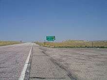
U.S. 20 enters Nebraska from Wyoming near the Niobrara River and continues 9 miles (14 km) before encountering the first city on the route, Harrison. It then crosses the White River near Fort Robinson and, at Crawford heads northeast where it meets with U.S. Highway 385 for two miles (3 km) before entering Chadron. It then heads southeast toward Hay Springs where it again turns in an east/northeasterly direction toward Merriman. At this point U.S. 20 is only about 5 miles (8.0 km) from the South Dakota border. From Merriman it heads east through the small towns of Cody, Nenzel, and Kilgore to Valentine. This 196-mile (315 km) section of U.S. 20 has been noted by the Department of Roads for its history and natural beauty and has been designated as the "Bridges to Buttes Byway."[1][2]
At Valentine U.S. 20 heads south as it overlaps U.S. Highway 83 for 5 miles (8.0 km). It then continues southeast towards Ainsworth passing through Wood Lake and Johnstown on the way. At Ainsworth it heads due east past Bassett and Newport. Then near Stuart it follows the Elkhorn River through Atkinson and Emmet before meeting up with U.S. 275 in O'Neill.[1][2]
In O'Neill U.S. 20 turns southeast and joins with U.S. Highway 275 for 13 miles (21 km), passing through Inman before again branching off on its own. From there it passes through Orchard, Royal, Plainview and Osmond before it junctions with U.S. Highway 81. From there it continues east through Laurel where it turns due north on a concurrency with Nebraska Highway 15 for 3 miles (4.8 km). Heading east again it passes through Willis and then Jackson near the South Sioux City outskirts.[1][2]
The last section of U.S. 20 is essentially a southern bypass of South Sioux City. About one mile (1.6 km) before the U.S. 20/U.S. 75/77 Jct it becomes an expressway. At the junction of U.S. Highway 75 and U.S. Highway 77 it joins with U.S. 75 and Interstate 129 as a freeway into Iowa. From there it continues its function as a southeast bypass of Sioux City.[1][2]
History
An older alignment of US-20 ran about 3 miles (4.8 km) south of the current section east of Laurel. This alignment went due east from Laurel, passing just north of Dixon and Allen, then headed north to the current alignment along Nebraska Highway 9.[3]
In November, 2010, Nebraska Governor Dave Heineman approved designating US-20 from Hay Springs to Fort Robinson in honor of Crazy Horse, capping a year-long effort by citizens of Chadron. The designation may extend east another 100 miles through Cherry County to Valentine.[4] These segments of US-20 are also part of the Nebraska Bridges to Buttes Scenic Highway and follows the well-known Cowboy Line, a partially abandoned railroad now used as a hiking and biking trail.
Major intersections
| County | Location | mi[1] | km | Exit | Destinations | Notes |
|---|---|---|---|---|---|---|
| Sioux | | 0.00 | 0.00 | Continuation into Wyoming | ||
| Harrison | 8.99 | 14.47 | ||||
| Dawes | Crawford | 35.34 | 56.87 | Western end of N-2/N-71 overlap | ||
| 36.20 | 58.26 | Eastern end of N-2/N-71 overlap | ||||
| Whitney | 45.07 | 72.53 | ||||
| | 56.06 | 90.22 | ||||
| | 56.39 | 90.75 | Western end of US 385 overlap | |||
| Chadron | 58.59 | 94.29 | Eastern end of US 385 overlap | |||
| Sheridan | Hay Springs | 78.88 | 126.95 | Western end of N-87 overlap | ||
| Rushville | 90.27 | 145.28 | Eastern end of N-87 overlap | |||
| 91.29 | 146.92 | |||||
| Gordon | 105.91 | 170.45 | ||||
| Cherry | Merriman | 135.81 | 218.57 | Western end of N-61 overlap | ||
| 135.84 | 218.61 | Eastern end of N-61 overlap | ||||
| Nenzel | 167.03 | 268.81 | ||||
| Valentine | 196.72 | 316.59 | ||||
| 196.92 | 316.91 | Western end of US 83 overlap | ||||
| | 202.08 | 325.22 | Eastern end of US 83 overlap | |||
| Brown | Ainsworth | 242.08 | 389.59 | Western end of N-7 overlap | ||
| Long Pine | 247.55 | 398.39 | Western end of US 183 overlap | |||
| 250.39 | 402.96 | |||||
| Rock | Bassett | 259.17 | 417.09 | Eastern end of US 183/N-7 overlap | ||
| Newport | 270.25 | 434.93 | ||||
| Holt | Atkinson | 289.25 | 465.50 | Western end of N-11 overlap | ||
| 289.76 | 466.32 | Eastern end of N-11 overlap | ||||
| O'Neill | 307.09 | 494.21 | Western end of US 281 overlap | |||
| 307.59 | 495.02 | Eastern end of US 281 overlap, west end of US 275 overlap | ||||
| | 320.62 | 515.99 | Eastern end of US 275 overlap | |||
| Page | 322.80 | 519.50 | ||||
| Ewing | 326.69 | 525.76 | ||||
| Antelope | | 342.73 | 551.57 | |||
| Brunswick | 345.77 | 556.46 | ||||
| | 349.75 | 562.87 | Western end of N-13 overlap | |||
| Pierce | Plainview | 354.43 | 570.40 | Eastern end of N-13 overlap | ||
| Osmond | 364.55 | 586.69 | Western end of N-121 overlap | |||
| 367.84 | 591.98 | Eastern end of N-121 overlap | ||||
| McLean | 371.83 | 598.40 | ||||
| | 373.83 | 601.62 | ||||
| Cedar | Belden | 385.36 | 620.18 | Western end of N-57 overlap | ||
| 386.38 | 621.82 | Eastern end of N-57 overlap | ||||
| Laurel | 391.41 | 629.91 | Western end of N-15 overlap | |||
| | 393.92 | 633.95 | Eastern end of N-15 overlap | |||
| | 394.62 | 635.08 | ||||
| Dixon | | 399.20 | 642.45 | |||
| | 406.93 | 654.89 | Western end of N-9 overlap | |||
| | 407.74 | 656.19 | Eastern end of N-9 overlap | |||
| Waterbury | 413.05 | 664.74 | ||||
| Dakota | | 418.07 | 672.82 | |||
| | 426.33 | 686.11 | ||||
| South Sioux City | 428.36 | 689.38 | Western end of I-129 overlap | |||
| 428.74– 428.76 | 689.99– 690.02 | 1A-B | Western end of US 75 overlap; signed as exits 1A (south) and 1B (north) | |||
| 429.86 | 691.79 | 2 | ||||
| Missouri River | 431.57 | 694.54 | Sergeant Floyd Memorial Bridge; Nebraska–Iowa state line | |||
| Woodbury | Sioux City | Continuation into Iowa | ||||
1.000 mi = 1.609 km; 1.000 km = 0.621 mi
| ||||||
References
- 1 2 3 4 5 6 Nebraska Highway Reference Log Book
- 1 2 3 4 Google (2010-11-11). "overview of U.S. Route 20 in Nebraska" (Map). Google Maps. Google. Retrieved 2010-11-11.
- ↑ "Nebraska Highways 1 to 30". Retrieved 9 October 2014.
- ↑ Rempp, Kerri (2010-11-17). "Nebraska highway to be named for Lakota leader". Rapid City Journal. Retrieved 2010-12-17.
External links
| Previous state: Wyoming |
Nebraska | Next state: Iowa |