Upper State Street Historic District
|
Upper State Street Historic District | |
|
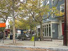
Upper State Street at Beech Street. | |
  | |
| Location | Roughly State St. from Bradley St. to Mill River St., New Haven, Connecticut |
|---|---|
| Coordinates | 41°18′53″N 72°54′41″W / 41.31472°N 72.91139°WCoordinates: 41°18′53″N 72°54′41″W / 41.31472°N 72.91139°W |
| Area | 23 acres (9.3 ha) |
| Architectural style | Late 19th and 20th Century Revivals, Late Victorian, Greek Revival |
| NRHP Reference # | 84001143[1] |
| Added to NRHP | September 7, 1984 |
The Upper State Street Historic District is a historic district in New Haven, Connecticut.
The district was listed on the U.S. National Register of Historic Places in 1984, at which time it included 86 contributing buildings.[1]
The district is an irregular strip running NNE to SSW mainly along State Street in New Haven (between Bradley Street and the Mill River), one block west of Interstate 91, the highway which determines the district's eastern and southern borders.[2]
The district is part of the official neighborhood planning area of the East Rock neighborhood of New Haven.
Gallery
 32 Walnut Street (about 1837), Franklin (now Jocelyn) Square.
 977-9 State Street.
 974-6 and 980 State Street.
 Eld Street west of State Street.
See also
References
- 1 2 National Park Service (2009-03-13). "National Register Information System". National Register of Historic Places. National Park Service.
- ↑ J. Paul Loether and John Herzan (January 5, 1984). "National Register of Historic Places Inventory-Nomination: Upper State Street Historic District" (PDF). National Park Service. and Accompanying 36 photos, from 1983
External links
- New Haven Preservation Trust: Upper State Street Historic District, with text adapted from NRHP nomination plus gallery of 10 photos
- Upper State Street Association
| Topics | |
|---|---|
| Lists by states |
|
| Lists by insular areas | |
| Lists by associated states | |
| Other areas | |
| |
This article is issued from Wikipedia - version of the 11/29/2016. The text is available under the Creative Commons Attribution/Share Alike but additional terms may apply for the media files.