Upton, Kentucky
| Upton, Kentucky | |
|---|---|
| City | |
 Location of Upton, Kentucky | |
| Coordinates: 37°27′44″N 85°53′43″W / 37.46222°N 85.89528°WCoordinates: 37°27′44″N 85°53′43″W / 37.46222°N 85.89528°W | |
| Country | United States |
| State | Kentucky |
| Counties | Hardin, LaRue |
| Area | |
| • Total | 1.5 sq mi (4.0 km2) |
| • Land | 1.5 sq mi (4.0 km2) |
| • Water | 0.0 sq mi (0.0 km2) |
| Elevation | 748 ft (228 m) |
| Population (2000) | |
| • Total | 654 |
| • Density | 422.9/sq mi (163.3/km2) |
| Time zone | Eastern (EST) (UTC-5) |
| • Summer (DST) | EDT (UTC-4) |
| ZIP code | 42784 |
| Area code(s) | 270 & 364 |
| FIPS code | 21-78672 |
| GNIS feature ID | 0505924 |
Upton is a city in Hardin and LaRue counties in the U.S. state of Kentucky. The population was 654 at the 2000 census. Its entire area is included in the Elizabethtown, Kentucky Metropolitan Statistical Area. City Hall: (270) 268-8993.
Geography
Upton is located at 37°27′44″N 85°53′43″W / 37.46222°N 85.89528°W (37.462175, -85.895335).[1]
According to the United States Census Bureau, the city has a total area of 1.5 square miles (4.0 km²), all land. US Highway 31-W passes through the middle of the city.
Demographics
| Historical population | |||
|---|---|---|---|
| Census | Pop. | %± | |
| 1900 | 125 | — | |
| 1910 | 141 | 12.8% | |
| 1920 | 369 | 161.7% | |
| 1930 | 402 | 8.9% | |
| 1940 | 369 | −8.2% | |
| 1950 | 383 | 3.8% | |
| 1960 | 547 | 42.8% | |
| 1970 | 552 | 0.9% | |
| 1980 | 731 | 32.4% | |
| 1990 | 719 | −1.6% | |
| 2000 | 654 | −9.0% | |
| 2010 | 683 | 4.4% | |
| Est. 2015 | 665 | [2] | −2.6% |
As of the census[4] of 2000, there were 654 people, 283 households, and 189 families residing in the city. The population density was 422.9 people per square mile (162.9/km²). There were 322 housing units at an average density of 208.2 per square mile (80.2/km²). The racial makeup of the city was 96.79% White, 0.76% African American, 0.15% Pacific Islander, 0.15% from other races, and 2.14% from two or more races. Hispanic or Latino of any race were 0.46% of the population.
There were 283 households out of which 24.7% had children under the age of 18 living with them, 55.1% were married couples living together, 8.8% had a female householder with no husband present, and 32.9% were non-families. 30.4% of all households were made up of individuals and 16.3% had someone living alone who was 65 years of age or older. The average household size was 2.31 and the average family size was 2.86.
The age distribution was 22.0% under the age of 18, 8.3% from 18 to 24, 27.1% from 25 to 44, 24.0% from 45 to 64, and 18.7% who were 65 years of age or older. The median age was 41 years. For every 100 females there were 97.0 males. For every 100 females age 18 and over, there were 88.2 males.
The median income for a household in the city was $26,250, and the median income for a family was $31,477. Males had a median income of $26,111 versus $19,375 for females. The per capita income for the city was $13,886. About 8.3% of families and 14.2% of the population were below the poverty line, including 17.5% of those under age 18 and 18.4% of those age 65 or over.
History
Upton was one of the targets of John Hunt Morgan during the American Civil War. Upton was on the L&N Railroad, one of the key North-South rail roads for the Union. The train station and nearby bridges were attacked during the day on December 26, 1862. The Union forces were quickly defeated and Morgan took advantage of the telegraph station in Upton to gather intelligence on Union troop disposition. Morgan then left Upton to destroy bridges at nearby Bacon Creek in Bonnieville, Kentucky and on the Nolin River.[5]
References
- ↑ "US Gazetteer files: 2010, 2000, and 1990". United States Census Bureau. 2011-02-12. Retrieved 2011-04-23.
- ↑ "Annual Estimates of the Resident Population for Incorporated Places: April 1, 2010 to July 1, 2015". Retrieved July 2, 2016.
- ↑ "Census of Population and Housing". Census.gov. Retrieved June 4, 2015.
- ↑ "American FactFinder". United States Census Bureau. Retrieved 2008-01-31.
- ↑ L&N Magazine, 1932, reprinted in the Kentucky Explorer, Volume 23, No.7, January 2009 Kentucky Explorer Website
Municipalities and communities of Hardin County, Kentucky, United States | ||
|---|---|---|
| Cities | 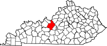 | |
| CDPs | ||
| Other unincorporated communities | ||
| Footnotes | ‡This populated place also has portions in an adjacent county or counties | |
Municipalities and communities of LaRue County, Kentucky, United States | ||
|---|---|---|
| Cities | 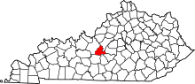 | |
| CDPs | ||
| Other unincorporated communities |
| |
| Footnotes | ‡This populated place also has portions in an adjacent county or counties | |