Vaux, Vienne
| Vaux-en-Couhé | |
|---|---|
|
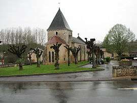
The church in Vaux | |
 Vaux-en-Couhé | |
|
Location within Nouvelle-Aquitaine region  Vaux-en-Couhé | |
| Coordinates: 46°17′54″N 0°13′19″E / 46.2983°N 0.2219°ECoordinates: 46°17′54″N 0°13′19″E / 46.2983°N 0.2219°E | |
| Country | France |
| Region | Nouvelle-Aquitaine |
| Department | Vienne |
| Arrondissement | Montmorillon |
| Canton | Couhé |
| Intercommunality | Région de Couhé |
| Government | |
| • Mayor (2008–2014) | Marie-José Gracient |
| Area1 | 25.84 km2 (9.98 sq mi) |
| Population (2006)2 | 689 |
| • Density | 27/km2 (69/sq mi) |
| Time zone | CET (UTC+1) |
| • Summer (DST) | CEST (UTC+2) |
| INSEE/Postal code | 86278 / 86700 |
| Elevation |
106–151 m (348–495 ft) (avg. 120 m or 390 ft) |
|
1 French Land Register data, which excludes lakes, ponds, glaciers > 1 km² (0.386 sq mi or 247 acres) and river estuaries. 2 Population without double counting: residents of multiple communes (e.g., students and military personnel) only counted once. | |
Vaux or Vaux-en-Couhé is a commune in the Vienne department in the Nouvelle-Aquitaine region in western France.
Vaux is a small French village, situated in the department of Vienne and the region of Nouvelle-Aquitaine . Its inhabitants are called the Valois and Valoises. The municipality covers 25.8 km ² and has 732 inhabitants since the last census from 2004. With a density of 28.3 inhabitants per km ², Vaux saw a sharp increase of 16.2% of its population over the 1999 census. Surrounded by the municipalities of Chatillon, Romagna and Ceaux en Couhé, Vaux is located 33 km southwest of Poitiers, the largest city nearby.
Located at 115 meters above sea level; Latitude: 46 ° 17 '50 North Longitude: 0 ° 13 '12 East.
Web address - http://www.annuaire-mairie.fr/mairie-vaux-86.html
References
| Wikimedia Commons has media related to Vaux (Vienne). |