Verdon, South Dakota
| Verdon, South Dakota | |
|---|---|
| Town | |
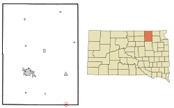 Location in Brown County and the state of South Dakota | |
| Coordinates: 45°14′32″N 98°6′4″W / 45.24222°N 98.10111°WCoordinates: 45°14′32″N 98°6′4″W / 45.24222°N 98.10111°W | |
| Country | United States |
| State | South Dakota |
| County | Brown |
| Incorporated | 1884[1] |
| Area[2] | |
| • Total | 0.25 sq mi (0.65 km2) |
| • Land | 0.25 sq mi (0.65 km2) |
| • Water | 0 sq mi (0 km2) |
| Elevation | 1,306 ft (398 m) |
| Population (2010)[3] | |
| • Total | 5 |
| • Estimate (2015)[4] | 5 |
| • Density | 20.0/sq mi (7.7/km2) |
| Time zone | Central (CST) (UTC-6) |
| • Summer (DST) | CDT (UTC-5) |
| Area code(s) | 605 |
| FIPS code | 46-66660 |
| GNIS feature ID | 1258742[5] |
Verdon is a town in Brown County, South Dakota, United States. The population was 5 at the 2010 census.
History
Verdon was platted in 1886.[6] It was named after the city of Verdun, France.[7] A post office was established at Verdon in 1887, and remained in operation until being discontinued in 1982.[8]
Geography
Verdon is located at 45°14′32″N 98°6′3″W / 45.24222°N 98.10083°W (45.24231, -98.10107).[9]
According to the United States Census Bureau, the town has a total area of 0.25 square miles (0.65 km2), all land.[2]
Demographics
| Historical population | |||
|---|---|---|---|
| Census | Pop. | %± | |
| 1910 | 136 | — | |
| 1920 | 90 | −33.8% | |
| 1930 | 69 | −23.3% | |
| 1940 | 65 | −5.8% | |
| 1950 | 34 | −47.7% | |
| 1960 | 28 | −17.6% | |
| 1970 | 18 | −35.7% | |
| 1980 | 7 | −61.1% | |
| 1990 | 7 | 0.0% | |
| 2000 | 6 | −14.3% | |
| 2010 | 5 | −16.7% | |
| Est. 2015 | 5 | [10] | 0.0% |
| U.S. Decennial Census[11] 2015 Estimate[4] | |||
2010 census
As of the census[3] of 2010, there were 5 people, 2 households, and 1 families residing in the town. The population density was 20.0 inhabitants per square mile (7.7/km2). There were 4 housing units at an average density of 16.0 per square mile (6.2/km2). The racial makeup of the town was 100.0% White.
There were 2 households of which 50.0% were married couples living together and 50.0% were non-families. 0.0% of all households were made up of individuals. The average household size was 2.50 and the average family size was 3.00.
The median age in the town was 22.5 years. 0.0% of residents were under the age of 18; 60% were between the ages of 18 and 24; 0.0% were from 25 to 44; 40% were from 45 to 64; and 0.0% were 65 years of age or older. The gender makeup of the town was 60.0% male and 40.0% female.
2000 census
As of the census of 2000, there were 6 people, 2 households, and 1 family residing in the town. The population density was 24.3 people per square mile (9.3/km²). There were 4 housing units at an average density of 16.2 per square mile (6.2/km²). The racial makeup of the town was 100.00% White.
There were 2 households out of which 50.0% had children under the age of 18 living with them, 50.0% were married couples, and 50.0% were non-families. 50.0% of all households were made up of individuals and 50.0% had someone living alone who was 65 years of age or older. The average household size was 3.00 and the average family size was 5.00.
In the town the population was spread out with 50.0% under the age of 18, 33.3% from 25 to 44, and 16.7% who were 65 years of age or older. The median age was 26 years. For every 100 females there were 100 males. For every 100 females age 18 and over, there were 50 males.
References
- ↑ "SD Towns" (PDF). South Dakota State Historical Society. Retrieved 2010-02-16.
- 1 2 "US Gazetteer files 2010". United States Census Bureau. Archived from the original on January 24, 2012. Retrieved 2012-06-21.
- 1 2 "American FactFinder". United States Census Bureau. Retrieved 2012-06-21.
- 1 2 "Population Estimates". United States Census Bureau. Retrieved June 23, 2016.
- ↑ "US Board on Geographic Names". United States Geological Survey. 2007-10-25. Retrieved 2008-01-31.
- ↑ Chicago and North Western Railway Company (1908). A History of the Origin of the Place Names Connected with the Chicago & North Western and Chicago, St. Paul, Minneapolis & Omaha Railways. p. 133.
- ↑ "Profile for Verdon, South Dakota". ePodunk. Retrieved 4 June 2014.
- ↑ "Brown County". Jim Forte Postal History. Retrieved 30 March 2015.
- ↑ "US Gazetteer files: 2010, 2000, and 1990". United States Census Bureau. 2011-02-12. Retrieved 2011-04-23.
- ↑ "Annual Estimates of the Resident Population for Incorporated Places: April 1, 2010 to July 1, 2015". Retrieved July 2, 2016.
- ↑ United States Census Bureau. "Census of Population and Housing". Archived from the original on May 11, 2015. Retrieved July 20, 2014.
Municipalities and communities of Brown County, South Dakota, United States | ||
|---|---|---|
| Cities | 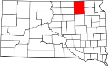 | |
| Towns | ||
| CDPs | ||
| Other unincorporated communities | ||
| Townships |
| |
| Footnotes | ‡This populated place also has portions in an adjacent county or counties | |