Uintah County, Utah
| Uintah County, Utah | |
|---|---|
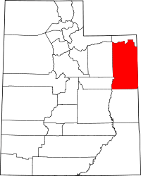 Location in the U.S. state of Utah | |
 Utah's location in the U.S. | |
| Founded | 1880 |
| Named for | Ute Tribe |
| Seat | Vernal |
| Largest city | Vernal |
| Area | |
| • Total | 4,501 sq mi (11,658 km2) |
| • Land | 4,480 sq mi (11,603 km2) |
| • Water | 22 sq mi (57 km2), 0.5% |
| Population | |
| • (2010) | 32,588 |
| • Density | 7.3/sq mi (3/km²) |
| Congressional district | 1st |
| Time zone | Mountain: UTC-7/-6 |
| Website |
www |
Uintah County /juːˈɪntə/ is a county located in the U.S. state of Utah. As of the 2010 census the population was 32,588.[1] Its county seat and largest city is Vernal.[2] The county was named for the portion of the Ute Indian tribe that lived in the basin.
Uintah County is the largest natural gas producer in Utah, with 272 billion cubic feet produced in 2008.[3]
The Vernal, UT Micropolitan Statistical Area includes all of Uintah County.
History
Archeologic evidence suggests that portions of the Uinta Basin have been inhabited by Archaic peoples and Fremont peoples. By the time of recorded history its inhabitants were the Ute people. The first known traverse by non-Indians was made by Fathers Dominguez and Escalante (1776), as they sought to establish a land route between California and Spanish America.[4]
By the early nineteenth century, occasional fur trappers entered the Basin. In 1831-32 Antoine Robidoux, a French trapper licensed by the Mexican government, established a trading post near present-day Whiterocks. He abandoned the effort in 1844.
In 1847 the Great Salt Lake Valley, still a property of Mexico, was first colonized by Brigham Young and his followers. In 1861 Young dispatched an exploring party to the Uinta Basin; they reported that "that section of country lying between the Wasatch Mountains and the eastern boundary of the territory, and south of Green River country, was one vast contiguity of waste and measurably valueless." Young made no further effort to colonize the area.
In 1861 US President Abraham Lincoln created the Uintah and Ouray Indian Reservation, reserved for the use and habitation of Utah and Colorado Indians. In the 1880s the Uncompahgre Reservation was created in the southern portion of present-day Uintah County. Ashley Valley was not part of either Reservation, and by 1880 enough ranchers and farmers had settled there that the Territorial Legislature created Uintah County (most of which had previously been part of Wasatch County, with the county seat at Ashley (now an abandoned area some three miles (5 km) of present-day Vernal).
Gilsonite was discovered in 1888 at Bonanza, in central Uintah County. This was on Reservation land, but miners pressured the US government to remove some 7000 acres (11 square miles; 28 km²) for mining use. Mining and its associated activities (including relative lawlessness) rapidly boomed in that area.[5]
The northern boundary of Uintah County originally extended to the north border of Utah. In 1918 the extreme northern portion (lying north of the Uinta Mountain watershed divide) was split off to form Daggett County, Utah.
Geography
According to the U.S. Census Bureau, the county has a total area of 4,501 square miles (11,660 km2), of which 4,480 square miles (11,600 km2) is land and 22 square miles (57 km2) (0.5%) is water.[6]
Uintah County is centered in the Uintah Basin, which runs from western Colorado on the east to the Wasatch Mountains on the west, and from the Uinta Mountains on the north to the Roan Plateau on the south. This basin was formed by a prehistoric lake ("Uinta Lake") during the late Tertiary period.
The county's geography ranges from high mountain terrain (Uinta Mountains) to the fertile Ashley Valley (site of the county seat), to a rugged and desolate canyonland which includes the Dinosaur National Monument, to desolate and largely uninhabited hills in the south ("The Bookcliffs" to locals; officially Roan Plateau).
Mines
- Dyer Mine, (copper, gold, silver)40°44′7.63″N 109°34′6.1″W / 40.7354528°N 109.568361°W, elevation: 9,852 feet (3,003 m) MSL
- Little Water Mine, (coal)40°32′15.37″N 109°49′20.54″W / 40.5376028°N 109.8223722°W, elevation: 6,913 feet (2,107 m) MSL
- Uteland Mine, (coal) 40°3′3.02″N 109°44′29.55″W / 40.0508389°N 109.7415417°W, elevation 4,675 feet (1,425 m) MSL[7]
Adjacent counties
- Daggett County (north)
- Moffat County, Colorado (northeast)
- Rio Blanco County, Colorado (east)
- Garfield County, Colorado (southeast)
- Grand County (south)
- Emery County (southwest)
- Carbon County (west)
- Duchesne County (west)
- Summit County (northwest)
National and State protected areas
- Ashley National Forest (part)
- Dinosaur National Monument (part)
- Ouray National Wildlife Refuge
- Red Fleet State Park
- Steinaker State Park
Demographics
| Historical population | |||
|---|---|---|---|
| Census | Pop. | %± | |
| 1880 | 799 | — | |
| 1890 | 2,762 | 245.7% | |
| 1900 | 6,458 | 133.8% | |
| 1910 | 7,050 | 9.2% | |
| 1920 | 8,470 | 20.1% | |
| 1930 | 9,035 | 6.7% | |
| 1940 | 9,898 | 9.6% | |
| 1950 | 10,300 | 4.1% | |
| 1960 | 11,582 | 12.4% | |
| 1970 | 12,684 | 9.5% | |
| 1980 | 20,506 | 61.7% | |
| 1990 | 22,211 | 8.3% | |
| 2000 | 25,224 | 13.6% | |
| 2010 | 32,588 | 29.2% | |
| Est. 2015 | 37,928 | [8] | 16.4% |
| U.S. Decennial Census[9] 1790–1960[10] 1900–1990[11] 1990–2000[12] 2010–2014[1] | |||
As of the census[13] of 2000, there were 25,224 people, 8,187 households, and 6,541 families residing in the county. The population density was 6 people per square mile (2/km²). There were 9,040 housing units at an average density of 2 per square mile (1/km²). The racial makeup of the county was 87.73% White, 0.11% Black or African American, 9.38% Native American, 0.22% Asian, 0.08% Pacific Islander, 1.05% from other races, and 1.43% from two or more races. 3.54% of the population was Hispanic or Latino of any race.
There were 8,187 households out of which 44.50% had children under the age of 18 living with them, 65.70% were married couples living together, 10.60% had a female householder with no husband present, and 20.10% were non-families. 17.20% of all households were made up of individuals and 7.30% had someone living alone who was 65 years of age or older. The average household size was 3.05 and the average family size was 3.45.
In the county, the population was spread out with 34.60% under the age of 18, 10.70% from 18 to 24, 25.40% from 25 to 44, 19.30% from 45 to 64, and 9.90% who were 65 years of age or older. The median age was 29 years. For every 100 females there were 99.30 males. For every 100 females age 18 and over, there were 95.90 males.
The median income for a household in the county was $34,518, and the median income for a family was $38,877. Males had a median income of $33,966 versus $21,199 for females. The per capita income for the county was $13,571. About 12% of families and 15% of the population were below the poverty line, including 18% of those under age 18 and 10% of those age 65 or over.
Economy
The extraction of natural resources including oil, natural gas, phosphate, and gilsonite constitute primary economic activity of Uintah County. There is some agriculture in Uintah County, primarily focusing on raising cattle and sheep, and cultivating alfalfa.
A significant portion of west Uintah County is taken up by the Uintah and Ouray Indian Reservation.[14] The Ute Tribe's headquarters is in Fort Duchesne. Much of the rest of the county is land owned by the Ashley National Forest and the Bureau of Land Management. There is relatively little private land in the county.
Discovery of significant dinosaur and other pre-historic remains on the eastern edge of the county caused nationwide interest, which culminated in establishment of Dinosaur National Monument. In addition to the large Visitor Center at the Monument's Jensen site, a Museum of Natural History, showcasing some of the area's finds, was established in Vernal by the State of Utah.[15]
Transportation
Airport
Located just outside Vernal, the Vernal-Uintah County Airport provides daily scheduled air service to Salt Lake City, Utah via Salt Lake City International Airport. Fixed-Base Operator (FBO) service is also available.
Attractions
Special events
Games, Anime, and More (G.A.M.) is a biannual fan convention. It is a multi-genre convention having video games, card games, cartoons, costumes, tournaments, tabletop gaming, and similar activities. The G.A.M. Convention is held during March and August in Uintah County, Utah. In 2015 it was the first anime convention held in Vernal, Utah as well as the first gaming convention held there, making it the first convention of its type in Vernal.[16] In 2016 it was held in Naples, Utah for the first time, making G.A.M. the first convention of its type in the city of Naples.
Communities
See also
- Fantasy Canyon
- National Register of Historic Places listings in Uintah County, Utah
- Uintah and Ouray Indian Reservation
References
- 1 2 "State & County QuickFacts". United States Census Bureau. Retrieved December 30, 2013.
- ↑ "Find a County". National Association of Counties. Retrieved 2011-06-07.
- ↑ "Annual natural gas production in MCF by the top 7 producing counties in Utah" (PDF). Retrieved 2010-09-12.
- ↑ In his diary Escalante called the basin "a fine plain abounding in pasturage and fertile, arable land, provided it were irrigated."
- ↑ Fuller, Craig (1994), "Uintah County", in Powell, Allan Kent, Utah History Encyclopedia, Salt Lake City, Utah: University of Utah Press, ISBN 0874804256, OCLC 30473917
- ↑ "2010 Census Gazetteer Files". United States Census Bureau. August 22, 2012. Retrieved June 26, 2015.
- ↑ Western Mining History
- ↑ "County Totals Dataset: Population, Population Change and Estimated Components of Population Change: April 1, 2010 to July 1, 2015". Retrieved July 2, 2016.
- ↑ "U.S. Decennial Census". United States Census Bureau. Retrieved June 26, 2015.
- ↑ "Historical Census Browser". University of Virginia Library. Retrieved June 26, 2015.
- ↑ Forstall, Richard L., ed. (March 27, 1995). "Population of Counties by Decennial Census: 1900 to 1990". United States Census Bureau. Retrieved June 26, 2015.
- ↑ "Census 2000 PHC-T-4. Ranking Tables for Counties: 1990 and 2000" (PDF). United States Census Bureau. April 2, 2001. Retrieved June 26, 2015.
- ↑ "American FactFinder". United States Census Bureau. Retrieved 2011-05-14.
- ↑ Ute Tribe website
- ↑ It was authorized in 1946 and opened to the public in 1948.
- ↑ Best, Liberty (2015-08-18). "First anime convention held in Vernal". Vernal Express. Uintah Basin Media. Retrieved 2016-03-06.
External links
 |
Summit County | Daggett County | |
|
| Duchesne County Carbon County |
|
| ||
| ||||
| | ||||
| Emery County | Grand County | |
Municipalities and communities of Uintah County, Utah, United States | ||
|---|---|---|
| Cities | | |
| Town | ||
| CDPs | ||
| Unincorporated communities | ||
| Indian reservation | ||
| Ghost town | ||
| Footnotes | ‡This populated place also has portions in an adjacent county or counties | |
Coordinates: 40°08′N 109°31′W / 40.13°N 109.52°W