Walnut Street Historic District (Muncie, Indiana)
|
Walnut Street Historic District | |
|
South Walnut Street, January 2012 | |
  | |
| Location | Roughly Walnut St. from Washington to Victor Sts., Muncie, Indiana |
|---|---|
| Coordinates | 40°11′31″N 85°23′11″W / 40.19194°N 85.38639°WCoordinates: 40°11′31″N 85°23′11″W / 40.19194°N 85.38639°W |
| Area | 18 acres (7.3 ha) |
| Architect | Taylor, James Knox; Et al. |
| Architectural style | Late 19th And 20th Century Revivals, Late Victorian, 20th Century Functional |
| MPS | Downtown Muncie MRA |
| NRHP Reference # | 88002112[1] |
| Added to NRHP | February 17, 1989 |
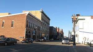
Walnut Street Historic District is a national historic district located at Muncie, Delaware County, Indiana. It encompasses 66 contributing buildings and 1 contributing object, and is located in the central business district of Muncie. The district includes notable examples of Italianate, Late Victorian, Colonial Revival, and Beaux-Arts style architecture. Located in the district are the separately listed Moore-Youse-Maxon House, Roberts Hotel, and Goddard Warehouse. Other notable buildings include the Patterson Bock (c. 1876), McNaughton Block (1901-1903), Mitchell Bock (1909), American National Bank Building (1924), Marsh Block (1888), and the Old Post Office designed by the Office of the Supervising Architect under James Knox Taylor (1907, 1930).[2]:50–53
It was added to the National Register of Historic Places in 1989.[1]
References
- 1 2 National Park Service (2010-07-09). "National Register Information System". National Register of Historic Places. National Park Service.
- ↑ "Indiana State Historic Architectural and Archaeological Research Database (SHAARD)" (Searchable database). Department of Natural Resources, Division of Historic Preservation and Archaeology. Retrieved 2015-08-01. Note: This includes Gary R. Rice; Lenny Lepola; Gretchen Bookout Cheesman & Paul C. Diebiold (May 1985). "National Register of Historic Places Inventory Nomination Form: Downtown Muncie MRA" (PDF). Retrieved 2015-08-01. and Accompanying photographs and site map.

