Wamego, Kansas
| Wamego, Kansas | |
|---|---|
| City | |
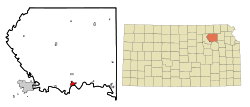 Location within Pottawatomie County and Kansas | |
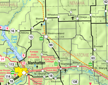 KDOT map of Pottawatomie County (legend) | |
| Coordinates: 39°12′15″N 96°18′30″W / 39.20417°N 96.30833°WCoordinates: 39°12′15″N 96°18′30″W / 39.20417°N 96.30833°W | |
| Country | United States |
| State | Kansas |
| County | Pottawatomie |
| Area[1] | |
| • Total | 2.25 sq mi (5.83 km2) |
| • Land | 2.21 sq mi (5.72 km2) |
| • Water | 0.04 sq mi (0.10 km2) |
| Elevation | 991 ft (302 m) |
| Population (2010)[2] | |
| • Total | 4,372 |
| • Estimate (2012[3]) | 4,485 |
| • Density | 1,900/sq mi (750/km2) |
| Time zone | Central (CST) (UTC-6) |
| • Summer (DST) | CDT (UTC-5) |
| ZIP code | 66547 |
| Area code | 785 |
| FIPS code | 20-75325 |
| GNIS feature ID | 0476420 [4] |
| Website |
wamego |
Wamego /wɔːˈmiːɡoʊ/ is a city in Pottawatomie County, Kansas, United States. As of the 2010 census, the city population was 4,372.[5]
History
Wamego was platted in 1866.[6] It was named for a Potawatomi Native American chief.[7]
The first post office in Wamego was established in October 1866.[8]
Geography
Wamego is located at 39°12′15″N 96°18′30″W / 39.20417°N 96.30833°W (39.204074, -96.308328).[9] According to the United States Census Bureau, the city has a total area of 2.25 square miles (5.83 km2), of which, 2.21 square miles (5.72 km2) is land and 0.04 square miles (0.10 km2) is water.[1]
Wamego is located at the intersection of U.S. Route 24 and K-99. It is about 14 mi (23 km) east of Manhattan; and about 42 mi (68 km) west-northwest of Topeka. The Kansas River flows along the southern edge of the city.
Climate
The climate in this area is characterized by hot, humid summers and generally mild to cool winters. According to the Köppen Climate Classification system, Wamego has a humid subtropical climate, abbreviated "Cfa" on climate maps.[10]
Demographics
| Historical population | |||
|---|---|---|---|
| Census | Pop. | %± | |
| 1890 | 1,473 | — | |
| 1900 | 1,618 | 9.8% | |
| 1910 | 1,714 | 5.9% | |
| 1920 | 1,585 | −7.5% | |
| 1930 | 1,647 | 3.9% | |
| 1940 | 1,767 | 7.3% | |
| 1950 | 1,869 | 5.8% | |
| 1960 | 2,363 | 26.4% | |
| 1970 | 2,507 | 6.1% | |
| 1980 | 3,159 | 26.0% | |
| 1990 | 3,706 | 17.3% | |
| 2000 | 4,246 | 14.6% | |
| 2010 | 4,372 | 3.0% | |
| Est. 2015 | 4,627 | [11] | 5.8% |
| U.S. Decennial Census[12] 2012 Estimate[13] | |||
Wamego is part of the Manhattan, Kansas Metropolitan Statistical Area.
2010 census
As of the census[2] of 2010, there were 4,372 people, 1,758 households, and 1,176 families residing in the city. The population density was 1,978.3 inhabitants per square mile (763.8/km2). There were 1,882 housing units at an average density of 851.6 per square mile (328.8/km2). The racial makeup of the city was 94.1% White, 0.8% African American, 0.6% Native American, 0.5% Asian, 0.1% Pacific Islander, 1.0% from other races, and 2.9% from two or more races. Hispanic or Latino of any race were 3.9% of the population.
There were 1,758 households of which 37.3% had children under the age of 18 living with them, 51.1% were married couples living together, 11.6% had a female householder with no husband present, 4.2% had a male householder with no wife present, and 33.1% were non-families. 27.5% of all households were made up of individuals and 12.2% had someone living alone who was 65 years of age or older. The average household size was 2.45 and the average family size was 3.00.
The median age in the city was 33.3 years. 27.3% of residents were under the age of 18; 8.5% were between the ages of 18 and 24; 28.6% were from 25 to 44; 22.3% were from 45 to 64; and 13.3% were 65 years of age or older. The gender makeup of the city was 47.6% male and 52.4% female.
2000 census
As of the census of 2000, there were 4,246 people, 1,630 households, and 1,155 families residing in the city. The population density was 2,615.3 people per square mile (1,012.0/km²). There were 1,740 housing units at an average density of 1,071.7 per square mile (414.7/km²). The racial makeup of the city was 96.75% White, 0.73% African American, 0.35% Native American, 0.12% Asian, 0.78% from other races, and 1.27% from two or more races. Hispanic or Latino of any race were 1.88% of the population.
There were 1,630 households out of which 38.3% had children under the age of 18 living with them, 56.7% were married couples living together, 10.8% had a female householder with no husband present, and 29.1% were non-families. 25.1% of all households were made up of individuals and 11.8% had someone living alone who was 65 years of age or older. The average household size was 2.57 and the average family size was 3.09.
In the city the population was spread out with 29.4% under the age of 18, 8.9% from 18 to 24, 29.3% from 25 to 44, 17.8% from 45 to 64, and 14.6% who were 65 years of age or older. The median age was 34 years. For every 100 females there were 93.3 males. For every 100 females age 18 and over, there were 88.7 males.
The median income for a household in the city was $38,115, and the median income for a family was $46,017. Males had a median income of $29,881 versus $21,974 for females. The per capita income for the city was $16,307. About 5.7% of families and 8.6% of the population were below the poverty line, including 9.1% of those under age 18 and 18.0% of those age 65 or over.
Economy
The primary industry of the area is agriculture. The broad river valley is used to grow alfalfa, sweetcorn, maize and wheat. In the hills around the city, rocky pastures support herds of cattle. There is a processing plant for alfalfa in Wamego. The other major industry is a factory which produces attachments for earth-moving and other heavy construction equipment, wholly owned by Caterpillar, Inc.. Many of the residents of the city commute to nearby areas for employment, chiefly Manhattan and Topeka.
In 2011, Caterpillar plans to add a new 40,000-square-foot building to its existing plant in Wamego. The expansion will eventually add 120 jobs to expand the total workforce at Wamego to about 500. The Wamego plant makes buckets, blades, and other tools.[14]
Area attractions
Oz Museum
Located in Wamego is a museum dedicated to The Wizard of Oz ,[15] featuring a collection of over 25,000 Oz artifacts on permanent loan from Friar Johnpaul Cafiero.[16][17] The Museum was founded in April 2004,[18] and led to the development of several other small businesses with the Oz theme, which have come to be known as the "Oz Cluster."[19] Prominent Oz-related businesses include the Oz Winery and Toto's Tacoz.[20] On the first weekend of October, Wamego holds its Annual OZtoberFEST, an Oktoberfest-type celebration with an Oz theme.[16] The annual street festival typically hosts Hot Air Balloon Rides, Tallgrass Brewery Beer Garden, the Yellow Brick Road Bike Ride, and a local stage or music production.[21]
 OZ Museum in 2008
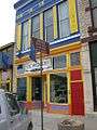 OZ Winery in 2008
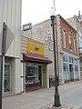 Toto's Tacoz in 2008
Points of interest
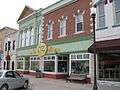
- The Columbian Theatre
- Wamego City Park and Windmill
- Poppyfield Gallery
- Walter Percy Chrysler boyhood home
- Wamego Public Library
- Patti Page Exhibit[22]
Filmmaking
Wamego served as the backdrop for the independent film production of Steve Balderson's surrealist crime drama, Firecracker. Named on Roger Ebert's list of the year's best films (2005), the film is based on a true crime that happened in Wamego. Balderson, a Wamego-native, used actual locations where the crime occurred.
Education
Wamego is served by Unified School District 320,[23][24] which provides Kindergarten through 12th grade public education. Highland Community College[25] has a branch facility in the city.
Notable people
- Steve Balderson, filmmaker
- Benjamin Butler, painter
- Walter Chrysler, automobile manufacturer, founder of Chrysler Corporation, born in Wamego but soon after his birth, his parents moved to Ellis, Kansas
- Maggie May, model, Playboy playmate
- Travis Metcalf, professional baseball player
- William Pickard, LSD chemist, was arrested one mile northwest of Wamego, serving two life sentences in federal prison
- Wiley Taylor, professional baseball player
See also
References
- 1 2 "US Gazetteer files 2010". United States Census Bureau. Retrieved 2012-07-06.
- 1 2 "American FactFinder". United States Census Bureau. Retrieved 2012-07-06.
- ↑ "Population Estimates". United States Census Bureau. Retrieved 2013-05-29.
- ↑ "US Board on Geographic Names". United States Geological Survey. 2007-10-25. Retrieved 2008-01-31.
- ↑ "2010 City Population and Housing Occupancy Status". U.S. Census Bureau. Retrieved December 29, 2011.
- ↑ Blackmar, Frank Wilson (1912). Kansas: A Cyclopedia of State History, Volume 2. Standard Publishing Company. p. 875.
- ↑ Kansas State Historical Society (1916). Biennial Report of the Board of Directors of the Kansas State Historical Society. Kansas State Printing Plant. p. 263.
- ↑ "Kansas Post Offices, 1828-1961, page 2". Kansas Historical Society. Retrieved 22 June 2014.
- ↑ "US Gazetteer files: 2010, 2000, and 1990". United States Census Bureau. 2011-02-12. Retrieved 2011-04-23.
- ↑ Climate Summary for Wamego, Kansas
- ↑ "Annual Estimates of the Resident Population for Incorporated Places: April 1, 2010 to July 1, 2015". Retrieved July 2, 2016.
- ↑ United States Census Bureau. "Census of Population and Housing". Retrieved February 14, 2014.
- ↑ "Annual Estimates of the Resident Population: April 1, 2010 to July 1, 2012". Retrieved February 14, 2014.
- ↑ Caterpillar to expand Kansas plant, add 120 jobs; Peoria Journal Star; August 18, 2011.
- ↑ The OZ Museum - Wamego, Kansas
- 1 2 http://www.oztoberfest.com/events/default.htm
- ↑ http://www.thefriars.org/atp/ATP-080320.pdf
- ↑ http://www.landmarkunitedstates.com/site/19196/OZ-Museum
- ↑ http://krex.k-state.edu/dspace/handle/2097/1331
- ↑ http://www.visitwamego.com/Things-To-Do/Oz-Attractions/default.aspx
- ↑ http://www.manhattanfreepress.com/efreepress09/eFreePress%2009.24.09.pdf
- ↑ http://cjonline.com/life/2009-08-01/exhibit_honors_patti_page
- ↑ http://www.wamegochamber.com/wamego/schools/default.htm
- ↑ http://www.usd320.k12.ks.us/welcome/
- ↑ http://highlandcc.edu/Site/Contact/Locations_and_Directions.php
External links
| Wikimedia Commons has media related to Wamego, Kansas. |
- City
- City of Wamego, official website
- Wamego - Directory of Public Officials
- Visit Wamego
- Schools
- USD 320, local school district
- Maps
- Wamego City Map, KDOT
Municipalities and communities of Pottawatomie County, Kansas, United States | ||
|---|---|---|
| Cities | 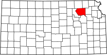 | |
| Unincorporated communities | ||
| Footnotes | ‡This populated place also has portions in an adjacent county or counties | |