Waukee, Iowa
| The city of Waukee | |
|---|---|
| City | |
| Motto: "The Key To Good Living"[1] | |
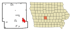 Location of Waukee, Iowa | |
| Coordinates: 41°36′32″N 93°51′55″W / 41.60889°N 93.86528°WCoordinates: 41°36′32″N 93°51′55″W / 41.60889°N 93.86528°W | |
| Country |
|
| State |
|
| County | Dallas |
| Area[2] | |
| • Total | 12.99 sq mi (33.64 km2) |
| • Land | 12.97 sq mi (33.59 km2) |
| • Water | 0.02 sq mi (0.05 km2) |
| Elevation | 1,030 ft (314 m) |
| Population (2010)[3] | |
| • Total | 13,790 |
| • Estimate (2013[4]) | 17,077 |
| • Density | 1,063.2/sq mi (410.5/km2) |
| Time zone | Central (CST) (UTC-6) |
| • Summer (DST) | CDT (UTC-5) |
| ZIP code | 50263 |
| Area code(s) | 515 |
| FIPS code | 19-82695 |
| GNIS feature ID | 0462752 |
| Website | City of Waukee, Iowa Website |
Waukee is a city in Dallas County, Iowa, United States. The population was 13,790 at the 2010 census. It is part of the Des Moines – West Des Moines Metropolitan Statistical Area.
History
Waukee was laid out as a town in 1869.[5] It is thought to be named after Milwaukee, Wisconsin.[6]
Waukee was incorporated on December 23, 1878,[7]
Geography
Waukee is located at 41°36′32″N 93°51′55″W / 41.60889°N 93.86528°W (41.608974, -93.865320).[8] According to the United States Census Bureau, the city has a total area of 12.99 square miles (33.64 km2), of which, 12.97 square miles (33.59 km2) is land and 0.02 square miles (0.05 km2) is water.[2]
Climate
Humid continental climate is a climatic region typified by large seasonal temperature differences, with warm to hot (and often humid) summers and cold (sometimes severely cold) winters. The Köppen Climate Classification subtype for this climate is "Dfa". (Hot Summer Continental Climate).[9]
Demographics
| Historical population | |||
|---|---|---|---|
| Census | Pop. | %± | |
| 1880 | 245 | — | |
| 1890 | 240 | −2.0% | |
| 1900 | 292 | 21.7% | |
| 1910 | 340 | 16.4% | |
| 1920 | 375 | 10.3% | |
| 1930 | 445 | 18.7% | |
| 1940 | 473 | 6.3% | |
| 1950 | 501 | 5.9% | |
| 1960 | 687 | 37.1% | |
| 1970 | 1,577 | 129.5% | |
| 1980 | 2,227 | 41.2% | |
| 1990 | 2,512 | 12.8% | |
| 2000 | 5,126 | 104.1% | |
| 2010 | 13,790 | 169.0% | |
| Est. 2015 | 18,990 | [10] | 37.7% |
2010 census
As of the census[3] of 2010, there were 13,790 people, 5,154 households, and 3,689 families residing in the city. The population density was 1,063.2 inhabitants per square mile (410.5/km2). There were 5,378 housing units at an average density of 414.6 per square mile (160.1/km2). The racial makeup of the city was 93.9% White, 1.3% African American, 0.2% Native American, 2.6% Asian, 0.1% Pacific Islander, 0.9% from other races, and 1.1% from two or more races. Hispanic or Latino of any race were 3.0% of the population.
There were 5,154 households of which 44.8% had children under the age of 18 living with them, 59.0% were married couples living together, 9.3% had a female householder with no husband present, 3.3% had a male householder with no wife present, and 28.4% were non-families. 23.0% of all households were made up of individuals and 6.7% had someone living alone who was 65 years of age or older. The average household size was 2.67 and the average family size was 3.19.
The median age in the city was 31.8 years. 32% of residents were under the age of 18; 5.1% were between the ages of 18 and 24; 36.3% were from 25 to 44; 18.5% were from 45 to 64; and 8% were 65 years of age or older. The gender makeup of the city was 48.6% male and 51.4% female.
2000 census
As of the census[12] of 2000, there were 5,126 people, 1,927 households, and 1,445 families residing in the city. The population density was 610.9 people per square mile (235.9/km²). There were 2,087 housing units at an average density of 248.7 per square mile (96.0/km²). The racial makeup of the city was 98.17% White, 0.43% African American, 0.57% Asian, 0.02% Pacific Islander, 0.31% from other races, and 0.51% from two or more races. Hispanic or Latino of any race were 0.74% of the population.
There were 1,927 households out of which 43.0% had children under the age of 18 living with them, 64.8% were married couples living together, 8.2% had a female householder with no husband present, and 25.0% were non-families. 21.1% of all households were made up of individuals and 6.7% had someone living alone who was 65 years of age or older. The average household size was 2.66 and the average family size was 3.12.
In the city the population was spread out with 30.4% under the age of 18, 5.5% from 18 to 24, 36.4% from 25 to 44, 19.9% from 45 to 64, and 7.6% who were 65 years of age or older. The median age was 33 years. For every 100 females there were 98.0 males. For every 100 females age 18 and over, there were 91.1 males.
The median income for a household in the city was $58,024, and the median income for a family was $64,362. Males had a median income of $38,958 and females had a median income of $30,898. The per capita income for the city was $24,351. About 2.1% of families and 3.0% of the population were below the poverty line, including 3.5% of those under age 18 and 6.6% of those age 65 or over.
Education
The Waukee Community School District is the fastest growing school district in the state of Iowa with more than 1,000 staff members serving more than 7,700 students in grades preschool through twelfth grade.[13] Its schools serve students from Clive, Urbandale, Waukee and West Des Moines as well as open enrollment students from other communities outside the 55 square miles of its district boundaries.[13] There are currently 12 school buildings operating in Waukee including seven elementary schools, two middle schools, two prairieviews (one called Timberline), (Waukee High School and Vincent Meyer Learning Center.[13]
Notable people
- Paul Gregory (producer) - film, Television and stage producer
- Joey Jordison — Former drummer for the band Slipknot
- Jake Knott — former Iowa State and Philadelphia Eagles linebacker
- Talia Leman — CEO and a founder of RandomKid, an organization that empowers young people to do good deeds
- Hal Manders — relief pitcher in Major League Baseball; born in Waukee[14]
- Ken Smith — internationally acclaimed landscape architect; born in Waukee[15]
See also
References
- ↑ "City of Waukee, Iowa". = City of Waukee, Iowa. Retrieved August 31, 2012.
- 1 2 "US Gazetteer files 2010". United States Census Bureau. Retrieved 2012-05-11.
- 1 2 "American FactFinder". United States Census Bureau. Retrieved 2012-05-11.
- ↑ "Population Estimates". United States Census Bureau. Retrieved 2015-06-27.
- ↑ The History of Dallas County, Iowa: Containing a History of the County, Its Cities, Towns, &c. Higginson Book Company. 1879. p. 489.
- ↑ "Profile for Waukee, Iowa, IA". ePodunk. Retrieved August 31, 2012.
- ↑ "Waukee, Iowa". City-Data.com. Retrieved August 31, 2012.
- ↑ "US Gazetteer files: 2010, 2000, and 1990". United States Census Bureau. 2011-02-12. Retrieved 2011-04-23.
- ↑ Climate Summary for closest city on record
- ↑ "Annual Estimates of the Resident Population for Incorporated Places: April 1, 2010 to July 1, 2015". Retrieved July 2, 2016.
- ↑ "Census of Population and Housing". Census.gov. Retrieved June 4, 2015.
- ↑ "American FactFinder". United States Census Bureau. Retrieved 2008-01-31.
- 1 2 3 https://www.waukee.k12.ia.us/our-district/about-the-district/
- ↑ "Hal Manders". = Baseball-Reference.com. Retrieved August 31, 2012.
- ↑ "Internationally renowned landscape architect Ken Smith to receive Christian Petersen Design Award at ISU". Iowa State University. Retrieved August 31, 2012.
External links
| Wikimedia Commons has media related to Waukee, Iowa. |
- City of Waukee, Iowa Website
- Chamber of commerce
- Waukee Community School District
- City-Data Comprehensive Statistical Data and more about Waukee
- ePodunk:Profile for Waukee, Iowa, IA
Municipalities and communities of Dallas County, Iowa, United States | ||
|---|---|---|
| Cities | ||
| Townships | ||
| Unincorporated communities | ||
| Footnotes | ‡This populated place also has portions in an adjacent county or counties | |