Weaubleau, Missouri
| Weaubleau, Missouri | |
|---|---|
| City | |
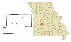 Location of Weaubleau, Missouri | |
| Coordinates: 37°53′30″N 93°32′28″W / 37.89167°N 93.54111°WCoordinates: 37°53′30″N 93°32′28″W / 37.89167°N 93.54111°W | |
| Country | United States |
| State | Missouri |
| County | Hickory |
| Area[1] | |
| • Total | 0.88 sq mi (2.28 km2) |
| • Land | 0.87 sq mi (2.25 km2) |
| • Water | 0.01 sq mi (0.03 km2) |
| Elevation | 978 ft (298 m) |
| Population (2010)[2] | |
| • Total | 418 |
| • Estimate (2012[3]) | 407 |
| • Density | 480.5/sq mi (185.5/km2) |
| Time zone | Central (CST) (UTC-6) |
| • Summer (DST) | CDT (UTC-5) |
| ZIP code | 65774 |
| Area code(s) | 417 |
| FIPS code | 29-78064[4] |
| GNIS feature ID | 0728443[5] |
Weaubleau is a town in Hickory County, Missouri, United States, founded in 1867.[6] The population was 418 at the 2010 census.
History
Weaubleau was first called Haran, but later renamed for the stream upon which it is located.[7] The town sprang up around the Weaubleau Christian College and Weaubleau Congregational Christian Church, which predated the town.[6]
Geography
Weaubleau is located at 37°53′30″N 93°32′28″W / 37.89167°N 93.54111°W (37.891647, -93.540987).[8]
According to the United States Census Bureau, the city has a total area of 0.88 square miles (2.28 km2), of which, 0.87 square miles (2.25 km2) is land and 0.01 square miles (0.03 km2) is water.[1]
Demographics
| Historical population | |||
|---|---|---|---|
| Census | Pop. | %± | |
| 1900 | 274 | — | |
| 1910 | 347 | 26.6% | |
| 1920 | 413 | 19.0% | |
| 1930 | 421 | 1.9% | |
| 1940 | 439 | 4.3% | |
| 1950 | 432 | −1.6% | |
| 1960 | 349 | −19.2% | |
| 1970 | 343 | −1.7% | |
| 1980 | 464 | 35.3% | |
| 1990 | 436 | −6.0% | |
| 2000 | 518 | 18.8% | |
| 2010 | 418 | −19.3% | |
| Est. 2015 | 398 | [9] | −4.8% |
2010 census
As of the census[2] of 2010, there were 418 people, 190 households, and 111 families residing in the city. The population density was 480.5 inhabitants per square mile (185.5/km2). There were 233 housing units at an average density of 267.8 per square mile (103.4/km2). The racial makeup of the city was 97.4% White, 0.2% African American, 0.7% Native American, and 1.7% from two or more races.
There were 190 households of which 26.8% had children under the age of 18 living with them, 42.1% were married couples living together, 13.2% had a female householder with no husband present, 3.2% had a male householder with no wife present, and 41.6% were non-families. 36.8% of all households were made up of individuals and 19.5% had someone living alone who was 65 years of age or older. The average household size was 2.20 and the average family size was 2.81.
The median age in the city was 46.3 years. 21.1% of residents were under the age of 18; 7.1% were between the ages of 18 and 24; 20.3% were from 25 to 44; 30.2% were from 45 to 64; and 21.3% were 65 years of age or older. The gender makeup of the city was 47.6% male and 52.4% female.
2000 census
As of the census[4] of 2000, there were 518 people, 220 households, and 133 families residing in the city. The population density was 590.8 people per square mile (227.3/km²). There were 257 housing units at an average density of 293.1 per square mile (112.8/km²). The racial makeup of the city was 97.68% White, 0.19% African American, 0.58% Native American, 0.19% from other races, and 1.35% from two or more races. Hispanic or Latino of any race were 1.16% of the population.
There were 220 households out of which 29.1% had children under the age of 18 living with them, 47.3% were married couples living together, 9.1% had a female householder with no husband present, and 39.5% were non-families. 33.2% of all households were made up of individuals and 19.5% had someone living alone who was 65 years of age or older. The average household size was 2.35 and the average family size was 3.02.
In the city the population was spread out with 26.3% under the age of 18, 8.1% from 18 to 24, 23.0% from 25 to 44, 21.2% from 45 to 64, and 21.4% who were 65 years of age or older. The median age was 39 years. For every 100 females there were 87.0 males. For every 100 females age 18 and over, there were 86.3 males.
The median income for a household in the city was $18,750, and the median income for a family was $21,765. Males had a median income of $19,643 versus $20,139 for females. The per capita income for the city was $9,952. About 17.6% of families and 27.3% of the population were below the poverty line, including 43.2% of those under age 18 and 18.0% of those age 65 or over.
References
- 1 2 "US Gazetteer files 2010". United States Census Bureau. Retrieved 2012-07-08.
- 1 2 "American FactFinder". United States Census Bureau. Retrieved 2012-07-08.
- ↑ "Population Estimates". United States Census Bureau. Retrieved 2013-05-30.
- 1 2 "American FactFinder". United States Census Bureau. Retrieved 2008-01-31.
- ↑ "US Board on Geographic Names". United States Geological Survey. 2007-10-25. Retrieved 2008-01-31.
- 1 2 Harryman, Eugene. "Weaubleau Congregational Christian Church". Weaubleau Congregational Christian Church. Retrieved 1 December 2015.
- ↑ Eaton, David Wolfe (1916). How Missouri Counties, Towns and Streams Were Named. The State Historical Society of Missouri. p. 173.
- ↑ "US Gazetteer files: 2010, 2000, and 1990". United States Census Bureau. 2011-02-12. Retrieved 2011-04-23.
- ↑ "Annual Estimates of the Resident Population for Incorporated Places: April 1, 2010 to July 1, 2015". Retrieved July 2, 2016.
- ↑ "Census of Population and Housing". Census.gov. Retrieved June 4, 2015.
Municipalities and communities of Hickory County, Missouri, United States | ||
|---|---|---|
| Cities | 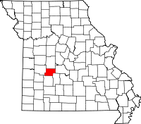 | |
| Village | ||
| Townships | ||
| Unincorporated communities | ||
| Footnotes | ‡This populated place also has portions in an adjacent county or counties | |