West Pittston, Pennsylvania
| West Pittston, Pennsylvania | |
|---|---|
| Borough | |
|
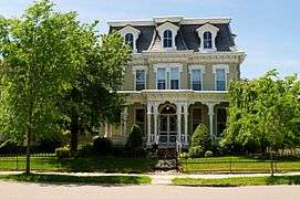
House on Luzerne Avenue | |
 West Pittston, Pennsylvania | |
| Coordinates: 41°19′45.35″N 75°47′56.57″W / 41.3292639°N 75.7990472°WCoordinates: 41°19′45.35″N 75°47′56.57″W / 41.3292639°N 75.7990472°W | |
| Country | United States |
| State | Pennsylvania |
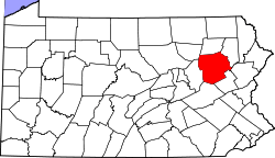
| County | Luzerne |
| Region | Greater Pittston |
| Settled | 1778 |
| Incorporated | 1857 |
| Government | |
| • Type | Borough Council |
| • Mayor | Tom Blaskiewicz |
| Area | |
| • Total | 1.0 sq mi (2.5 km2) |
| • Land | 0.8 sq mi (2.1 km2) |
| • Water | 0.2 sq mi (0.4 km2) |
| Population (2010) | |
| • Total | 4,868 |
| • Density | 5,000/sq mi (1,900/km2) |
| Time zone | Eastern (EST) (UTC-5) |
| • Summer (DST) | EDT (UTC-4) |
| Zip code | 18643 |
| Area code(s) | 570 |
West Pittston is a borough in the Greater Pittston area of Luzerne County, Pennsylvania, United States. It is located on the Susquehanna River opposite Pittston. As of the 2010 census it had a population of 4,868.[1]
The town once produced mine screens, cut glass, crackers, and knit and silk goods. West Pittston rose to national attention on September 8, 2011, when catastrophic flooding of the Susquehanna River caused by the remnants of Tropical Storm Lee left much of the borough under water. Nearing the end of 2012, many Tropical Storm Lee Refugees have yet to return to their homes.
Geography
West Pittston is located at 41°19′45″N 75°47′57″W / 41.32917°N 75.79917°W (41.329265, -75.799048).[2]
According to the United States Census Bureau, the borough has a total area of 0.97 square miles (2.5 km2), of which 0.81 square miles (2.1 km2) is land and 0.15 square miles (0.4 km2), or 15.10%, is water.[3]
West Pittston lies at the northern end of the Wyoming Valley, an area along the Susquehanna River. The cities of Wilkes-Barre and Pittston are also part of this valley.
The borough resides within the Wyoming Area School District.
Demographics
| Historical population | |||
|---|---|---|---|
| Census | Pop. | %± | |
| 1860 | 599 | — | |
| 1870 | 1,416 | 136.4% | |
| 1880 | 2,544 | 79.7% | |
| 1890 | 3,906 | 53.5% | |
| 1900 | 5,846 | 49.7% | |
| 1910 | 6,848 | 17.1% | |
| 1920 | 6,968 | 1.8% | |
| 1930 | 7,940 | 13.9% | |
| 1940 | 7,943 | 0.0% | |
| 1950 | 7,230 | −9.0% | |
| 1960 | 6,998 | −3.2% | |
| 1970 | 7,074 | 1.1% | |
| 1980 | 5,980 | −15.5% | |
| 1990 | 5,590 | −6.5% | |
| 2000 | 5,072 | −9.3% | |
| 2010 | 4,868 | −4.0% | |
| Est. 2015 | 4,772 | [4] | −2.0% |
| Sources:[5][6][7] | |||
As of the census[6] of 2000, there were 5,072 people, 2,243 households, and 1,397 families residing in the borough. The population density was 6,199.1 people per square mile (2,388.2/km2). There were 2,381 housing units at an average density of 2,910.1 per square mile (1,121.1/km2). The racial makeup of the borough was 98.8% White, 0.3% African American, 0.00% Native American, 0.1% Asian, 0.00% from other races, and 0.3% from two or more races. Hispanic or Latino of any race were 0.4% of the population.
There were 2,243 households, out of which 24.2% had children under the age of 18 living with them, 46.4% were married couples living together, 12.3% had a female householder with no husband present, and 37.7% were non-families. 34.0% of all households were made up of individuals, and 19.5% had someone living alone who was 65 years of age or older. The average household size was 2.26 and the average family size was 2.92.
In the borough the population was spread out, with 20.0% under the age of 18, 6.5% from 18 to 24, 27.3% from 25 to 44, 23.4% from 45 to 64, and 22.9% who were 65 years of age or older. The median age was 42 years. For every 100 females there were 82.4 males. For every 100 females age 18 and over, there were 77.5 males.
The median income for a household in the borough was $33,030, and the median income for a family was $41,729. Males had a median income of $35,386 versus $20,656 for females. The per capita income for the borough was $20,370. About 9.6% of families and 10.1% of the population were below the poverty line, including 20.5% of those under age 18 and 8.4% of those age 65 or over.
Community
Unlike the hardscrabble coal towns around it, West Pittston was generally a quiet town and home to the white-collar workers of the anthracite coal industry. As such, it fared better than its neighbors when the coal industry collapsed in the 1950s. Billed as the "Garden Village", it is home to several businesses of note: Keystone Automotive, Pride Mobility, the online gourmet food company Igourmet, the online classic Halloween decorations company RetroWeen, and Renaissance Entertainment Technologies. Blue Ribbon Farm Dairy Inc. is also located in West Pittston and known for their homemade ice cream.
The West Pittston Police Department was established in 1857. Sgt. Michael Turner is the current Officer in Charge.
West Pittston is the home of Company D: 1st Battalion, 109th Infantry Regiment, part of the 28th Infantry Division.
West Pittston was the site of the alleged Smurl haunting, as recounted in the book and movie The Haunted.
West Pittston was the birthplace of actress Marion Lorne, who portrayed Aunt Clara on the ABC sitcom Bewitched.
West Pittston is home to one of the first bridges illuminated by fiber optic cable. The bridge is outlined with a fiber optic cable which is coupled to a lighting control box. The colors of the lights can be changed manually to reflect holidays and local sporting rivalries or set to a mode which cycles colors over set intervals.
West Pittston has an annual Cherry Blossom Festival. The event usually begins on a Friday night with bands and food, but the official start is the parade on Saturday morning in which local school Wyoming Area Marching Band, Little League teams, Boy Scout troops and various local emergency service crews walk across town, ending at the festival. The festival continues all weekend with a Miss Cherry Blossom contest, musical concerts, and skit shows.

On September 8, 2011, the Susquehanna River, spurred by heavy rains from Tropical Storm Lee, crested at a record 42.66 feet (13.00 m), overflowing its banks, and flooding more than a quarter of the town. This was considered to be a historic flooding event which displaced thousands of people and caused millions of dollars in damages to businesses and homes.
Following record flooding, the non-profit organization West Pittston Tomorrow was founded. Its purpose is to provide activities for the betterment of the community, such as expanding the public library and creating community gardens. It also aims to provide for emergency notifications to residents through a block captain system.[8]
Notable people
- Marion Lorne, actress, was born in West Pittston.
References
- ↑ "Profile of General Population and Housing Characteristics: 2010 Demographic Profile Data (DP-1): West Pittston borough, Pennsylvania". U.S. Census Bureau, American Factfinder. Retrieved April 13, 2012.
- ↑ "US Gazetteer files: 2010, 2000, and 1990". United States Census Bureau. 2011-02-12. Retrieved 2011-04-23.
- ↑ "Geographic Identifiers: 2010 Demographic Profile Data (G001): West Pittston borough, Pennsylvania". U.S. Census Bureau, American Factfinder. Retrieved April 13, 2012.
- ↑ "Annual Estimates of the Resident Population for Incorporated Places: April 1, 2010 to July 1, 2015". Retrieved July 2, 2016.
- ↑ "Census of Population and Housing". U.S. Census Bureau. Retrieved 11 December 2013.
- 1 2 "American FactFinder". United States Census Bureau. Retrieved 2008-01-31.
- ↑ "Incorporated Places and Minor Civil Divisions Datasets: Subcounty Resident Population Estimates: April 1, 2010 to July 1, 2012". Population Estimates. U.S. Census Bureau. Retrieved 11 December 2013.
- ↑ "W. Pittston volunteers eye next emergency". The Times Leader. Retrieved May 14, 2013.

