Westfield Township, Medina County, Ohio
| Westfield Township, Medina County, Ohio | |
|---|---|
| Township | |
 Location of Westfield Township in Medina County | |
| Coordinates: 41°1′44″N 81°55′47″W / 41.02889°N 81.92972°WCoordinates: 41°1′44″N 81°55′47″W / 41.02889°N 81.92972°W | |
| Country | United States |
| State | Ohio |
| County | Medina |
| Area | |
| • Total | 25.5 sq mi (66.1 km2) |
| • Land | 25.4 sq mi (65.8 km2) |
| • Water | 0.1 sq mi (0.4 km2) |
| Elevation[1] | 1,017 ft (310 m) |
| Population (2000) | |
| • Total | 4,172 |
| • Density | 164.2/sq mi (63.4/km2) |
| Time zone | Eastern (EST) (UTC-5) |
| • Summer (DST) | EDT (UTC-4) |
| FIPS code | 39-83426[2] |
| GNIS feature ID | 1086606[1] |
Westfield Township is one of the seventeen townships of Medina County, Ohio, United States. The 2000 census found 4,172 people in the township, 2,545 of whom lived in the unincorporated portions of the township.[3]
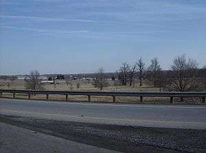
Geography
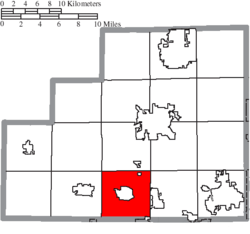
Located in the southern part of the county, it borders the following townships:
- Lafayette Township - north
- Montville Township - northeast corner
- Guilford Township - east
- Milton Township, Wayne County - southeast corner
- Canaan Township, Wayne County - south
- Harrisville Township - west
- Chatham Township - northwest corner
Three villages are located in Westfield Township:
- Part of Creston, in the southeast
- Part of Gloria Glens Park, in the northeast
- Westfield Center, in the center
Name and history
Statewide, the only other Westfield Township is located in Morrow County.
Government
The township is governed by a three-member board of trustees, who are elected in November of odd-numbered years to a four-year term beginning on the following January 1. Two are elected in the year after the presidential election and one is elected in the year before it. There is also an elected township fiscal officer,[4] who serves a four-year term beginning on April 1 of the year after the election, which is held in November of the year before the presidential election. Vacancies in the fiscal officership or on the board of trustees are filled by the remaining trustees.
References
- 1 2 "US Board on Geographic Names". United States Geological Survey. 2007-10-25. Retrieved 2008-01-31.
- ↑ "American FactFinder". United States Census Bureau. Retrieved 2008-01-31.
- ↑ Medina County, Ohio — Population by Places Estimates Ohio State University, 2007. Accessed 15 May 2007.
- ↑ §503.24, §505.01, and §507.01 of the Ohio Revised Code. Accessed 4/30/2009.
External links
Municipalities and communities of Medina County, Ohio, United States | ||
|---|---|---|
| Cities | 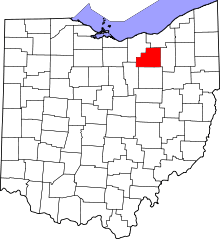 | |
| Villages | ||
| Townships | ||
| Unincorporated communities | ||
| Footnotes | ‡This populated place also has portions in an adjacent county or counties | |