Homerville, Ohio
| Homerville, Ohio | |
|---|---|
| Unincorporated community | |
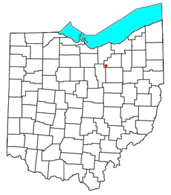 Location of Homerville, Ohio | |
| Coordinates: 41°01′45″N 82°07′34″W / 41.02917°N 82.12611°WCoordinates: 41°01′45″N 82°07′34″W / 41.02917°N 82.12611°W | |
| Country | United States |
| State | Ohio |
| County | Medina |
| Township | Homer |
| Time zone | Eastern (EST) (UTC-5) |
| • Summer (DST) | EDT (UTC-4) |
| ZIP codes | 44235 |
Homerville is an unincorporated community in central Homer Township, Medina County, Ohio, United States. Although it is unincorporated, it has a post office, with the ZIP code of 44235.[1] It lies at the intersection of U.S. Route 224 with State Route 301.
Homerville is situated in the rural quad-county area where Ashland, Lorain, Medina, and Wayne Counties meet. The economy is based largely upon agriculture, including livestock raising, dairy farming, and crop farming. Children in the Homerville area attend the schools of Black River School District.
A post office called Homerville has been in operation since 1844.[2] The community's name commemorates Homer, the Ancient Greek poet.[3]
References
- ↑ Zip Code Lookup
- ↑ "Medina County". Jim Forte Postal History. Retrieved 1 November 2015.
- ↑ "The 'other' Homerville". The Clinch County News. Mar 1, 2006. p. 1. Retrieved 1 November 2015.
Municipalities and communities of Medina County, Ohio, United States | ||
|---|---|---|
| Cities | 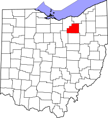 | |
| Villages | ||
| Townships | ||
| Unincorporated communities | ||
| Footnotes | ‡This populated place also has portions in an adjacent county or counties | |
This article is issued from Wikipedia - version of the 9/4/2016. The text is available under the Creative Commons Attribution/Share Alike but additional terms may apply for the media files.