Wimberley, Texas
| Wimberley, Texas | |
|---|---|
| City | |
|
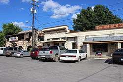
Downtown Wimberley | |
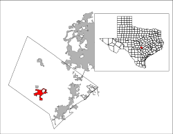 Location of Wimberley, Texas | |
| Coordinates: 29°59′44″N 98°6′3″W / 29.99556°N 98.10083°WCoordinates: 29°59′44″N 98°6′3″W / 29.99556°N 98.10083°W | |
| Country | United States |
| State | Texas |
| County | Hays |
| Settled (as Winters' Mill) | 1856 |
| Named | 1880 |
| Incorporated (city) | 2000 |
| Founded by | Preston Justice Nielson |
| Named for | Pleasant Wimberley |
| Government | |
| • Type | Mayor-council government |
| • Mayor | Steve Thurber [1] |
| Area | |
| • Total | 16.1 sq mi (41.8 km2) |
| • Land | 16.1 sq mi (41.8 km2) |
| • Water | 0.0 sq mi (0.0 km2) |
| Elevation | 860 ft (262 m) |
| Population (2010) | |
| • Total | 2,626 |
| • Density | 160/sq mi (63/km2) |
| Time zone | Central (CST) (UTC-6) |
| • Summer (DST) | CDT (UTC-5) |
| ZIP code | 78676 |
| Area code(s) | 512 & 737 |
| FIPS code | 48-79624 [2] |
| GNIS feature ID | 1350280 [3] |
| Website | City Website |
Wimberley is a city in Hays County, Texas, United States. The population was 2,626 at the 2010 census.[4]
History
Wimberley started as a trading post settlement near Cypress Creek in 1848, the year Hays County was organized. After William Carvin Winters built a gristmill at the site in 1856, it took on the name Winters' Mill. When the mill was sold in 1864 to the Cude family, its name was changed to Cude's Mill. It was sold again in 1874 to Pleasant Wimberley and took on his name. Over the years, the mill was expanded to process lumber, shingles, flour, molasses, and cotton.
In 1880, Alfred vom Stein, a postmaster from San Marcos, applied to have a post office established in the community, calling it Wimberleyville. The application was granted, but the name shortened to Wimberley. Although the mill was shut down in 1925, the community was established and continued to grow, eventually becoming known as a resort town and becoming popular with tourists.[5] Prior to its incorporation in May 2000,[6] it was a census-designated place (CDP).
On May 25, 2015, the town was hit by catastrophic flooding during the 2015 Texas–Oklahoma floods, along the Blanco River which flows through town. The river crested at an estimated 41.5 feet, which was almost 30 feet above flood stage.
Geography
Wimberley is located at 29°59′44″N 98°06′03″W / 29.995474°N 98.100832°W (29.995474, -98.100832),[7] 28 miles (45 km) southwest of Austin and 46 mi (74 km) northeast of San Antonio.
According to the United States Census Bureau, the CDP had a total area of 16.1 sq mi (42 km2), all of it land.
Cypress Creek joins the Blanco River in Wimberley. The Blanco then continues until it joins the San Marcos River. Blue Hole and Jacob's Well are located along Cypress Creek.
Climate
The climate in this area is characterized by hot, humid summers and generally mild to cool winters. According to the Köppen climate classification system, Wimberley has a humid subtropical climate, Cfa on climate maps.[8]
Demographics
| Historical population | |||
|---|---|---|---|
| Census | Pop. | %± | |
| 2010 | 2,626 | — | |
| Est. 2015 | 2,670 | [9] | 1.7% |
As of the census[2] of 2000, 3,797 people, 1,576 households, and 1,076 families resided in the CDP. The population density was 235.3 people per square mile (90.8/km2). The 1,928 housing units averaged 119.5 per square mile (46.1/km2). The racial makeup of the CDP was 94.52% White, 0.18% African American, 0.79% Native American, 0.13% Asian, 0.08% Pacific Islander, 2.98% from other races and 1.32% from two or more races. Hispanics or Latinos of any race were 6.93% of the population.
Of the 1,576 households, 27.2% had children under the age of 18 living with them, 56.6% were married couples living together, 9.1% had a female householder with no husband present, and 31.7% were not families. About 26.6% of all households were made up of individuals and 11.4% had someone living alone who was 65 years of age or older. The average household size was 2.34 and the average family size was 2.79.
In the CDP, the population was distributed as 21.5% under the age of 18, 4.7% from 18 to 24, 22.5% from 25 to 44, 28.9% from 45 to 64, and 22.3% 65 years of age or older. The median age was 46 years. For every 100 females, there were 89.3 males. For every 100 females age 18 and over, there were 86.0 males.
The median income for a household in the CDP was $46,042, and for a family was $56,910. Males had a median income of $41,019 versus $26,729 for females. The per capita income for the CDP was $25,033. About 3.0% of families and 3.9% of the population were below the poverty line, including 3.2% of those under age 18 and 5.0% of those age 65 or over.
Education
Wimberley Public Schools are part of the Wimberley Independent School District. The district has one primary school, one elementary school, one junior high school, and one high school. Students attend Wimberley High School, Scudder Primary School, Jacob's Well Elementary School and Danforth Junior High School.[11]
Notable people
- Sarah Jarosz, bluegrass singer-songwriter and multi-instrumentalist, was raised in Wimberley.
- Leon Jaworski, special prosecutor in the Watergate Scandal, died in Wimberley in 1982 while chopping wood at his Circle J. Ranch
- Rupert Neve, renowned British creator of audio recording equipment bearing his name, lives in Wimberley.
Further reading
- Kerbow, Dorothy Wimberley (July 1994). Wimberley, Texas: Historic Belle of the Blanco. Eakin Press Company. ISBN 978-0-89015-964-4.
References
- ↑ "Election '10". Wimberley City Council. Retrieved April 30, 2010.
- 1 2 "American FactFinder". United States Census Bureau. Retrieved 2008-01-31.
- ↑ "US Board on Geographic Names". United States Geological Survey. 2007-10-25. Retrieved 2008-01-31.
- ↑ http://factfinder2.census.gov/faces/nav/jsf/pages/community_facts.xhtml#none
- ↑ Kerbow, Dorothy Wimberley (February 22, 2010). "Wimberley, Texas". Handbook of Texas. Texas State Historical Association. Retrieved April 30, 2010.
- ↑ "Boundary Changes". Geographic Change Notes: Texas. Population Division, United States Census Bureau. 2006-05-19. Retrieved 2008-05-27.
- ↑ "US Gazetteer files: 2010, 2000, and 1990". United States Census Bureau. 2011-02-12. Retrieved 2011-04-23.
- ↑ Climate Summary for Wimberley, Texas
- ↑ "Annual Estimates of the Resident Population for Incorporated Places: April 1, 2010 to July 1, 2015". Retrieved July 2, 2016.
- ↑ "Census of Population and Housing". Census.gov. Retrieved June 4, 2015.
- ↑ "Wimberley Independent School District". Wimberley Independent School District. Retrieved August 4, 2012.
External links
| Wikimedia Commons has media related to Wimberley, Texas. |
- City of Wimberley
- Official Wimberley High School Subreddit
- Official Wimberley Chamber of Commerce site
- Wimberley from the Handbook of Texas Online
Municipalities and communities of Hays County, Texas, United States | ||
|---|---|---|
| Cities |  | |
| Village | ||
| CDP | ||
| Footnotes | ‡This populated place also has portions in an adjacent county or counties | |
| Central city | 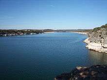 | ||||||
|---|---|---|---|---|---|---|---|
| Satellite cities | |||||||
| Other communities | |||||||
| Counties |
| ||||||
| Parks and preserves |
| ||||||
| Geography | |||||||
| Bodies of water | |||||||
| Transportation | |||||||