Ynys Bery
 Ynys Bery from Ramsey Island | |
 Ynys Bery | |
| Geography | |
|---|---|
| Coordinates | 51°50′56.72″N 5°20′27.02″W / 51.8490889°N 5.3408389°W |
| Administration | |
|
Wales | |
| County | Pembrokeshire |
| Demographics | |
| Population | 0 |
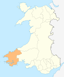
Ynys Bery is a small island south of Ramsey Island, Pembrokeshire, Wales.
Etymology
The island's name in Welsh means falcon's Island.[1]
History
It is the site of a shipwreck: the S.S. Graffoe (a 2,996-ton steamship bound from Glasgow to Buenos Aires with coal) struck Ramsey Island and sank at the northern end of Ynys Bery in 1903. It lies at a depth of 15 metres, and is one of many Pembrokeshire wrecks popular with divers. Ynys Bery's highest point is 71 metres[2] (233 feet), the highest of Wales`s islets.
See also
References
- ↑ Will. Basil Jones (1852). The History and Antiquities of Saint David's: By Will. Basil Jones and Edw. A. Freeman. 1. Pickering, Parker and Petheram. p. 17.
- ↑ Ynys Bery on www.hill-bagging.co.uk
External links
- grid reference SM700220
 Media related to Ynys Bery at Wikimedia Commons
Coordinates: 51°50′57″N 5°20′27″W / 51.84909°N 5.34084°W
This article is issued from Wikipedia - version of the 11/11/2016. The text is available under the Creative Commons Attribution/Share Alike but additional terms may apply for the media files.
