Ramsey Island
| Native name: <span class="nickname" ">Ynys Dewi | |
|---|---|
 Ramsey Island viewed from St David's Head | |
 Ramsey | |
| Geography | |
| Location | St Brides Bay |
| Coordinates | 51°51′42″N 5°20′34″W / 51.86167°N 5.34278°W |
| Length | 3.2 km (1.99 mi) |
| Highest elevation | 136 m (446 ft) |
| Highest point | Carnllundain |
| Administration | |
|
Wales | |
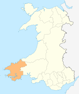
| County | Pembrokeshire |
| Demographics | |
| Population | 2 |
| Ethnic groups | Welsh people |
Ramsey Island (Welsh: Ynys Dewi) is an island about 1 km off the coast of the St David's peninsula in Pembrokeshire on the northern side of St Brides Bay, in southwest Wales. It is 640 acres (259.00 hectares) in area.
In Welsh the island is named after Saint David (Dewi Sant), the patron saint of Wales. It was the home of his confessor, Saint Justinian. The nearest town, strictly a city, is St David's.
Ramsey Island is less than 3.2 km (2 mi) long and its highest point is 136 metres (446 ft) above sea level at Carnllundain, and is listed as a HuMP. It is the fourth largest island in Wales, after Anglesey, Holy Island and Skomer.[1]
Geology
The island has a diverse geology for a relatively small area; it comprises sedimentary, volcanic and intrusive igneous rocks dating from the early Palaeozoic Era. The larger part of the north of the island is formed from mudstones of the Tetragraptus Mudstone Formation (also known as the 'Penmaen Dewi Shale Formation' and again as the 'Road Uchaf Formation' (sic) after the Rhod Uchaf locality on the island's east coast). However Carnysgubor stands proud to their west as it is formed from a more resistant microtonalite intrusion. In contrast the coastal cliffs between Trwyn-drain-du and Trwyn-Sion-Owen and also between Trwyn Ogof Hen and Rhod Uchaf are formed by sedimentary rocks, the mica-rich Lingula Flags and the sandstones and mudstones of the Ogof Hen Formation. The rock strata is typically steeply tilted and commonly faulted.
Running NW-SE across the centre of the island from Aber Mawr to the vicinity of The Bitches is a band of late Arenig age tuffs and 'pencil slates' assigned to the Abermawr Formation. Its boundary with the sediments to the north is a fault.
The south of the island is dominated by a rhyolite intrusion as are the islets off its southern coast. To the west of the Ramsey Fault which runs from Aber Mawr to Porth Lleuog, is Carnllundain which is formed from the tough rhyolitic tuffs of the Carn Llundain Formation. These tuffs arose as volcanic ash falls, ash flows and turbidite deposits. Smaller areas of dark grey mudstones interbedded with debris flows grouped together as the Porth Llauog Formation occur around the margins of the rhyolite. Part of the southern margin of the inlet of Aber Mawr is characterised by the mudstones and sandstones of the Trwyn Llundain Formation, a part of the Solva Group of Cambrian rocks.[2][3]
Ramsey Sound
The waters around the island have significant tidal effects, and tidal waterfalls occur between The Bitches.[4][5][6][7][8] The asymmetrical underwater flow can be 3.8 m/s (12.5 ft/s) northward (flood) and 1.9 m/s (6.2 ft/s) southward (ebb), with some turbulence. The sound reaches some 66 metres (217 feet) deep, although a tidal island called Horse Rock protrudes from the water at low tide.[9]
A 400 kW tidal power turbine project was planned from 2014[10][11][12][13][14] and the first turbine of three was installed in December 2015.[15]
Nature Reserve
Owned and managed by the Royal Society for the Protection of Birds (RSPB),[16] the island has spectacular bird cliffs, coastal scenery and heathland. Ramsey has the most important grey seal breeding colony in southern Britain, with over 400 seal pups born each autumn.[16] It is one of the best sites in Wales to see choughs.
Other breeding species include ravens, common buzzards, peregrines, northern wheatears, gulls, auks, Manx shearwaters, razorbills and guillemots.
With a permanent population of just two human residents, the Royal Society for the Protection of Birds (RSPB) Warden and Assistant Warden who live in a farmhouse there, the island is otherwise uninhabited. Tourist boats sail around the island and a ferry service run by Thousand Islands Expeditions operates from Easter-31 October from Saint Justinian's RNLI lifeboat station on the mainland.
Ramsey Island is surrounded by a number of smaller islands, islets and rock clusters, including:
- Bancyn-ffald
- The Bitches tidal race
- The Bishops and Clerks group, including:
- Carreg Rhoson and Maen Rhoson
- Carreg-trai
- Cribog
- Daufraich and Maen Daufraich
- Emsger or South Bishop (37 metres, 121 feet)
- Llechau-isaf and Llechau-uchaf
- Moelyn
- North Bishop (44 metres, 144 feet)
- Carreg-gwylan
- Meini Duon (Black Rocks)
- The Bitches
- Trwynmynachdy
- Ynys Bery (71 metres, 233 feet)
- Ynys Cantwr (tidal island; 54 metres, 177 feet)
- Ynys Eilun and Pont yr Eilun
- Ynys Gwelltog (Grassy Island; 56 metres, 184 feet)
Sources
- ↑ The Rough Guide to Wales, Rough Guides, Rough Guide Travel Guides, Mike Parker, Paul Whitfield, 4, illustrated, Rough Guides, 2003, ISBN 1-84353-120-8, ISBN 978-1-84353-120-3, pg. 194
- ↑ British Geological Survey 1992 1:50,000 scale provisional geological map sheet 209 (England and Wales) St David's
- ↑ Howells, M.F. 2007 British Regional Geology: Wales (Keyworth, Nottingham, British Geological Survey) pp45-51
- ↑ "Nature"
- ↑ "The Bitches". the-bitches.co.uk.
- ↑ -. "Bitches tidal rapid - South - Wales - Rivers - The UK Rivers Guidebook". ukriversguidebook.co.uk.
- ↑ "Canoe Wales -". canoewales.com.
- ↑ "Bitches and Tides"
- ↑ Evans, Paul Stephen (2014). Hydrodynamic characteristics of macrotidal straits and implications for tidal stream turbine deployment pages 107-109, 169. PhD Thesis, Cardiff University
- ↑ Macalister, Terry. "Tidal power firm signs deal to sell electricity to EDF Energy" The Guardian, 25 September 2014.
- ↑ , Ellie. "First full-scale tidal generator in Wales unveiled: Deltastream array to power 10,000 homes using ebb and flow of the ocean" Daily Mail, 7 August 2014.
- ↑ Chris Kelsey (17 June 2015). "DeltaStream tidal energy device further delayed as company seeks new funding". walesonline.
- ↑ "Tidal Energy Ltd » Talking Tides: Martin Murphy of Tidal Energy". tidalenergyltd.com.
- ↑ "Turbine design turns the tide for renewables". eurekamagazine.co.uk.
- ↑ "Giant tidal turbine placed on seabed off Pembrokeshire". BBC. 14 December 2015. Retrieved 14 December 2015.
- 1 2 Countryside Council for Wales, National Nature Reserves|Ramsey (retrieved 2011-10-28).
External links
| Wikimedia Commons has media related to Ramsey Island. |
- RSPB website
- RSPB ferry to Ramsey Island
- Ramsey Island RSPB Nature Reserve
- CPRW description
- JNCC description – includes map of GB showing location
- Guided Geology Walks on Ramsey Island
- Map sources for Ramsey Island
Coordinates: 51°51′42″N 5°20′34″W / 51.86167°N 5.34278°W