Čitluk, Bosnia and Herzegovina
| Čitluk Читлук | ||
|---|---|---|
| Municipality and town | ||
 | ||
| ||
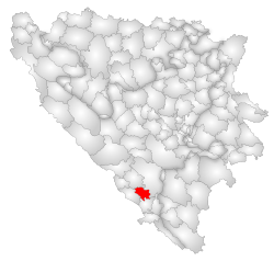 Location of Čitluk within Bosnia and Herzegovina. | ||
 Čitluk Location of Čitluk | ||
| Coordinates: 43°12′N 17°42′E / 43.200°N 17.700°E | ||
| Country |
| |
| Government | ||
| • Municipality president | Ivo Jerkić (HDZ BiH) | |
| Area | ||
| • Total | 181 km2 (70 sq mi) | |
| Population (2013 census) | ||
| • Total | 18,552 | |
| • Density | 102,5/km2 (2,650/sq mi) | |
| Time zone | CET (UTC+1) | |
| • Summer (DST) | CEST (UTC+2) | |
| Area code(s) | +387 36 | |
| Website | http://www.citluk.ba | |

Čitluk ![]() listen Latin: Aequum is a town and municipality located in Herzegovina, in southern Bosnia and Herzegovina. It is a municipality of the Herzegovina-Neretva Canton in the Federation of Bosnia and Herzegovina.
listen Latin: Aequum is a town and municipality located in Herzegovina, in southern Bosnia and Herzegovina. It is a municipality of the Herzegovina-Neretva Canton in the Federation of Bosnia and Herzegovina.
Overview
The municipality includes the village of Međugorje where Marian apparitions have been reported.
Other nearby places are Služanj, Potpolje, Blatnica, Čerin, Hamzići and Gornji Veliki Ograđenik. The rich soil in this area is used for growing wine-producing grapes. Many varieties grown in Brotnjo are popular throughout the world (e.g., Blatina).
Population/Demographics
1971
15,359 total
1991
In 1991, the municipality had a population of 14,709, of which there were
- 14,544 Croats (98.9%)
- 110 Bosniaks (0.8%)
- 19 Serbs (0.1%)
- 17 Yugoslavs (0.1%) * 19 others (0.1%)
The town of Čitluk had 4,317 residents: with 99% of those being Croats.
Settlements
• Bijakovići • Biletići • Blatnica • Blizanci • Čalići • Čerin • Čitluk • Dobro Selo • Dragičina • Gradnići • Hamzići • Krehin Gradac • Krućevići • Mali Ograđenik • Međugorje • Paoča • Potpolje • Služanj • Tromeđa City • Tepčići • Veliki Ograđenik i Vionica.
Sports
The town is home to the football club NK Brotnjo, and the basketball club HKK Brotnjo.
Notable people
- Marin Čilić, tennis player
- Zoran Planinić, basketball player
- Mate Bulić, singer
- Ivica Zubac, basketball player
Twin cities
External links
| Wikimedia Commons has media related to Čitluk. |
- Municipality of Čitluk-official website (Croatian)
Municipalities of the Herzegovina-Neretva Canton | ||
|---|---|---|
Coordinates: 43°12′N 17°42′E / 43.2°N 17.7°E