Agostinho Neto Airport
For the airport in the Republic of the Congo, see Agostinho Neto International Airport
| Agostinho Neto Airport Aeroporto de Agostinho Neto | |||||||||||
|---|---|---|---|---|---|---|---|---|---|---|---|
| IATA: NTO – ICAO: GVAN | |||||||||||
| Summary | |||||||||||
| Airport type | Public | ||||||||||
| Owner | ASA | ||||||||||
| Operator | TACV | ||||||||||
| Serves | Ribeira-Grande, Praia, São Vicente, Sal | ||||||||||
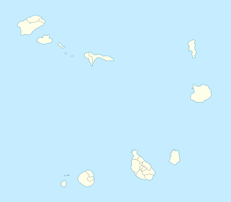
| Location | Ponta do Sol, Santo Antão, Cape Verde | ||||||||||
| Closed | late 2000s | ||||||||||
| Elevation AMSL | 32 ft / 10 m | ||||||||||
| Coordinates | 17°12′11″N 25°05′27″W / 17.203058°N 25.090874°WCoordinates: 17°12′11″N 25°05′27″W / 17.203058°N 25.090874°W | ||||||||||
| Map | |||||||||||
 GVAN Location of Aeródromo Agostinho Neto/Ilha de São Antão in Cape Verde | |||||||||||
| Runways | |||||||||||
| |||||||||||
|
Aeroporto Inactivo | |||||||||||
The Agostinho Neto (Portuguese Aeroporto Agostinho Neto) (IATA: NTO, ICAO: GVAN) is an airport in Cape Verde located next to the town of Ponta do Sol, Cape Verde on the northern tip of the island of Santo Antão. The airport was named after Agostinho Neto, an Angolan politician. The airport was first constructed in the 1960s and adopted the name in the 1970s after independence. Because of dangerous crosswinds and weather that is often below VFR minima, the airport is closed since March 2007 and was until further notice, the island's airport would never be located at Ponta do Sol again. The island's airport service would be on São Vicente. Along with Brava, it is an island without its own airport.
In 2010, there were plans to revive the airport and surveying the area to locate it in a new safe location without crosswinds, its location around Porto Sul, 7 kilometers from Porto Novo[1][2]
See also
- List of airports in Cape Verde
- Agostinho Neto International Airport, another airport named after in Pointe-Noire in the Republic of the Congo
References
- ↑ "Novo aeroporto de Santo Antão será em Ponte Sul, no Porto Novo" (in Portuguese). Neves Travel. 1 February 2010.
- ↑ "OJE. Apresentados estudos para localização novo aeroporto de Santo Antão, em Cabo Verde" [Several Studies on the New Airport's Location for Santo Antão, Cape Verde] (in Portuguese). OJE.
External links
| Parishes | 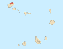 | |
|---|---|---|
| Communities and settlements | ||
| Geographical features |
| |
| Landmarks and points of Interests | ||
| Defunct airport | ||
| Culture |
| |