Moroços
| Moroços Natural Park | |
|---|---|
| Area | around 15 km² |
Moroços Natural Park (Parque Natural do Moroços), in the middle of the island of Santo Antão, is one of nine "natural parks" in the country of Cape Verde.[1] It can sometime be known as Moroços-Gudo de Cavaleiro, Moroços are named after three summits sharing the same name. The area is around 20 km² and is the island's second largest. The area covers the southwesternmost part of the municipality of Ribeira Grande, the southern portion also forms a boundary with Porto Novo. Its length is 5 km and its width is about 1.5 km, the length curves toward the northwest and the width shrinks in the northwestern portion.
The nearest settlement to the park is Lagoa in the southeast a kilometer from the crater and more than 2 km from the natural park, further east is Lagoinha and the smaller unhabited settlement of Espadana (rarely Lagoa III). Northeast is the village of Garça de Cima and bbout 1.5 kilometers southwest is the village of Alto Mira along with its stream.
About the Natural Park
The natural park includes the three Moroços summit along with Monte Hortelão, taller than Gudo de Moroço and the island's third tallest summit, Gudo de Cavaleiro. The southeastern portion features some trees, much of it are grasslands and features several rock formations. The natural park features a dirt road and has its terminus in the northwestern portion and are connected with a trail connecting to Figueiras de Baixo.
The park has one of three sources of Ribeira da Garça known as Cabuca Dragum which flows to the north, southwest is the source of Ribeira Alto Mira and northwest not far from its boundaries as the source of the smaller Ribeira da Figueiras.
Rock formations includes that of the Lagoa Group and parts of the Coroa Group consisting of nephelite rocks, it was formed in around 400,000 to 100,000 years ago. [2]
East of the natural part is the Espadana Crater elevating 1,513 meters, a volcanic crater with a diameter of slightly more than a kilometer.
Other geographical features as well as notable landmarks in the natural park includes:
- Gudo de Cavaleiro, the island's third tallest mountain and one of the tallest in Cape Verde elevating 1,811 meters
- Monte Moroço, a mountain elevating 1,676 meters
- Cruz de Moroço, a summit elevating 1,646 meters
- Gudo dos Moroços, a peak elevating 1,604 meters
- Monte Hortelão, a summit elevating 1,631 meters, taller than Gudo dos Moroços
Panoramics
Up above it has panoramic views of much of the island including its nearby valleys and except for Tarrafal de Monte Trigo and the outer parts of the island's northern part, it has a view of Canal de São Vicente along with the island of São Vicente and its adjacent islands and the western part of São Nicolau.
See also
References
- ↑ Espaços Naturais Protegidos , 2013
- ↑ Holm, Paul Martin (2006). Sampling the Cape Verde Mantle Plume: Evolution of Melt Compositions on Santo Antão, Cape Verde Island. 47. p. 145-18. doi:10.1093/petrology/egi071.
| Parishes | 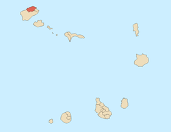 | |
|---|---|---|
| Communities and settlements | ||
| Geographical features |
| |
| Landmarks and points of Interests | ||
| Defunct airport | ||
| Culture |
| |
Coordinates: 17°05′50″N 25°11′10″W / 17.0972°N 25.186°W