Corda, Ribeira Grande
| Corda | |
|---|---|
| Settlement | |
 Corda | |
| Coordinates: 17°08′10″N 25°05′17″W / 17.136°N 25.088°WCoordinates: 17°08′10″N 25°05′17″W / 17.136°N 25.088°W | |
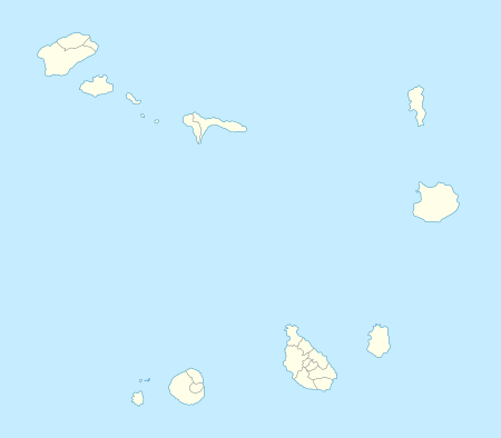
| Country | Cape Verde |
| Island | Santo Antão |
| Municipality | Ribeira Grande |
| Civil parish | Santo Crucifixo |
| Population (2010)[1] | |
| • Total | 833 |
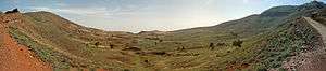
Corda is a settlement in the island of Santo Antão, Cape Verde. It is situated in the mountainous interior of the island and on a central plateau 1,200 to 1,500 meters high, 13 km north of the island capital Porto Novo.
Some of the localities includes Espongeiro.
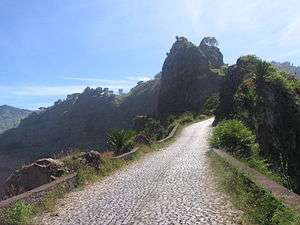
Around the area is passed by the difficult Estrada de Corda (EN1-SA2, formerly the LBRA2), first constructed in 1962 and no longer the main road linking the north and the south and the west of the island in 2009. Around 2 to 3 kilometers south is a huge caldeira named Espadana dominating 1 km in diameter and forms the second largest after Chã das Caldeiras.
Geology
Its geology is inside the Cova Group of rock formation that includes Paul and Corda. The formation was formed around 1.4 million to 700,000 years ago.[2]
Climate data for Espongeiros
The yearly rainall in Espongeiro amounts to 351 millimeters making it the wettest on the island as it is on higher elevation compared to the coastal and southern areas, also temperatures are continental and cool and the coolest on the island and fanges from 10 to 19 °C (50–66 °F). The wettest month is September with 105 millimeters, fewer than Sinagoga and the driest months are May and June without any precipitation
| Climate data for Espongeiro, 1250-1400 metres ASL | |||||||||||||
|---|---|---|---|---|---|---|---|---|---|---|---|---|---|
| Month | Jan | Feb | Mar | Apr | May | Jun | Jul | Aug | Sep | Oct | Nov | Dec | Year |
| Average high °C (°F) | 15.5 (59.9) |
15.3 (59.5) |
15.9 (60.6) |
16.3 (61.3) |
17.2 (63) |
17.9 (64.2) |
19.0 (66.2) |
20.0 (68) |
20.3 (68.5) |
19.8 (67.6) |
18.5 (65.3) |
16.5 (61.7) |
17.7 (63.9) |
| Daily mean °C (°F) | 13.2 (55.8) |
12.8 (55) |
13.2 (55.8) |
13.6 (56.5) |
14.5 (58.1) |
15.3 (59.5) |
16.3 (61.3) |
17.3 (63.1) |
17.7 (63.9) |
17.4 (63.3) |
16.0 (60.8) |
14.4 (57.9) |
15.1 (59.2) |
| Average low °C (°F) | 10.9 (51.6) |
10.4 (50.7) |
10.6 (51.1) |
10.9 (51.6) |
11.9 (53.4) |
12.8 (55) |
13.7 (56.7) |
14.7 (58.5) |
15.1 (59.2) |
15.0 (59) |
13.6 (56.5) |
12.3 (54.1) |
12.7 (54.9) |
| Average rainfall mm (inches) | 24 (0.94) |
4 (0.16) |
4 (0.16) |
1 (0.04) |
0 (0) |
0 (0) |
20 (0.79) |
82 (3.23) |
105 (4.13) |
55 (2.17) |
31 (1.22) |
25 (0.98) |
351 (13.82) |
| Source: Climate-Data.ORG | |||||||||||||
References
- ↑ "2010 Census results". Instituto Nacional de Estatística Cabo Verde (in Portuguese). 17 March 2014.
- ↑ Holm, Paul Martin (2006). Sampling the Cape Verde Mantle Plume: Evolution of Melt Compositions on Santo Antão, Cape Verde Island. 47. p. 145-18. doi:10.1093/petrology/egi071.
Subdivisions of the island of Santo Antão | |||||||||||||||
|---|---|---|---|---|---|---|---|---|---|---|---|---|---|---|---|
| Paul |
|  | |||||||||||||
| Porto Novo | |||||||||||||||
| Ribeira Grande | |||||||||||||||
| Parishes | 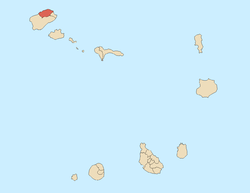 | |
|---|---|---|
| Communities and settlements | ||
| Geographical features |
| |
| Landmarks and points of Interests | ||
| Defunct airport | ||
| Culture |
| |