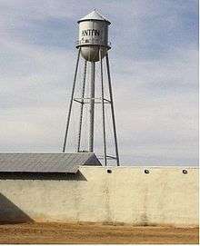
Anton, Texas
| Anton, Texas | |
|---|---|
| City | |
|
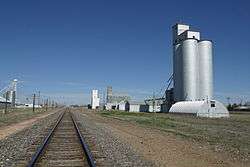
Boothe Elevators and BNSF Railway in Anton | |
 Anton | |
| Coordinates: 33°48′40″N 102°09′50″W / 33.81111°N 102.16389°WCoordinates: 33°48′40″N 102°09′50″W / 33.81111°N 102.16389°W[1] | |
| Country |
|
| State |
|
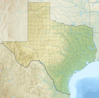
| County | Hockley |
| Region | Llano Estacado |
| Established | 1924 |
| Elevation[1] | 3,389 ft (1,033 m) |
| Population (2000) | |
| • Total | 1,200 |
| Time zone | CST (UTC-6) |
| ZIP code | 79313 |
| Area code | 806 |
| Website | Handbook of Texas |
Anton is a city in Hockley County, Texas, United States. The population was 1,200 at the 2000 census.
History
Anton was founded in 1924 near the center of the north pasture of the former Spade Ranch when ranch owner William Leonard Ellwood contracted with the Anton Townsite Company to plat a town at the site of Danforth Switch, a spur of the Pecos and Northern Texas Railway. The town was named in honor of J.F. Anton, a Santa Fe railroad executive.[2]
Anton's first mayor was Paul Grover Whitfield, who was born in July 1908 so in 1924 was only 16 or 17 years old, but told everyone he was 18 and so was able to accept the position. He's therefore on record as being the youngest mayor ever in the state of Texas at the time and since he was under the age of 18 it's likely that record stands to this day and will for all time. It's unclear if there was an election or if he simply volunteered for the position. In those days an ID was not required because most things were done with a handshake. [2]
Geography
Anton sits just to the east of the geographic center of the level high plains of the Llano Estacado. The flat terrain is broken to the west by a dry watercourse called Yellow House Draw, which passes about 0.5 miles (1 km) to the east of Anton.
Anton is well situated with regard to transportation. Anton is located at the intersection of U.S. Route 84 and Farm to Market Roads 168 and 597. The Burlington Northern Santa Fe Railway passes through the western edge of town.
According to the United States Census Bureau, the city has a total area of 0.8 square miles (2.1 km2), all of it land.
Demographics
| Historical population | |||
|---|---|---|---|
| Census | Pop. | %± | |
| 1940 | 548 | — | |
| 1950 | 934 | 70.4% | |
| 1960 | 1,068 | 14.3% | |
| 1970 | 1,034 | −3.2% | |
| 1980 | 1,180 | 14.1% | |
| 1990 | 1,212 | 2.7% | |
| 2000 | 1,200 | −1.0% | |
| 2010 | 1,126 | −6.2% | |
| Est. 2015 | 1,128 | [3] | 0.2% |
As of the census[5] of 2000, there were 1,200 people, 423 households, and 313 families residing in the city. The population density was 1,512.4 people per square mile (586.5/km²). There were 465 housing units at an average density of 586.1 per square mile (227.3/km²). The racial makeup of the city was 71.92% White, 5.33% African American, 21.17% from other races, and 1.58% from two or more races. Hispanic or Latino of any race were 45.83% of the population.
There were 423 households out of which 39.7% had children under the age of 18 living with them, 61.5% were married couples living together, 9.0% had a female householder with no husband present, and 25.8% were non-families. 23.9% of all households were made up of individuals and 14.7% had someone living alone who was 65 years of age or older. The average household size was 2.84 and the average family size was 3.40.
In the city the population was spread out with 32.8% under the age of 18, 7.8% from 18 to 24, 25.9% from 25 to 44, 18.8% from 45 to 64, and 14.8% who were 65 years of age or older. The median age was 34 years. For every 100 females there were 95.4 males. For every 100 females age 18 and over, there were 89.9 males.
The median income for a household in the city was $30,924, and the median income for a family was $36,250. Males had a median income of $26,188 versus $18,036 for females. The per capita income for the city was $13,001. About 15.0% of families and 21.6% of the population were below the poverty line, including 23.8% of those under age 18 and 21.5% of those age 65 or over.
Education
Anton is served by the Anton Independent School District and is home to the Anton High School Bulldogs.
See also
References
- 1 2 "Anton". Geographic Names Information System. United States Geological Survey.
- 1 2 Rachel Jenkins. "Anton, Texas". Handbook of Texas Online. Retrieved 11 March 2013.
- ↑ "Annual Estimates of the Resident Population for Incorporated Places: April 1, 2010 to July 1, 2015". Retrieved July 2, 2016.
- ↑ "Census of Population and Housing". Census.gov. Archived from the original on May 11, 2015. Retrieved June 4, 2015.
- ↑ "American FactFinder". United States Census Bureau. Archived from the original on 2013-09-11. Retrieved 2008-01-31.
External links
Municipalities and communities of Hockley County, Texas, United States | ||
|---|---|---|
| Cities | 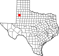 | |
| Towns | ||
| Unincorporated communities | ||