High Plains (United States)
| High Plains | |
| physiographic region | |
 A buffalo wallow on the High Plains.[1] | |
| Country | United States |
|---|---|
| Coordinates | 39°N 102°W / 39°N 102°WCoordinates: 39°N 102°W / 39°N 102°W |
| Highest point | |
| - elevation | 7,800 ft (2,377 m) [2] |
| Lowest point | |
| - elevation | 1,160 ft (354 m) [2] |
| Length | 800 mi (1,287 km) |
| Width | 400 mi (644 km) |
| Area | 174,000 sq mi (450,658 km2) [2] |
 Physiographic regions of the United States. The High Plains region is the center yellow area designated 13d.[4] | |
| Website: GeoKansas: High PLains | |


The High Plains are a subregion of the Great Plains mostly in the Western United States, but also partly in the Midwest states of Nebraska, Kansas, and South Dakota, generally encompassing the western part of the Great Plains before the region reaches the Rocky Mountains. The High Plains are located in southeastern Wyoming, southwestern South Dakota, western Nebraska, eastern Colorado, western Kansas, eastern New Mexico, western Oklahoma, and south of the Texas Panhandle.[5] The southern region of the Western High Plains ecology region contains the geological formation known as Llano Estacado which can be seen from a short distance or from miles away on satellite maps.[6] From east to west, the High Plains rise in elevation from around 1,160 feet (350 m) to over 7,800 feet (2,400 m).[2]
Name
The term "Great Plains", for the region west of about the 96th or 98th meridian and east of the Rocky Mountains, was not generally used before the early 20th century. Nevin Fenneman's 1916 study, Physiographic Subdivision of the United States,[7] brought the term Great Plains into more widespread usage. Prior to 1916, the region was almost invariably called the High Plains, in contrast to the lower Prairie Plains of the Midwestern states.[8] Today the term "High Plains" is usually used for a subregion instead of the whole of the Great Plains.
Geography and climate
The High Plains has a "cold semi-arid" climate—Köppen BSk—receiving between 10–20 inches (250–510 mm) of precipitation annually.
Due to low moisture and high elevation, the High Plains commonly experiences wide ranges and extremes in temperature. The temperature range from day to night is usually 30 degrees Fahrenheit, and 24-hour temperature shifts of 100 degrees Fahrenheit are possible, as evidenced by a weather event that occurred in Browning, Montana from January 23, 1916 to January 24, 1916, when the temperature fell 100 °F (56 °C) from 44 °F (7 °C) to −56 °F (−49 °C). This is the United States and also the world record for the greatest temperature change in 24 hours.[9] The region is known for the steady, and sometimes intense, winds that prevail from the west. The winds add a considerable wind chill factor in the winter. The development of wind farms in the High Plains is one of the newest areas of economic development.
The High Plains are anomalously high in elevation. An explanation has recently been proposed to explain this high elevation. As the Farallon plate was subducted into the mantle beneath the region, water trapped in hydrous minerals in the descending slab was forced up into the lower crust above. Within the crust this water caused the hydration of dense garnet and other phases into lower density amphibole and mica minerals. The resulting increase in crustal volume raised the elevation nearly two kilometers.[10][11]
Flora
Plants endemic to the region are shortgrass prairie, prickly pear cacti and scrub.
Economy
Agriculture in the forms of cattle ranching and the growing of wheat, corn and sunflowers is the primary economic activity in the region. The aridity of the region necessitates either dryland farming methods or irrigation; much water for irrigation is drawn from the underlying Ogallala Aquifer, which makes it possible to grow water-intensive crops such as corn, which the region's aridity would otherwise not support. Some areas of the High Plains have significant petroleum and natural gas deposits.
The combination of oil, natural gas, and wind energy along with plentiful underground water, has allowed some areas (such as West Texas) to sustain a range of economic activity, including occasional industry. For example, the ASARCO refinery in Amarillo, Texas has been in operation since 1924 due to the plentiful and inexpensive natural gas and water that are needed in metal ore refining.
Demographics
The High Plains has one of the lowest population densities of any region in the continental United States; Wyoming, for example, has the second lowest population density in the country after Alaska. In contrast to the rather low and stagnant population in the northern and western High Plains, cities in west Texas have shown sustained growth; Amarillo and Lubbock both have populations near or above 200,000 and continue to grow. Smaller towns, on the other hand, often struggle to sustain their population.
Major Cities and Towns
Gallery

 Cimarron County near Boise City. (2009)
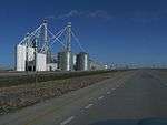 Grain Silos are a common sight on the High Plains. (2009)
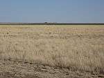
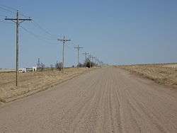 High Plains in Southeastern Colorado (2009)
See also
|
|
Notes
- ↑ Darton, Nelson Horatio (1920). Syracuse-Lakin folio, Kansas. Folios of the Geologic Atlas, No. 212: United States Department of the Interior, U.S. Geological Survey. p. 17 (plate 2).
- 1 2 3 4 "USGS High Plains Aquifer WLMS". U.S. Department of the Interior. U.S. Geological Survey. Retrieved 2010-10-06.
- ↑ "Physiographic Regions". U.S. Department of the Interior. U.S. Geological Survey. Retrieved 2010-10-06.
- ↑ "Physiographic Regions". U.S. Department of the Interior. U.S. Geological Survey. Retrieved 2010-10-06.
- ↑ File:Level III ecoregions, United States.png
- ↑ "Shaded relief image of the Llano Estacado.". Handbook of Texas: Llano Estacado.
- ↑ Fenneman, Nevin M. (January 1917). "Physiographic Subdivision of the United States". Proceedings of the National Academy of Sciences of the United States of America. 3 (1): 17–22. doi:10.1073/pnas.3.1.17. OCLC 43473694. PMC 1091163
 . PMID 16586678.
 - ↑ Brown, Ralph Hall (1948). Historical Geography of the United States. New York: Harcourt, Brace & Co. pp. 373–374. OCLC 186331193.
- ↑ "Top Ten Montana Weather Events of the 20th Century". National Weather Service Unveils Montana's Top Ten Weather/Water/Climate Events of the 20th Century. National Weather Service. Retrieved 2015-06-01.
- ↑ Why Are the High Plains So High? THECHERRYCREEKNEWS.COM, Mar 15, 2005 (2015?)
- ↑ Jones, Craig H.; Mahan, Kevin H.; Butcher, Lesley A.; Levandowski, William B.; Farmer, G. Lang (2015). "Continental uplift through crustal hydration". Geology. 43 (4): 355–358. doi:10.1130/G36509.1.
External links
| Wikivoyage has a travel guide for High Plains. |
- High Plains Regional Climate Center High Plains climatological resources
- High Plains information - U.S. Department of the Interior (with map)
- Trains on the High Plains
- Texas counties map showing the ecoregion