Bachra
| Bachra | |
|---|---|
| Census Town | |
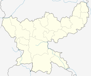
 Bachra  Bachra Location in Jharkhand, India | |
| Coordinates: 23°41′19″N 85°4′13″E / 23.68861°N 85.07028°ECoordinates: 23°41′19″N 85°4′13″E / 23.68861°N 85.07028°E | |
| Country |
|
| State | Jharkhand |
| District | Chatra |
| Elevation | 377 m (1,237 ft) |
| Population (2011) | |
| • Total | 12,969 |
| Languages | |
| • Official | Hindi, Santali |
| Time zone | IST (UTC+5:30) |
| Telephone code | 06553 |
| Vehicle registration | JH |
| Lok Sabha constituency | Chatra |
| Vidhan Sabha constituency | Simaria |
| Website |
chatra |
| Census Town | |
Bachra is a census town in Tandwa Block of Chatra district in the state of Jharkhand, India.
Geography
Bachra is a colliery township located at 23°41′19″N 85°4′13″E / 23.68861°N 85.07028°E.[1]
Demographics
As per 2011 Census of India Bachra had a population of 12,969, of which 7,169 were males and 5,800 were females. Scheduled Castes numbered 1,519 and Scheduled Tribes numbered 826.[2]
Literacy
As per 2011 census the total number of literates in Bachra was 9,718 out of which 5,887 were males and 3,831 were females.[2]
Economy
The North Karanpura Coalfield is spread across parts of Ranchi, Hazaribagh, Chatra and Latehar districts of Jharkhand covering an area of 1,230 km2. This coalfield in the upper reaches of the Damodar Valley, has reserves of around 14 billion tonnes of coal, very little of which has been exploited. Karkatta, KD Hesalong, Manki, Churi, Bachara UG, Bachara OC, and Dakara are long established collieries south of the Damodar. North of the Damodar lies comparatively new major mines such as Piparwar Mine and Ashoka Project. 23 mines are planned in the northern sector (near Bachra). Those in an advanced stage of planning are: Dhadu, Purnadih, Magadh, and Amrapali.This happens to be the largest mining sector of Central Coalfields Limited.[3]
Projects in the Piparwar area of Central Coalfields Limited (as in 2015) were: Piparwar open cast, Ray-Bachra underground, Ashoka open cast, Piparwar coal handling plant and Piparwar coal preparation plant.[4]
Transportation
Bachra is served by Ray railway station, about 25 km from Barkakana railway station on the Sonnagar-Barkakana loop line.
References
- ↑ "Bachra". Jharkhand. Wikimapia. Retrieved 29 November 2015.
- 1 2 "2011 Census C.D. Block Wise Primary Census Abstract Data(PCA)". Jharkhand – District-wise CD Blocks. Registrar General and Census Commissioner, India. Retrieved 29 November 2015.
- ↑ "The North Karanpura Coalfields". Jharkhand. sinclair-environmental. Retrieved 29 November 2015.
- ↑ "Areas". Piparwar. CCL. Retrieved 30 November 2015.