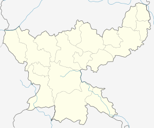
Tenu
| Tenu | |
|---|---|
| Census Town | |
 Tenu  Tenu Location in Jharkhand, India | |
| Coordinates: 23°44′4″N 85°50′26″E / 23.73444°N 85.84056°ECoordinates: 23°44′4″N 85°50′26″E / 23.73444°N 85.84056°E | |
| Country |
|
| State | Jharkhand |
| District | Bokaro |
| Elevation | 237 m (778 ft) |
| Population (2011) | |
| • Total | 4,533 |
| Languages | |
| • Official | Hindi, Santali |
| Time zone | IST (UTC+5:30) |
| PIN | 829123 (Tenughat Dam) |
| Telephone/STD code | 06544 |
| Vehicle registration | JH |
| Website |
bokaro |
Tenu (also known as Tenughat) is a census town in Petarwar block in Bermo subdivision of Bokaro district in the Indian state of Jharkhand. It is located at the foot of Tenughat Dam, 42 km from Bokaro Steel City, the district headquarters,
Geography
Tenu is located at 23°44′4″N 85°50′26″E / 23.73444°N 85.84056°E.[1]
Demographics
As per 2011 Census of India Tenu had a population of 4,533, of which 2,523 were males and 2,010 females. Scheduled Castes numbered 522 and Scheduled Tribes numbered 321.[2]
Literacy
As per 2011 census the total number of literates in Tenu was 3,619 out of which 2,120 were males and 1,499 were females.[2]
Economy
Tenughat Dam
Tenughat Dam was constructed across the Damodar River in 1978 by the Government of Bihar, outside the control of the Damodar Valley Corporation.[3]
References
- ↑ "Tenughat". Jharkhand. Wikimapia. Retrieved 5 December 2015.
- 1 2 "2011 Census C.D. Block Wise Primary Census Abstract Data(PCA)". Jharkhand – District-wise CD Blocks. Registrar General and Census Commissioner, India. Retrieved 5 December 2015.
- ↑ "Integrated Flood Management Case Study1 India: Flood Management – Damodar River Basin" (PDF). World Meteorological Organization. Retrieved 11 December 2015.