Barrington Township, Cook County, Illinois
| Barrington Township | |
|---|---|
| Township | |
 Location in Cook County | |
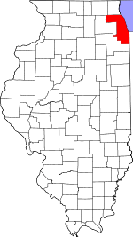
 Cook County's location in Illinois | |
| Coordinates: 42°06′41″N 88°10′46″W / 42.11139°N 88.17944°WCoordinates: 42°06′41″N 88°10′46″W / 42.11139°N 88.17944°W | |
| Country | United States |
| State | Illinois |
| County | Cook |
| Government | |
| • Supervisor | Eugene "Gene" Dawson |
| • Town Clerk | D. Robert Alberding |
| • Assessor | Amy Nykaza |
| • Tax Collector | Linda Post |
| • Trustees |
Daniel Fitzgerald Robert A Nykaza, Jr. Michael W. Ryan Ronald F. Szymanski |
| Area | |
| • Total | 36.0 sq mi (93.3 km2) |
| • Land | 34.8 sq mi (90.2 km2) |
| • Water | 1.2 sq mi (3.0 km2) 3.26% |
| Elevation | 883 ft (269 m) |
| Population (2010) | |
| • Total | 15,636 |
| • Density | 449/sq mi (173.3/km2) |
| Time zone | CST (UTC-6) |
| • Summer (DST) | CDT (UTC-5) |
| ZIP codes | 60010, 60118, 60192, 60195 |
| GNIS feature ID | 0428638 |
| Website |
www |
Barrington Township is one of 29 townships in Cook County, Illinois, USA. As of the 2010 census, its population was 15,636.[1] The northwestern corner of the Cook County panhandle, it is the county's northwesternmost township. It is also by far the least densely populated township in the county, with less than half the population density of the next least Lemont Township.
Barrington Township was named after the town of Great Barrington, Massachusetts.[2]
Geography
According to the United States Census Bureau, Barrington Township covers an area of 36.0 square miles (93.3 km2); of this, 34.8 square miles (90.2 km2) is land and 1.2 square miles (3.0 km2) (3.26 percent) is water.[1]
Cities, towns, villages
- Barrington
- Barrington Hills (south three-quarters)
- East Dundee
- Hoffman Estates
- Inverness (west quarter)
- South Barrington
Cemeteries
The township contains two cemeteries: Evergreen and Union.
Major highways
Airports and landing strips
- Allstate Commercial Plaza Heliport
- Mill Rose Farm RLA Airport
- Rose Number 2 Heliport
Lakes
- Beverly Lake
- Crabtree Lake
- Dana Lake
- Goose Lake
- Hawley Lake
- Hawthorne Lake
- Heather Lake
- Keene Lake
- Lacey Lake
- Mirror Lake
- Mud Lake
- Spring Lake
- Stephanie Lake
Landmarks
- Barrington Forest Preserve (west quarter)
- Cook County-Potawatomi Woods Forest Preserve
- Crabtree Nature Center (Cook County Forest Preserve)
- Prairie Stone Business Park
School districts
- Barrington Community Unit School District 220
- Community Unit School District 300
- School District 46
Political districts
- Illinois' 6th congressional district
- State House District 52
- State House District 54
- State Senate District 26
- State Senate District 27
References
- 1 2 "Geographic Identifier: 2010 Demographic Profile Data (DP-1): Barrington township, Cook County, Illinois". U.S. Census Bureau, American Factfinder. Retrieved March 20, 2013.
- ↑ Chicago and North Western Railway Company (1908). A History of the Origin of the Place Names Connected with the Chicago & North Western and Chicago, St. Paul, Minneapolis & Omaha Railways. p. 41.
- "Barrington Township, Cook County, Illinois". Geographic Names Information System. United States Geological Survey. Retrieved 2010-01-10.
- United States Census Bureau 2007 TIGER/Line Shapefiles
- United States National Atlas
External links
- Barrington Township official website
- City-Data.com
- Illinois State Archives
- Township Officials of Illinois
- Cook County official website
 |
Algonquin Township, McHenry County | Cuba Township, Lake County | Ela Township, Lake County |  |
| Dundee Township, Kane County | |
Palatine Township | ||
| ||||
| | ||||
| Hanover Township | Schaumburg Township |
This article is issued from Wikipedia - version of the 11/17/2016. The text is available under the Creative Commons Attribution/Share Alike but additional terms may apply for the media files.