Riverside Township, Cook County, Illinois
| Riverside Township | |
|---|---|
| Township | |
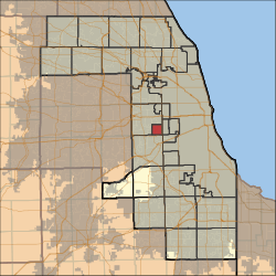 Location in Cook County | |
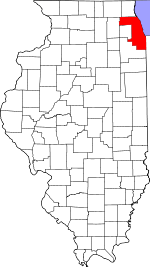 Cook County's location in Illinois | |
| Coordinates: 41°50′09″N 87°49′24″W / 41.83583°N 87.82333°WCoordinates: 41°50′09″N 87°49′24″W / 41.83583°N 87.82333°W | |
| Country | United States |
| State | Illinois |
| County | Cook |
| Government | |
| • Supervisor | Rich Tuscher |
| Area | |
| • Total | 4.04 sq mi (10.46 km2) |
| • Land | 4.02 sq mi (10.42 km2) |
| • Water | 0.02 sq mi (0.04 km2) 0.38% |
| Elevation | 620 ft (189 m) |
| Population (2010) | |
| • Total | 15,594 |
| • Density | 3,876/sq mi (1,496.5/km2) |
| Time zone | CST (UTC-6) |
| • Summer (DST) | CDT (UTC-5) |
| ZIP codes | 60130, 60513, 60534, 60546 |
| GNIS feature ID | 0429647 |
Riverside Township is one of 29 townships in Cook County, Illinois, USA. As of the 2010 census, its population was 15,594.[1]
Geography
According to the United States Census Bureau, Riverside Township covers an area of 4.04 square miles (10.5 km2); of this, 4.02 square miles (10.4 km2) (99.62 percent) is land and 0.02 square miles (0.052 km2) (0.38 percent) is water.
Cities, towns, villages
- Brookfield (northeast quarter)
- Lyons
- North Riverside (east three-quarters)
- Riverside (vast majority)
Adjacent townships
- Berwyn Township (east)
- Stickney Township (southeast)
- Lyons Township (southwest)
- Proviso Township (northwest)
Major highways
Rivers
Landmarks
Political districts
- Illinois's 3rd congressional district
- State House District 08
- State House District 21
- State House District 41
- State Senate District 04
- State Senate District 11
- State Senate District 21
References
- "Riverside Township, Cook County, Illinois". Geographic Names Information System. United States Geological Survey. Retrieved 2010-01-10.
- United States Census Bureau 2007 TIGER/Line Shapefiles
- United States National Atlas
- ↑ "Geographic Identifiers: 2010 Demographic Profile Data (DP-1): Riverside township, Cook County, Illinois". U.S. Census Bureau, American Factfinder. Retrieved March 21, 2013.
External links
This article is issued from Wikipedia - version of the 11/17/2016. The text is available under the Creative Commons Attribution/Share Alike but additional terms may apply for the media files.