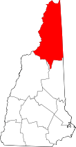
Bean's Grant, New Hampshire
Coordinates: 44°15′13″N 71°22′23″W / 44.25361°N 71.37306°W Bean's Grant is a township located in southern Coos County, New Hampshire, United States, north of Crawford Notch State Park. In New Hampshire, locations, grants, townships (which are different from towns), and purchases are unincorporated portions of a county which are not part of any town and have limited self-government (if any, as many are uninhabited). The population was 0 at the 2010 census.[1]
History
In 1851, the New Hampshire General Court authorized the governor and council to appoint a land commissioner to sell the public lands, and James Willey of Conway was appointed to that office. Bean's Grant was made by Commissioner Willey to Charles Bean of Maine in 1855, and it contained about 3,300 acres (13 km2).
Geography
According to the United States Census Bureau, the location has a total area of 9.7 square miles (25 km2), all land.
Bean's Grant is bordered to the east by Chandler's Purchase, to the southeast by Cutt's Grant, to the southwest by Hart's Location and Carroll, and to the northwest by Crawford's Purchase.
The only roadway in the grant is Base Road, running from the Jefferson Notch Road (a small section of which is also in the Grant) to the nearby Cog Railway at Marshfield Station, to the east.
Many mountains of the Presidential Range are located here, including Mount Pierce, Mount Jackson and Mount Webster, each of which is traversed by the Appalachian Trail. The summit of Mount Pierce is the highest point in Bean's Grant, measuring 4,310 feet (1,310 m) above sea level. Brooks in the grant drain east to the Saco River or west to the Ammonoosuc River. Several popular hiking trails to the Presidential Range traverse the grant, originating near Saco Lake or further south in Crawford Notch.
Demographics
| Historical population | |||
|---|---|---|---|
| Census | Pop. | %± | |
| Est. 2015 | 0 | [2] | |
As of the census[4] of 2010, there are no people living in the location, although there are seasonal residents at the AMC hut at Mizpah Spring, along the Appalachian Trail.
References
- ↑ United States Census Bureau, American FactFinder, 2010 Census figures. Retrieved March 23, 2011.
- ↑ "Annual Estimates of the Resident Population for Incorporated Places: April 1, 2010 to July 1, 2015". Retrieved July 2, 2016.
- ↑ "Census of Population and Housing". Census.gov. Archived from the original on May 11, 2015. Retrieved June 4, 2016.
- ↑ "American FactFinder". United States Census Bureau. Archived from the original on 2013-09-11. Retrieved 2008-01-31.