Bois Brule Township, Perry County, Missouri
| Bois Brule, Missouri | |
|---|---|
| Civil Township | |
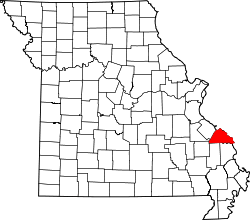 Location of Perry County | |
| Coordinates: 37°49′18″N 89°47′32″W / 37.82154°N 89.79222°WCoordinates: 37°49′18″N 89°47′32″W / 37.82154°N 89.79222°W[1] | |
| Country | United States |
| State | Missouri |
| County | Perry |
| Area | |
| • Total | 64 sq mi (165 km2) |
| • Land | 61 sq mi (157 km2) |
| • Water | 3 sq mi (8 km2) |
| GNIS Feature ID | 767151 |
Bois Brûlé is one of the eight townships located in Perry County, Missouri, in the United States of America.
Etymology
Bois Brûlé comes from the French word Bois-Brûlés (Burnt Woods)[2] which was named for the Mississippi River bottom land by the same name. The name for the area was given by French colonial habitants, and was frequently applied by the French to a burnt tract of forest.
History
The early Native American inhabitants of the area were the Mississippian Mound Builders. The Mississippian Mound Builders were part of the Mississippian culture which went into decline in the 12th and 13th centuries.[3]
In the 1770s, members of the Kaskaskia Tribe living in the Illinois Country began migrating into area. In the 1780s, the Shawnee and Delaware tribes, living in Ohio and Indiana but originating in Delaware and Pennsylvania, had been once again displaced and had immigrated with Colonial Spanish consent to the present-area of the Bois Brûlé bottoms. The Spanish authorities invited them to settle and act as a buffer to the native Osage Indians to the south.
The first European settler in the Bois Brûlé Bottoms was Jean Baptiste Barsaloux, a traveling merchant. In response to the presence of the Shawnee and Delaware, he moved to the area in 1787, and applied for a concession of land for himself and his father, Girard Barsaloux.
By 1779 immigration into the Spanish Colony was still restricted only to Catholics. At this time seven men of the “English Nation” as the Americans were known, petitioned Francois Valle and received permission from Lieutenant Governor Leyba to settle tin the Bois Brûlé bottom, as safety against incursions of Indians and to prevent the wandering away of cattle.[4][5]
In 1798, a number of Irish Catholics were given permission to settle in the Bois Brûlé area.[6]
The Bois Brûlé Township was organized in 1821 and was one of Perry County’s original 3 townships.
The Bois Brûlé Post Office (1886-1902) was located at a landing on the Mississippi River sometimes called Anchor Landing.[7]
Geography
The Bois Brule Bottomlands cover an area eighteen miles long and 3 to 6 miles wide along the Mississippi River. To the north lie the Grand Champ bottomlands while hills and river bluffs lie to the south. There are 6 unincorporated communities in Bois Brûlé Township: Allans Landing, Belgique, Bishop’s Landing, Claryville, McBride, Menfro and Sereno.[8][9]
Demographics
2000 Census
As of the census of 2000, there were 501 people residing in the township. The racial makeup of the town was 98.30% White, 0.3% American Indian and Alaska Native, and 0.80% from other races.[10][11]
2010 Census
As of the census of 2010, there were 540 people residing in the township. The racial makeup of the town was 97.9% White, 0.19% American Indian and Alaska Native, and 1.30% from other races.[12]
References
- ↑ "Township of Bois Brule". Geographic Names Information System. United States Geological Survey. Retrieved 2014-01-15.
- ↑ Eaton, David Wolfe (1917). How Missouri Counties, Towns and Streams Were Named. The State Historical Society of Missouri. p. 338.
- ↑ Louis Houck (1908). "A History of Missouri: From the Earliest Explorations and Settlements Until the Admission of the State Into the Union".
- ↑ Walter A. Schroeder (2002). "Opening the Ozarks: A Historical Geography of Missouri's Ste. Genevieve District, 1760-1830". ISBN 9780826263063.
- ↑ Robert Sidney Douglass (1912). "History of Southeast Missouri: A Narrative Account of Its Historical Progress, Its People and Its Principal Interests, Volume 1".
- ↑ Michael C. O'Laughlin (2007). "Missouri Irish, the Original History of the Irish in St. Louis; Kansas City; the Irish Wilderness and More: From the Earliest Times to the Current Day in America". ISBN 9780940134263.
- ↑ The State Historical Society of Missouri: Perry County Place Names http://shs.umsystem.edu/manuscripts/ramsay/ramsay_perry.html
- ↑ Landmark Hunter.com: Perry County, Missouri http://landmarkhunter.com/mo/perry/
- ↑ The State Historical Society of Missouri: Perry County Place Names http://shs.umsystem.edu/manuscripts/ramsay/ramsay_perry.html
- ↑ U.S. Department of Commerce, Economics and Statistics Administration, U.S. Census (2002). "Missouri, 2000: 2000 Census of Population and Housing. Summary population and housing characteristics".
- ↑ Missouri: 2010 - Population and Housing Unit Counts, 2010 Census of Population and Housing http://www.census.gov/prod/cen2010/cph-2-27.pdf
- ↑ Missouri: 2010 - Population and Housing Unit Counts, 2010 Census of Population and Housing http://www.census.gov/prod/cen2010/cph-2-27.pdf
Municipalities and communities of Perry County, Missouri, United States | ||
|---|---|---|
| Cities | | |
| Villages | ||
| Townships | ||
| CDP | ||
| Other unincorporated communities | ||
| Abandoned villages | ||
| Footnotes | ‡This populated place also has portions in an adjacent county or counties | |