Menfro, Missouri
| Menfro, Missouri | |
|---|---|
| unincorporated community | |
 Location of Menfro, Missouri | |
| Coordinates: 37°46′37″N 89°43′24″W / 37.77694°N 89.72333°W | |
| Country | United States |
| State | Missouri |
| County | Perry |
| Township | Bois Brule |
| Elevation | 360 ft (110 m) |
| Time zone | Central (CST) (UTC-6) |
| • Summer (DST) | CDT (UTC-5) |
| ZIP code | 63775 |
| Area code(s) | 573 |
| FIPS code | 29-47324 [1] |
| GNIS feature ID | 722232 [2] |
Menfro is an unincorporated community in northeastern Perry County, Missouri. It is located eight miles (13 km) northeast of Perryville.
Name
The town is said to have been named by St. Louis-San Francisco Railroad officials in 1904 "for the three men who were killed on the river, who were bringing in supplies for the railroad." [3]
History
Menfro was established on a small portion of Levi Wiggin's land grant #1328. In January 1877, this small plot of land was subdivided by the Perry County Surveyor and eventually became known as the Town of Menfro.
In September 1879, Valentine and Margaret Hoehn sold a portion of land grant #1328 to Frederick Moldenhauer. The Moldenhauer family still owns this tract of land which is home to the Moldenhauer Alfalfa Mill.[4]
Menfro began as a stop on the St. Louis, Memphis & South Eastern Railroad, which began construction on 22 September 1902, with the intention of linking Perry County with St. Louis in time for the 1904 World's Fair. A post office was opened in 1904 (closed in 1996).[5]
Floods
The Town of Menfro is located on Cinque Hommes Creek, which is usually called "Menfro Creek" by the local population. Menfro Creek empties into the Mississippi River just a mile (1.6k) downstream from the Town of Menfro. When the water level in the Mississippi River rises, the Menfro Creek runs backwards, taking in the rising water from the Mississippi. As such, when the Mississippi River floods, so does Menfro.

Three major floods have affected Menfro (1943, 1973 and 1993). Each time, the Town of Menfro was destroyed. After the 1943 and 1973 floods the town was rebuilt; however, after the 1993 flood the town did not recover.[6]
Geography
Menfro is situated in the Mississippi River Valley within an alluvial flood plain called the Bois Brule Bottom. Being nestled between the limestone bluffs along the western edge of Bois Brule Bottom and Cinque Hommes Creek directly to the east has made Menfro susceptible to flooding.
References
- ↑ Roadsidethoughts.com http://www.roadsidethoughts.com/mo/menfro-misc.htm
- ↑ Roadsidethoughts.com http://www.roadsidethoughts.com/mo/menfro-misc.htm
- ↑ The State Historical Society of Missouri: Perry County Place Names, 1928-1945 http://shs.umsystem.edu/manuscripts/ramsay/ramsay_perry.html
- ↑ Country Homes of Missouri.com http://www.countryhomesofmissouri.com/city/detail/?id=105956
- ↑ Missouri Postal History http://www.missouripostalhistory.org/pe157pe.htm
- ↑ US Army Corps of Engineers (December 1993). "Upper Mississippi River Basin Flood of 1993, Flood-Fight Reconnaissance and Survey of Expedient Methods Employed".
Further reading
Erzfeld, Patricia L. Menfro: People's Dream, Mother Nature's Plan, Perry County Historical Society, softcover, 161 pages. This book is one of the few compilations on the History of Menfro, written from first and secondary sources. This article was written from the information found in this book.
Coordinates: 37°46′37″N 89°43′24″W / 37.77694°N 89.72333°W
Municipalities and communities of Perry County, Missouri, United States | ||
|---|---|---|
| Cities | 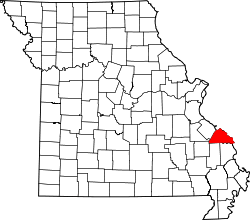 | |
| Villages | ||
| Townships | ||
| CDP | ||
| Other unincorporated communities | ||
| Abandoned villages | ||
| Footnotes | ‡This populated place also has portions in an adjacent county or counties | |