Farrar, Missouri
| Farrar, Missouri | |
|---|---|
| unincorporated community | |
|
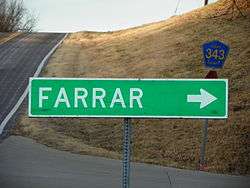
Farrar, Missouri, road sign | |
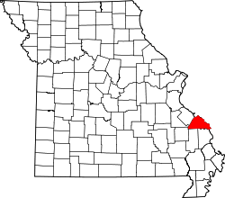 Location of Farrar, Missouri | |
| Coordinates: 37°42′08″N 89°41′19″W / 37.70222°N 89.68861°WCoordinates: 37°42′08″N 89°41′19″W / 37.70222°N 89.68861°W | |
| Country | United States |
| State | Missouri |
| County | Perry |
| Township | Salem |
| Area[1] | |
| • Total | 1.26 sq mi (3.26 km2) |
| • Land | 1.26 sq mi (3.26 km2) |
| • Water | 0 sq mi (0 km2) |
| Elevation | 590 ft (179 m) |
| Population (2000) | |
| • Total | 65 [2] |
| • Estimate (2010) | 66 |
| • Density | 51.56/sq mi (302.9/km2) |
| Time zone | Central (CST) (UTC-6) |
| • Summer (DST) | CDT (UTC-5) |
| ZIP code | 63746 |
| Area code(s) | 573 |
| FIPS code | 29-29157 [3] |
| GNIS feature ID | 717857 [4] |
Farrar /ˈfɑːr/ is an unincorporated community in Salem Township in eastern Perry County, Missouri. It is located eight miles east of Perryville, ninety miles south of Saint Louis, and 3.7 miles from the Mississippi River.
History
The original German-Saxon settlement was known as Salem and was centered on the Salem Lutheran Church built in 1859. In 1890, R.P.Farrar opened the Farrar General Store. Originally, mail had been brought in from the nearby town of Schalls and handed out on the church steps after Sunday services, until 1892 when R.P.Farrar rode by horseback to Jefferson City to make a request for a post office.[5] Upon arriving, he learned that the name Salem had already been taken. Due to an already existing Salem in Missouri, the soon-to-be postmaster Farrar used his name as a temporary solution, which became permanent.[6] Soon after, the "Bueckman" General Store and two blacksmiths were established in Farrar.[7] Despite its size, over the years Farrar has fielded a number of general stores, a dairy cooperative, a transport company, as well as a couple local baseball teams. The post office closed in 2006.
Community
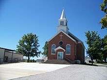
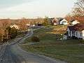
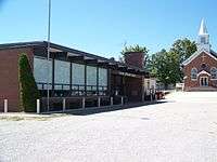
At present the community of Farrar has around 22 households, a church: Salem Lutheran Church, Missouri Synod, which serves the local Lutheran population, the Salem Lutheran Parochial School providing education to students grades 1-8, and a historic B&B.[8]
Geography
According to the United States Post Service, the zip code of Farrar covers a total area of 1.26 sq mi/3.26 km2, all of it land. The area is surrounded by farms and woodland.
Demographics
2000 census
As Farrar is no longer an incorporated town, census data is no longer collected on the community as a whole. However, according to demographic data related to the census of 2000, there were an estimated 22 households with 66 people residing in the village. The racial makeup of the village was 100.0% White and 0.0% from other races. Hispanic or Latino of any race were 0.0% of the population.[9]
The median age in the village was 35.30 years. The gender makeup of the village was 38 male individuals and 27 female individuals.[10]
Gallery
-
Farrar, Missouri
-
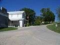
Salem Lutheran School
-
Egger's General Store
-
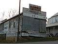
Old Farrar General Market
References
- ↑ Hometown Locator: Missouri http://www.hometownlocator.com/maps/accessproblem.cfm
- ↑ Hometown Locator: Missouri http://missouri.hometownlocator.com/mo/perry/farrar.cfm
- ↑ http://www.us-zip.org/missouri/farrar/
- ↑ Hometown Locator: Missouri http://missouri.hometownlocator.com/mo/perry/farrar.cfm
- ↑ Eggers and Company General Store, Bed and Breakfast http://eggersandco.wordpress.com/history/
- ↑ Family Tree Maker: Eggers http://familytreemaker.genealogy.com/users/e/g/g/Calvin-W-Eggers/BOOK-0001/0008-0001.html
- ↑ Bill Earngey (1995). "Missouri Roadsides: The Traveler's Companion". ISBN 9780826210210.
- ↑ Great Schools http://www.greatschools.org/missouri/farrar/2613-Salem-Lutheran-School/
- ↑ US Zip Codes http://www.zip-codes.com/zip-code/63746/zip-code-63746.asp
- ↑ Zip-Codes.com https://www.zip-codes.com/city/mo-farrar.asp
Municipalities and communities of Perry County, Missouri, United States | ||
|---|---|---|
| Cities | | |
| Villages | ||
| Townships | ||
| CDP | ||
| Other unincorporated communities | ||
| Abandoned villages | ||
| Footnotes | ‡This populated place also has portions in an adjacent county or counties | |