Wittenberg, Missouri

Wittenberg is an unincorporated community in Brazeau Township in eastern Perry County, Missouri. It is located on the Mississippi River 14 miles (23 km) southeast of Perryville. Wittenberg is located in the Brazeau Bottoms on Brazeau Creek opposite Grand Tower, Illinois and Tower Rock, a landmark island in the Mississippi River.
History

Wittenberg is one of seven towns and villages in the area founded by German Lutheran immigrants in 1839. It and the others—Altenburg, Dresden, Frohna, Johannisberg, Paitzdorf, and Seelitz—were all named by settlers for towns in the Saxony region of their native country.[1] The city's namesake, Wittenberg, Germany, is important in Lutheran history as the place where founder Martin Luther started the Protestant Reformation.[2]
| Historical population | |||
|---|---|---|---|
| Census | Pop. | %± | |
| 1900 | 114 | — | |
| 1910 | 87 | −23.7% | |
| 1920 | 269 | 209.2% | |
| 1930 | 95 | −64.7% | |
| 1940 | 84 | −11.6% | |
| 1950 | 54 | −35.7% | |
| 1960 | 30 | −44.4% | |
| 1970 | 9 | −70.0% | |
| 1980 | 4 | −55.6% | |
| U.S. Decennial Census[3] | |||
The immigrant group would eventually form the backbone of the Lutheran Church–Missouri Synod, and they considered Tower Rock, nearby in the Mississippi River, to be their own version of Plymouth Rock in their search for religious freedom.[4] At its high point, Wittenberg had as many as 400 residents. In addition to St. Paul's Lutheran church and one-room school, the town supported a brewery, a furniture factory, two grocery stores, a tavern, a flour mill, a cooperage, and two hotels.[4]
Among Wittenberg's claims to fame is the last train robbery in Missouri. In November, 1922, a train bound for San Francisco, California from St. Louis was robbed approximately 2 miles (3.2 km) north of Wittenberg. Over $100,000 dollars was taken by Jack "Quail Hunter" Kennedy, a notorious train robber and last active member of the Jesse James gang.[5] Unfortunately one of his two accomplices was secretly working undercover for the railroad police. When Kennedy and the other robber showed up to board their getaway autos, they were met by a host of law officers including two deputy sheriffs, three railroad special agents, and six postal inspectors. Not heeding demands to surrender, Kennedy reached for his weapon and both robbers were shot dead.
Floods in 1927 and 1973 badly damaged the town, destroying most of the businesses. The school closed in 1969.[4] In 1980 the few remaining residents of Wittenberg took on the U.S Census Bureau. The official government tally was four. The village members were able to show proof that in fact the population was double that, with eight residents.[1] Finally in 1983, with the population now five people, residents petitioned a Perry County judge to disincorporate the town, which was granted. The Great Mississippi and Missouri Rivers Flood of 1993 destroyed what little was left of the community.[4] Today only a few house foundations, steps, and the paved riverfront boat dock remain. In 1994 the Lutheran Historical Society of Perry County erected a large marker on the site where the Wittenberg Lutheran Church once stood.[4]
Geography
Wittenberg lies at the southern end of Brazeau Bottom along the Mississippi River. To its west lie the Mississippi River bluffs, and to the east lie Tower Rock, Grand Tower Island, and Grand Tower, Illinois. Brazeau Creek empties into the Mississippi River at Wittenberg. The Grand Tower Pipeline Bridge crosses the Mississippi River at Wittenberg.
Gallery
-

Town and church marker
-
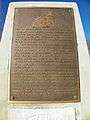
Marker
-
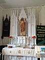
St. Paul's Lutheran Church altar
-
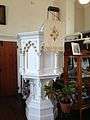
St. Paul's Lutheran Church pulpit
-

St. Paul's Cemetery
-
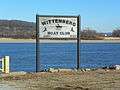
Boat club landing
-
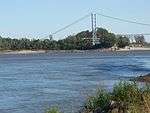
Grand Tower Pipeline Bridge
References
- 1 2 McMillen, Margot Ford (1994). Paris, Tightwad and Peculiar: Missouri Place Names. Columbia, Missouri: University of Missouri Press. pp. 55–56. ISBN 0-8262-0972-6.
- ↑ Earngey, Bill (1995). Missouri Roadsides: The Traveler's Companion. University of Missouri Press. p. 5.
- ↑ United States Census Bureau. "Census of Population and Housing". Retrieved July 9, 2015.
- 1 2 3 4 5 "Wittenberg: Nothing left but relics and memories". The Southeast Missourian. December 10, 2005. Retrieved September 24, 2012.
- ↑ "West's Last Notorious Train Robber Dies Fighting Officers in Hold-Up". The Washington Post. November 5, 1922. p. 2.
Coordinates: 37°39′09″N 89°31′28″W / 37.65250°N 89.52444°W
Municipalities and communities of Perry County, Missouri, United States | ||
|---|---|---|
| Cities | 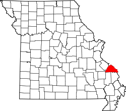 | |
| Villages | ||
| Townships | ||
| CDP | ||
| Other unincorporated communities | ||
| Abandoned villages | ||
| Footnotes | ‡This populated place also has portions in an adjacent county or counties | |