Brimson, Missouri
| Brimson, Missouri | |
|---|---|
| Village | |
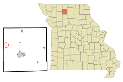 Location of Brimson, Missouri | |
| Coordinates: 40°8′39″N 93°44′17″W / 40.14417°N 93.73806°WCoordinates: 40°8′39″N 93°44′17″W / 40.14417°N 93.73806°W | |
| Country | United States |
| State | Missouri |
| County | Grundy |
| Area[1] | |
| • Total | 0.09 sq mi (0.23 km2) |
| • Land | 0.09 sq mi (0.23 km2) |
| • Water | 0 sq mi (0 km2) |
| Elevation | 774 ft (236 m) |
| Population (2010)[2] | |
| • Total | 63 |
| • Estimate (2012[3]) | 64 |
| • Density | 700.0/sq mi (270.3/km2) |
| Time zone | Central (CST) (UTC-6) |
| • Summer (DST) | CDT (UTC-5) |
| FIPS code | 29-08470[4] |
| GNIS feature ID | 0714709[5] |
Brimson is a village in Grundy County, Missouri, United States. The population was 63 at the 2010 census.
History
Brimson was laid out in 1898, and named after W. G. Brimson, a railroad official.[6] A post office called Brimson was established in 1901, and remained in operation until 1978.[7]
Geography
Brimson is located at 40°8′39″N 93°44′17″W / 40.14417°N 93.73806°W (40.144230, -93.737977).[8]
According to the United States Census Bureau, the village has a total area of 0.09 square miles (0.23 km2), all land.[1]
Demographics
| Historical population | |||
|---|---|---|---|
| Census | Pop. | %± | |
| 1910 | 104 | — | |
| 1920 | 171 | 64.4% | |
| 1930 | 181 | 5.8% | |
| 1940 | 193 | 6.6% | |
| 1950 | 139 | −28.0% | |
| 1960 | 107 | −23.0% | |
| 1970 | 103 | −3.7% | |
| 1980 | 104 | 1.0% | |
| 1990 | 72 | −30.8% | |
| 2000 | 63 | −12.5% | |
| 2010 | 63 | 0.0% | |
| Est. 2015 | 62 | [9] | −1.6% |
2010 census
As of the census[2] of 2010, there were 63 people, 30 households, and 22 families residing in the village. The population density was 700.0 inhabitants per square mile (270.3/km2). There were 34 housing units at an average density of 377.8 per square mile (145.9/km2). The racial makeup of the village was 100.0% White.
There were 30 households of which 20.0% had children under the age of 18 living with them, 53.3% were married couples living together, 6.7% had a female householder with no husband present, 13.3% had a male householder with no wife present, and 26.7% were non-families. 26.7% of all households were made up of individuals and 13.3% had someone living alone who was 65 years of age or older. The average household size was 2.10 and the average family size was 2.50.
The median age in the village was 45.8 years. 14.3% of residents were under the age of 18; 9.6% were between the ages of 18 and 24; 23.8% were from 25 to 44; 33.2% were from 45 to 64; and 19% were 65 years of age or older. The gender makeup of the village was 50.8% male and 49.2% female.
2000 census
As of the census[4] of 2000, there were 63 people, 29 households, and 18 families residing in the village. The population density was 737.9 people per square mile (270.3/km²). There were 36 housing units at an average density of 421.6 per square mile (154.4/km²). The racial makeup of the village was 98.41% White, and 1.59% from two or more races.
There were 29 households out of which 34.5% had children under the age of 18 living with them, 48.3% were married couples living together, 10.3% had a female householder with no husband present, and 37.9% were non-families. 37.9% of all households were made up of individuals and 17.2% had someone living alone who was 65 years of age or older. The average household size was 2.17 and the average family size was 2.83.
In the village the population was spread out with 28.6% under the age of 18, 3.2% from 18 to 24, 30.2% from 25 to 44, 23.8% from 45 to 64, and 14.3% who were 65 years of age or older. The median age was 36 years. For every 100 females there were 90.9 males. For every 100 females age 18 and over, there were 80.0 males.
The median income for a household in the village was $19,000, and the median income for a family was $21,250. Males had a median income of $17,500 versus $19,583 for females. The per capita income for the village was $13,368. There were 20.0% of families and 12.2% of the population living below the poverty line, including 42.9% of under eighteens and none of those over 64.
References
- 1 2 "US Gazetteer files 2010". United States Census Bureau. Archived from the original on 2012-01-24. Retrieved 2012-07-08.
- 1 2 "American FactFinder". United States Census Bureau. Retrieved 2012-07-08.
- ↑ "Population Estimates". United States Census Bureau. Archived from the original on 2013-06-17. Retrieved 2013-05-30.
- 1 2 "American FactFinder". United States Census Bureau. Archived from the original on 2013-09-11. Retrieved 2008-01-31.
- ↑ "US Board on Geographic Names". United States Geological Survey. 2007-10-25. Retrieved 2008-01-31.
- ↑ "Grundy County Place Names, 1928–1945 (archived)". The State Historical Society of Missouri. Archived from the original on 24 June 2016. Retrieved 3 October 2016.
- ↑ "Post Offices". Jim Forte Postal History. Retrieved 3 October 2016.
- ↑ "US Gazetteer files: 2010, 2000, and 1990". United States Census Bureau. 2011-02-12. Retrieved 2011-04-23.
- ↑ "Annual Estimates of the Resident Population for Incorporated Places: April 1, 2010 to July 1, 2015". Retrieved July 2, 2016.
- ↑ "Census of Population and Housing". Census.gov. Archived from the original on May 11, 2015. Retrieved June 4, 2015.
Municipalities and communities of Grundy County, Missouri, United States | ||
|---|---|---|
| Cities | 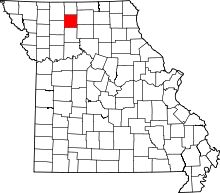 | |
| Village | ||
| Townships | ||
| CDPs |
| |
| Unincorparated communities | ||
| Footnotes | ‡This populated place also has portions in an adjacent county or counties | |