Bronckhorst
This article is about the Dutch town. For the Dutch footballer, see Giovanni van Bronckhorst.
| Bronckhorst | |||
|---|---|---|---|
| Municipality | |||
|
Vorden Castle | |||
| |||
.svg.png) Location in Gelderland | |||
| Coordinates: 52°3′N 6°18′E / 52.050°N 6.300°ECoordinates: 52°3′N 6°18′E / 52.050°N 6.300°E | |||
| Country | Netherlands | ||
| Province | Gelderland | ||
| Established | 1 January 2005[1] | ||
| Government[2] | |||
| • Body | Municipal council | ||
| Area[3] | |||
| • Total | 286.42 km2 (110.59 sq mi) | ||
| • Land | 283.56 km2 (109.48 sq mi) | ||
| • Water | 2.86 km2 (1.10 sq mi) | ||
| Elevation[4] | 13 m (43 ft) | ||
| Population (May 2014)[5] | |||
| • Total | 36,833 | ||
| • Density | 130/km2 (300/sq mi) | ||
| Time zone | CET (UTC+1) | ||
| • Summer (DST) | CEST (UTC+2) | ||
| Postcode | Parts of 6900, 7000 and 7200 ranges | ||
| Area code | 0313, 0314, 0575 | ||
| Website |
www | ||


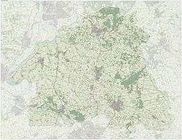
Dutch Topographic map of Bronckhorst, June 2015
Bronckhorst (![]() pronunciation ) is a municipality in Gelderland, the Netherlands. The municipality is the result of a merger of the former municipalities Hengelo, Hummelo en Keppel, Steenderen, Vorden and Zelhem, on 1 January 2005. The new municipality is named after the medieval castle of the Bronckhorst family, who once ruled this area.
pronunciation ) is a municipality in Gelderland, the Netherlands. The municipality is the result of a merger of the former municipalities Hengelo, Hummelo en Keppel, Steenderen, Vorden and Zelhem, on 1 January 2005. The new municipality is named after the medieval castle of the Bronckhorst family, who once ruled this area.
The seat of the municipality is Hengelo.
Population centres
Formerly in Hengelo:
Formerly in Hummelo en Keppel:
Formerly in Vorden:
|
Formerly in Zelhem:
Formerly in Steenderen:
|
Keppel
Keppel received city rights in 1404.
References
- ↑ "Gemeentelijke indeling op 1 januari 2005" [Municipal divisions on 1 January 2005]. cbs.nl (in Dutch). CBS. Retrieved 20 June 2014.
- ↑ "Samenstelling en taakverdeling" [Members and tasks] (in Dutch). Gemeente Bronckhorst. Retrieved 20 June 2014.
- ↑ "Kerncijfers wijken en buurten" [Key figures for neighbourhoods]. CBS Statline (in Dutch). CBS. 2 July 2013. Retrieved 12 March 2014.
- ↑ "Postcodetool for 7255KA". Actueel Hoogtebestand Nederland (in Dutch). Het Waterschapshuis. Retrieved 20 June 2014.
- ↑ "Bevolkingsontwikkeling; regio per maand" [Population growth; regions per month]. CBS Statline (in Dutch). CBS. 26 June 2014. Retrieved 24 July 2014.
External links
 Media related to Bronckhorst at Wikimedia Commons
- Official website
 |
Brummen | Zutphen, Lochem | | |
| Rheden Doesburg |
|
Berkelland Oost Gelre | ||
| ||||
| | ||||
| Zevenaar | Doetinchem | Oude IJsselstreek |

This article is issued from Wikipedia - version of the 8/16/2016. The text is available under the Creative Commons Attribution/Share Alike but additional terms may apply for the media files.