Rheden
This article is about the Dutch municipality. For the German municipality, see Rheden, Lower Saxony. For the similarly named town, see Rhede.
| Rheden | |||
|---|---|---|---|
| Municipality | |||
|
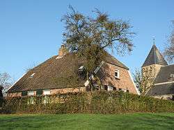
Monumental farmhouse and church in Rhenen | |||
| |||
.svg.png) Location in Gelderland | |||
| Coordinates: 52°1′N 6°3′E / 52.017°N 6.050°ECoordinates: 52°1′N 6°3′E / 52.017°N 6.050°E | |||
| Country | Netherlands | ||
| Province | Gelderland | ||
| Government[1] | |||
| • Body | Municipal council | ||
| • Mayor | Petra van Wingerden-Boers (VVD) | ||
| Area[2] | |||
| • Total | 84.35 km2 (32.57 sq mi) | ||
| • Land | 81.76 km2 (31.57 sq mi) | ||
| • Water | 2.59 km2 (1.00 sq mi) | ||
| Elevation[3] | 28 m (92 ft) | ||
| Population (May 2014)[4] | |||
| • Total | 43,561 | ||
| • Density | 533/km2 (1,380/sq mi) | ||
| Demonym(s) | Rhedenaar | ||
| Time zone | CET (UTC+1) | ||
| • Summer (DST) | CEST (UTC+2) | ||
| Postcode | 6880–6883, 6950–6957, 6990–6994 | ||
| Area code | 026, 0313 | ||
| Website |
www | ||


Rheden (![]() pronunciation ) is a municipality and a town in the eastern Netherlands.
pronunciation ) is a municipality and a town in the eastern Netherlands.
Population centres
Population of the seven villages on 1 January 2013[5]
- Velp (17,723)
- Dieren (14,340)
- Rheden (7,614)
- De Steeg (1,122)
- Ellecom (1,104)
- Spankeren (958)
- Laag-Soeren (835)
Gallery
 Rheden, country house: de Valkenberg
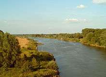 Velp, river: de IJssel
 Velp, view to a street (de Hoofdstraat)
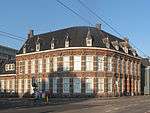 Velp, monumental office building at the Hoofdstraat
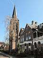 Dieren, tower: de Dierense toren
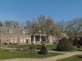 Dieren, monumental house: Schweer bey der Beckehof
 De Steeg, monumental house at Hoofdstraat 1
 Spankeren, reformed church
Topography

Dutch Topographic map of the municipality of Rheden, June 2015
Transportation
Notable residents
- Erik Breukink, cyclist
- Hans van den Broek, former Minister of Foreign Affairs and member of the municipal council from 1970 to 1974
- Simon Carmiggelt, author who had a home in De Steeg
- Louis Couperus, author who lived in Rheden when he died in 1923
- Erik Proper, computer scientist
Miscellaneous
- The Gazelle bicycle factory is situated in Dieren.
References
- ↑ "College burgemeester en wethouders" [Board of mayor and aldermen] (in Dutch). Gemeente Rheden. Retrieved 16 July 2014.
- ↑ "Kerncijfers wijken en buurten" [Key figures for neighbourhoods]. CBS Statline (in Dutch). CBS. 2 July 2013. Retrieved 12 March 2014.
- ↑ "Postcodetool for 6994AB". Actueel Hoogtebestand Nederland (in Dutch). Het Waterschapshuis. Retrieved 16 July 2014.
- ↑ "Bevolkingsontwikkeling; regio per maand" [Population growth; regions per month]. CBS Statline (in Dutch). CBS. 26 June 2014. Retrieved 24 July 2014.
- ↑ Statistics on Rheden.nl
External links
 Media related to Rheden at Wikimedia Commons
- Official website
 |
Brummen | | ||
| Rozendaal | |
Bronckhorst Doesburg | ||
| ||||
| | ||||
| Arnhem | Westervoort, Zevenaar |

This article is issued from Wikipedia - version of the 3/23/2016. The text is available under the Creative Commons Attribution/Share Alike but additional terms may apply for the media files.