Geldermalsen
| Geldermalsen | |||
|---|---|---|---|
| Municipality | |||
|
| |||
| |||
.svg.png) Location in Gelderland | |||
| Coordinates: 51°53′N 5°17′E / 51.883°N 5.283°ECoordinates: 51°53′N 5°17′E / 51.883°N 5.283°E | |||
| Country | Netherlands | ||
| Province | Gelderland | ||
| Government[1] | |||
| • Body | Municipal council | ||
| • Mayor | Miranda de Vries (PvdA) | ||
| Area[2] | |||
| • Total | 101.73 km2 (39.28 sq mi) | ||
| • Land | 99.98 km2 (38.60 sq mi) | ||
| • Water | 1.75 km2 (0.68 sq mi) | ||
| Elevation[3] | 4 m (13 ft) | ||
| Population (May 2014)[4] | |||
| • Total | 26,334 | ||
| • Density | 263/km2 (680/sq mi) | ||
| Time zone | CET (UTC+1) | ||
| • Summer (DST) | CEST (UTC+2) | ||
| Postcode | 4150–4158, 4190–4197 | ||
| Area code | 0345 | ||
| Website |
www | ||


Geldermalsen (![]() pronunciation ) is a municipality and a town in the western Netherlands. The municipality of Geldermalsen was formed on the 1 January 1978 when the former municipalities of Beesd, Buurmalsen, Deil and Geldermalsen were joined. The new municipality with an area of 101.73 km2 (39.28 sq mi) is one of the largest municipalities in the Western Betuwe. The municipality had a population of 26,334 in 2014. They all live in the eleven villages that form Geldermalsen.
pronunciation ) is a municipality and a town in the western Netherlands. The municipality of Geldermalsen was formed on the 1 January 1978 when the former municipalities of Beesd, Buurmalsen, Deil and Geldermalsen were joined. The new municipality with an area of 101.73 km2 (39.28 sq mi) is one of the largest municipalities in the Western Betuwe. The municipality had a population of 26,334 in 2014. They all live in the eleven villages that form Geldermalsen.
Geography
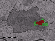
The town of Geldermalsen within the municipality of Geldermalsen.
The river Linge flows through Geldermalsen. The town of Geldermalsen itself had a population of 10,637 in 2006.
Population centres
Topography

Dutch Topographic map of the municipality of Geldermalsen, June 2015
Demographics
Demographics of Geldermalsen, 2010:
See also
Gallery
 The road bridge between Buurmalsen and Geldermalsen
 Linge river
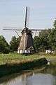 Windmill in Geldermalsen
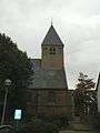 Tower of the Reformed Church in the center of Geldermalsen
 Choir of the Reformed Church
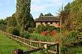 The villa was built in 1929 by architect A. H. Wegerif
References
- ↑ "Mevrouw Miranda de Vries" (in Dutch). Gemeente Geldermalsen. Retrieved 3 July 2014.
- ↑ "Kerncijfers wijken en buurten" [Key figures for neighbourhoods]. CBS Statline (in Dutch). CBS. 2 July 2013. Retrieved 12 March 2014.
- ↑ "Postcodetool for 4191KH". Actueel Hoogtebestand Nederland (in Dutch). Het Waterschapshuis. Retrieved 3 July 2014.
- ↑ "Bevolkingsontwikkeling; regio per maand" [Population growth; regions per month]. CBS Statline (in Dutch). CBS. 26 June 2014. Retrieved 24 July 2014.
- ↑ "Niet-westerse allochtonen per gemeente 2010-2040 - Nationale Atlas Volksgezondheid". Zorgatlas.nl. Retrieved 2014-03-27.
External links
 Media related to Geldermalsen at Wikimedia Commons
- Official website
 |
Culemborg | Buren | | |
| Leerdam (ZH) | |
Tiel | ||
| ||||
| | ||||
| Lingewaal | Neerijnen |

This article is issued from Wikipedia - version of the 11/13/2016. The text is available under the Creative Commons Attribution/Share Alike but additional terms may apply for the media files.