Brownsdale, Minnesota
| Brownsdale, Minnesota | |
|---|---|
| City | |
 Location of Brownsdale, Minnesota | |
| Coordinates: 43°44′25″N 92°52′3″W / 43.74028°N 92.86750°W | |
| Country | United States |
| State | Minnesota |
| County | Mower |
| Area[1] | |
| • Total | 0.47 sq mi (1.22 km2) |
| • Land | 0.47 sq mi (1.22 km2) |
| • Water | 0 sq mi (0 km2) |
| Elevation | 1,283 ft (391 m) |
| Population (2010)[2] | |
| • Total | 676 |
| • Estimate (2012[3]) | 679 |
| • Density | 1,438.3/sq mi (555.3/km2) |
| Time zone | Central (CST) (UTC-6) |
| • Summer (DST) | CDT (UTC-5) |
| ZIP code | 55918 |
| Area code(s) | 507 |
| FIPS code | 27-08164[4] |
| GNIS feature ID | 0640546[5] |
Brownsdale is a city in Red Rock Township, Mower County, Minnesota, United States. The population was 676 at the 2010 census.[6]
History
Brownsdale was platted in 1856, and named for Andrew D. Brown, a businessperson in the lumber industry.[7] A post office has been in operation at Brownsdale since 1857.[8] Brownsdale was incorporated in 1876.[7]
Geography
According to the United States Census Bureau, the city has a total area of 0.47 square miles (1.22 km2), all of it land.[1]
Demographics
| Historical population | |||
|---|---|---|---|
| Census | Pop. | %± | |
| 1880 | 346 | — | |
| 1890 | 282 | −18.5% | |
| 1900 | 261 | −7.4% | |
| 1910 | 264 | 1.1% | |
| 1920 | 271 | 2.7% | |
| 1930 | 273 | 0.7% | |
| 1940 | 355 | 30.0% | |
| 1950 | 493 | 38.9% | |
| 1960 | 622 | 26.2% | |
| 1970 | 625 | 0.5% | |
| 1980 | 691 | 10.6% | |
| 1990 | 695 | 0.6% | |
| 2000 | 718 | 3.3% | |
| 2010 | 676 | −5.8% | |
| Est. 2015 | 684 | [9] | 1.2% |
2010 census
As of the census[2] of 2010, there were 676 people, 286 households, and 190 families residing in the city. The population density was 1,438.3 inhabitants per square mile (555.3/km2). There were 315 housing units at an average density of 670.2 per square mile (258.8/km2). The racial makeup of the city was 98.1% White, 0.1% African American, 1.3% from other races, and 0.4% from two or more races. Hispanic or Latino of any race were 5.5% of the population.
There were 286 households of which 30.1% had children under the age of 18 living with them, 48.6% were married couples living together, 13.3% had a female householder with no husband present, 4.5% had a male householder with no wife present, and 33.6% were non-families. 25.2% of all households were made up of individuals and 14.7% had someone living alone who was 65 years of age or older. The average household size was 2.36 and the average family size was 2.83.
The median age in the city was 41.4 years. 24.6% of residents were under the age of 18; 5% were between the ages of 18 and 24; 24.1% were from 25 to 44; 28.5% were from 45 to 64; and 17.8% were 65 years of age or older. The gender makeup of the city was 46.7% male and 53.3% female.
2000 census
As of the census[4] of 2000, there were 718 people, 290 households, and 198 families residing in the city. The population density was 1,574.4 people per square mile (602.7/km²). There were 312 housing units at an average density of 684.1 per square mile (261.9/km²). The racial makeup of the city was 95.40% White, 3.48% from other races, and 1.11% from two or more races. Hispanic or Latino of any race were 3.48% of the population.
There were 290 households out of which 30.7% had children under the age of 18 living with them, 55.9% were married couples living together, 8.3% had a female householder with no husband present, and 31.7% were non-families. 26.9% of all households were made up of individuals and 13.4% had someone living alone who was 65 years of age or older. The average household size was 2.48 and the average family size was 2.97.
In the city the population was spread out with 26.3% under the age of 18, 8.9% from 18 to 24, 26.0% from 25 to 44, 20.8% from 45 to 64, and 18.0% who were 65 years of age or older. The median age was 37 years. For every 100 females there were 102.8 males. For every 100 females age 18 and over, there were 98.9 males.
The median income for a household in the city was $32,857, and the median income for a family was $43,864. Males had a median income of $31,842 versus $22,031 for females. The per capita income for the city was $15,778. About 4.5% of families and 7.4% of the population were below the poverty line, including 4.3% of those under age 18 and 10.3% of those age 65 or over.
References
- 1 2 "US Gazetteer files 2010". United States Census Bureau. Archived from the original on 2012-07-14. Retrieved 2012-11-13.
- 1 2 "American FactFinder". United States Census Bureau. Retrieved 2012-11-13.
- ↑ "Population Estimates". United States Census Bureau. Archived from the original on 2013-06-17. Retrieved 2013-05-28.
- 1 2 "American FactFinder". United States Census Bureau. Archived from the original on 2013-09-11. Retrieved 2008-01-31.
- ↑ "US Board on Geographic Names". United States Geological Survey. 2007-10-25. Retrieved 2008-01-31.
- ↑ "2010 Census Redistricting Data (Public Law 94-171) Summary File". American FactFinder. United States Census Bureau. Archived from the original on 21 July 2011. Retrieved 27 April 2011.
- 1 2 Upham, Warren (1920). Minnesota Geographic Names: Their Origin and Historic Significance. Minnesota Historical Society. p. 360.
- ↑ "Mower County". Jim Forte Postal History. Retrieved 22 July 2015.
- ↑ "Annual Estimates of the Resident Population for Incorporated Places: April 1, 2010 to July 1, 2015". Retrieved July 2, 2016.
- ↑ "Census of Population and Housing". Census.gov. Archived from the original on May 11, 2015. Retrieved June 4, 2015.
Municipalities and communities of Mower County, Minnesota, United States | ||
|---|---|---|
| Cities | 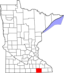 | |
| Townships | ||
| CDP | ||
| Unincorporated communities | ||
| Footnotes | ‡This populated place also has portions in adjacent county or counties | |
Coordinates: 43°44′25″N 92°52′10″W / 43.74028°N 92.86944°W