Bull Creek, Missouri
| Bull Creek, Missouri | |
|---|---|
| Village | |
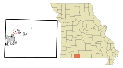 Location of Bull Creek, Missouri | |
| Coordinates: 36°42′52″N 93°12′11″W / 36.71444°N 93.20306°WCoordinates: 36°42′52″N 93°12′11″W / 36.71444°N 93.20306°W | |
| Country | United States |
| State | Missouri |
| County | Taney |
| Area[1] | |
| • Total | 0.16 sq mi (0.41 km2) |
| • Land | 0.16 sq mi (0.41 km2) |
| • Water | 0 sq mi (0 km2) |
| Elevation | 728 ft (222 m) |
| Population (2010)[2] | |
| • Total | 603 |
| • Estimate (2012[3]) | 600 |
| • Density | 3,768.8/sq mi (1,455.1/km2) |
| Time zone | Central (CST) (UTC-6) |
| • Summer (DST) | CDT (UTC-5) |
| FIPS code | 29-09642[4] |
| GNIS feature ID | 1669615[5] |
Bull Creek is a village in Taney County, Missouri, United States. The population was 603 at the 2010 census. It is part of the Branson, Missouri Micropolitan Statistical Area.
Geography
Bull Creek is located at 36°42′52″N 93°12′11″W / 36.71444°N 93.20306°W (36.714491, -93.203054).[6]
According to the United States Census Bureau, the village has a total area of 0.16 square miles (0.41 km2), all of it land.[1]
Demographics
| Historical population | |||
|---|---|---|---|
| Census | Pop. | %± | |
| 2000 | 225 | — | |
| 2010 | 603 | 168.0% | |
| Est. 2015 | 595 | [7] | −1.3% |
2010 census
As of the census[2] of 2010, there were 603 people, 199 households, and 162 families residing in the village. The population density was 3,768.8 inhabitants per square mile (1,455.1/km2). There were 235 housing units at an average density of 1,468.8 per square mile (567.1/km2). The racial makeup of the village was 88.7% White, 1.3% African American, 0.2% Native American, 0.7% Asian, 0.8% Pacific Islander, 4.8% from other races, and 3.5% from two or more races. Hispanic or Latino of any race were 10.1% of the population.
There were 199 households of which 66.3% had children under the age of 18 living with them, 30.2% were married couples living together, 42.2% had a female householder with no husband present, 9.0% had a male householder with no wife present, and 18.6% were non-families. 13.1% of all households were made up of individuals and 4.5% had someone living alone who was 65 years of age or older. The average household size was 3.03 and the average family size was 3.23.
The median age in the village was 21.5 years. 43.3% of residents were under the age of 18; 14.3% were between the ages of 18 and 24; 25.3% were from 25 to 44; 13.6% were from 45 to 64; and 3.6% were 65 years of age or older. The gender makeup of the village was 44.1% male and 55.9% female.
2000 census
As of the census[4] of 2000, there were 225 people, 80 households, and 55 families residing in the village. The population density was 1,315.6 people per square mile (511.0/km²). There were 104 housing units at an average density of 608.1 per square mile (236.2/km²). The racial makeup of the village was 93.78% White, 0.89% Native American, 2.22% from other races, and 3.11% from two or more races. Hispanic or Latino of any race were 4.00% of the population.
There were 80 households out of which 42.5% had children under the age of 18 living with them, 47.5% were married couples living together, 12.5% had a female householder with no husband present, and 31.3% were non-families. 25.0% of all households were made up of individuals and 3.8% had someone living alone who was 65 years of age or older. The average household size was 2.81 and the average family size was 3.35.
In the village the population was spread out with 36.0% under the age of 18, 8.4% from 18 to 24, 30.7% from 25 to 44, 21.3% from 45 to 64, and 3.6% who were 65 years of age or older. The median age was 29 years. For every 100 females there were 97.4 males. For every 100 females age 18 and over, there were 92.0 males.
The median income for a household in the village was $21,667, and the median income for a family was $31,042. Males had a median income of $16,719 versus $16,250 for females. The per capita income for the village was $10,411. About 19.6% of families and 23.8% of the population were below the poverty line, including 41.5% of those under the age of eighteen and 25.0% of those sixty five or over.
References
- 1 2 "US Gazetteer files 2010". United States Census Bureau. Archived from the original on 2012-01-24. Retrieved 2012-07-08.
- 1 2 "American FactFinder". United States Census Bureau. Retrieved 2012-07-08.
- ↑ "Population Estimates". United States Census Bureau. Archived from the original on 2013-06-17. Retrieved 2013-05-30.
- 1 2 "American FactFinder". United States Census Bureau. Archived from the original on 2013-09-11. Retrieved 2008-01-31.
- ↑ "US Board on Geographic Names". United States Geological Survey. 2007-10-25. Retrieved 2008-01-31.
- ↑ "US Gazetteer files: 2010, 2000, and 1990". United States Census Bureau. 2011-02-12. Retrieved 2011-04-23.
- ↑ "Annual Estimates of the Resident Population for Incorporated Places: April 1, 2010 to July 1, 2015". Retrieved July 2, 2016.
- ↑ "Census of Population and Housing". Census.gov. Archived from the original on April 22, 2013. Retrieved June 4, 2015.
Municipalities and communities of Taney County, Missouri, United States | ||
|---|---|---|
| Cities | 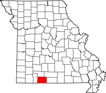 | |
| Villages | ||
| Townships |
| |
| CDP | ||
| Other unincorporated communities | ||
| Footnotes | ‡This populated place also has portions in an adjacent county or counties | |