Cabool, Missouri
| Cabool, Missouri | |
|---|---|
| City | |
|
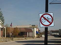
Main street, Cabool | |
 Location of Cabool, Missouri | |
| Coordinates: 37°7′34″N 92°6′13″W / 37.12611°N 92.10361°WCoordinates: 37°7′34″N 92°6′13″W / 37.12611°N 92.10361°W | |
| Country | United States |
| State | Missouri |
| County | Texas |
| Area[1] | |
| • Total | 3.90 sq mi (10.10 km2) |
| • Land | 3.84 sq mi (9.95 km2) |
| • Water | 0.06 sq mi (0.16 km2) |
| Elevation | 1,283 ft (391 m) |
| Population (2010)[2] | |
| • Total | 2,146 |
| • Estimate (2012[3]) | 2,132 |
| • Density | 558.9/sq mi (215.8/km2) |
| Time zone | Central (CST) (UTC-6) |
| • Summer (DST) | CDT (UTC-5) |
| FIPS code | 29-10288[4] |
| GNIS feature ID | 0749152[5] |
Cabool is a city in Texas County, Missouri, United States. The population was 2,146 at the 2010 census.
Geography
According to the United States Census Bureau, the city has a total area of 3.90 square miles (10.10 km2), of which, 3.84 square miles (9.95 km2) is land and 0.06 square miles (0.16 km2) is water.[1]
Origin of name
The city was named after Kabul, Afghanistan, using an older English spelling of the name, in 1882. The British had just pulled out of Kabul at the end of the Second Anglo-Afghan War in 1881. As local legend goes, one of the construction engineers who built the railroad through Cabool also worked on railroad construction in Afghanistan and thought this area of southern Texas County looked similar to the region of Kabul, Afghanistan.[6][7] Prior to being called Cabool, the community was known as Cedar Bluff. It remains the only "Cabool" in the United States of America.
Old Legends claim that Cabool was named after the Indian chief that lived there, whose name was "Chief Kabul" (pronounced Kay-Bull). The legend says Chief Kabul and his sweetheart jumped ( into the "onyx pool" ) together to their deaths off Cedar Bluff at Cabool, as their parents disapproved of their relationship. This legend was depicted in the 1903 poem Legend of Cabool written by Tug Wilson and Ben Durnell.[8] The yearbook at Cabool Schools is still known as the "Kabul", named for Chief Kabul.
Demographics
| Historical population | |||
|---|---|---|---|
| Census | Pop. | %± | |
| 1890 | 359 | — | |
| 1900 | 471 | 31.2% | |
| 1910 | 789 | 67.5% | |
| 1920 | 905 | 14.7% | |
| 1930 | 908 | 0.3% | |
| 1940 | 1,069 | 17.7% | |
| 1950 | 1,245 | 16.5% | |
| 1960 | 1,284 | 3.1% | |
| 1970 | 1,848 | 43.9% | |
| 1980 | 2,090 | 13.1% | |
| 1990 | 2,006 | −4.0% | |
| 2000 | 2,168 | 8.1% | |
| 2010 | 2,146 | −1.0% | |
| Est. 2015 | 2,130 | [9] | −0.7% |
Historically, Texas County consistently voted Democratic in elections. Recently Texas county has voted mostly for Republicans.
In 2000, Cabool was the largest city in the largest geographic county (Texas County) in Missouri. The school district is the home of the "Bulldogs". Cabool High School is a historic native rock structure with the oldest buildings being constructed in 1932. At least one of the buildings on the high school campus was a project of the federal Works Projects Administration (WPA).
2010 census
As of the census[2] of 2010, there were 2,146 people, 918 households, and 515 families residing in the city. The population density was 558.9 inhabitants per square mile (215.8/km2). There were 1,054 housing units at an average density of 274.5 per square mile (106.0/km2). The racial makeup of the city was 96.4% White, 0.4% African American, 0.5% Native American, 0.6% Asian, 0.1% from other races, and 2.1% from two or more races. Hispanic or Latino of any race were 2.6% of the population.
There were 918 households of which 31.3% had children under the age of 18 living with them, 39.8% were married couples living together, 12.7% had a female householder with no husband present, 3.6% had a male householder with no wife present, and 43.9% were non-families. 39.9% of all households were made up of individuals and 22.9% had someone living alone who was 65 years of age or older. The average household size was 2.24 and the average family size was 3.02.
The median age in the city was 39.6 years. 26.9% of residents were under the age of 18; 7.7% were between the ages of 18 and 24; 21.2% were from 25 to 44; 22.3% were from 45 to 64; and 21.9% were 65 years of age or older. The gender makeup of the city was 47.6% male and 52.4% female.
2000 census
As of the census[4] of 2000, there were 2,168 people, 883 households, and 544 families residing in the city. The population density was 583.7 people per square mile (225.6/km²). There were 1,013 housing units at an average density of 272.7/sq mi (105.4/km²). The racial makeup of the city was 95.85% White, 0.23% African American, 0.83% Native American, 0.83% Asian, 0.09% Pacific Islander, 0.23% from other races, and 1.94% from two or more races. Hispanic or Latino of any race were 1.01% of the population.
There were 883 households out of which 31.9% had children under the age of 18 living with them, 45.0% were married couples living together, 14.2% had a female householder with no husband present, and 38.3% were non-families. 34.5% of all households were made up of individuals and 19.9% had someone living alone who was 65 years of age or older. The average household size was 2.29 and the average family size was 2.94.
In the city the population was spread out with 27.2% under the age of 18, 6.5% from 18 to 24, 23.7% from 25 to 44, 18.8% from 45 to 64, and 23.9% who were 65 years of age or older. The median age was 40 years. For every 100 females there were 81.9 males. For every 100 females age 18 and over, there were 71.3 males.
The median income for a household in the city was $21,887, and the median income for a family was $29,154. Males had a median income of $26,625 versus $16,500 for females. The per capita income for the city was $13,069. About 45.0% of families and 22.4% of the population were below the poverty line, including 28.5% of those under age 18 and 18.8% of those age 65 or over.
Notable people
Willard Edwin "Fred" House (October 3, 1890 - November 16, 1923), Major League Baseball pitcher who played for the Detroit Tigers in 1913.
References
- 1 2 "US Gazetteer files 2010". United States Census Bureau. Archived from the original on 2012-01-24. Retrieved 2012-07-08.
- 1 2 "American FactFinder". United States Census Bureau. Retrieved 2012-07-08.
- ↑ "Population Estimates". United States Census Bureau. Archived from the original on 2013-06-17. Retrieved 2013-05-30.
- 1 2 "American FactFinder". United States Census Bureau. Archived from the original on 2013-09-11. Retrieved 2008-01-31.
- ↑ "US Board on Geographic Names". United States Geological Survey. 2007-10-25. Retrieved 2008-01-31.
- ↑ KSMU Ozarks Public Radio: How The Town of Cabool Got Its Name
- ↑ Cabool Missouri: The History of Cabool
- ↑ Cabool Missouri: The Legend of Cabool.
- ↑ "Annual Estimates of the Resident Population for Incorporated Places: April 1, 2010 to July 1, 2015". Retrieved July 2, 2016.
- ↑ "Census of Population and Housing". Census.gov. Archived from the original on May 11, 2015. Retrieved June 4, 2015.
External links
- Cabool R-IV School District & Cabool Current Weather
- City of Cabool, Missouri
- Cabool Alumni Social Network
- Historic maps of Cabool in the Sanborn Maps of Missouri Collection at the University of Missouri
Municipalities and communities of Texas County, Missouri, United States | ||
|---|---|---|
| Cities | 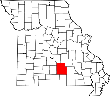 | |
| Villages | ||
| Townships |
| |
| Unincorporated communities | ||
| Footnotes | ‡This populated place also has portions in an adjacent county or counties | |