Summersville, Missouri
| Summersville, Missouri | |
|---|---|
| City | |
 Location of Summersville, Missouri | |
| Coordinates: 37°10′41″N 91°39′31″W / 37.17806°N 91.65861°WCoordinates: 37°10′41″N 91°39′31″W / 37.17806°N 91.65861°W | |
| Country | United States |
| State | Missouri |
| Counties | Texas, Shannon |
| Townships |
Spring Valley (Shannon) Carroll (Texas) |
| Government | |
| • Mayor | Marilyn Howell |
| Area[1] | |
| • Total | 1.11 sq mi (2.87 km2) |
| • Land | 1.11 sq mi (2.87 km2) |
| • Water | 0 sq mi (0 km2) |
| Elevation | 1,234 ft (376 m) |
| Population (2010)[2] | |
| • Total | 502 |
| • Estimate (2012[3]) | 500 |
| • Density | 452.3/sq mi (174.6/km2) |
| Time zone | Central (CST) (UTC-6) |
| • Summer (DST) | CDT (UTC-5) |
| ZIP code | 65571 |
| Area code(s) | 417 |
| FIPS code | 29-71512[4] |
| GNIS feature ID | 0727291[5] |
Summersville is a city in Shannon and Texas counties in the U.S. state of Missouri. The population was 502 at the 2010 census.
Geography
Summersville is located at 37°10′41″N 91°39′31″W / 37.17806°N 91.65861°W (37.178141, -91.658521).[6]
According to the United States Census Bureau, the city has a total area of 1.11 square miles (2.87 km2), all of it land.[1]
Demographics
| Historical population | |||
|---|---|---|---|
| Census | Pop. | %± | |
| 1900 | 187 | — | |
| 1910 | 236 | 26.2% | |
| 1920 | 286 | 21.2% | |
| 1930 | 316 | 10.5% | |
| 1940 | 306 | −3.2% | |
| 1950 | 306 | 0.0% | |
| 1960 | 356 | 16.3% | |
| 1970 | 435 | 22.2% | |
| 1980 | 551 | 26.7% | |
| 1990 | 571 | 3.6% | |
| 2000 | 544 | −4.7% | |
| 2010 | 502 | −7.7% | |
| Est. 2015 | 500 | [7] | −0.4% |
2010 census
As of the census[2] of 2010, there were 502 people, 232 households, and 133 families residing in the city. The population density was 452.3 inhabitants per square mile (174.6/km2). There were 269 housing units at an average density of 242.3 per square mile (93.6/km2). The racial makeup of the city was 96.8% White, 0.8% Native American, 0.2% Asian, and 2.2% from two or more races. Hispanic or Latino of any race were 1.4% of the population.
There were 232 households of which 25.9% had children under the age of 18 living with them, 40.5% were married couples living together, 12.5% had a female householder with no husband present, 4.3% had a male householder with no wife present, and 42.7% were non-families. 36.2% of all households were made up of individuals and 22.4% had someone living alone who was 65 years of age or older. The average household size was 2.16 and the average family size was 2.78.
The median age in the city was 43 years. 23.7% of residents were under the age of 18; 8.9% were between the ages of 18 and 24; 20% were from 25 to 44; 23.6% were from 45 to 64; and 24.1% were 65 years of age or older. The gender makeup of the city was 48.6% male and 51.4% female.
2000 census
As of the census[4] of 2000, there were 544 people, 236 households, and 148 families residing in the city. The population density was 489.0 people per square mile (189.2/km²). There were 284 housing units at an average density of 255.3 per square mile (98.8/km²). The racial makeup of the city was 98.53% White, 0.92% Native American, 0.18% Asian, and 0.37% from two or more races. Hispanic or Latino of any race were 0.37% of the population.
There were 236 households out of which 33.5% had children under the age of 18 living with them, 51.3% were married couples living together, 10.6% had a female householder with no husband present, and 36.9% were non-families. 35.6% of all households were made up of individuals and 25.0% had someone living alone who was 65 years of age or older. The average household size was 2.31 and the average family size was 2.96.
In the city the population was spread out with 28.1% under the age of 18, 8.5% from 18 to 24, 23.0% from 25 to 44, 18.4% from 45 to 64, and 22.1% who were 65 years of age or older. The median age was 35 years. For every 100 females there were 86.3 males. For every 100 females age 18 and over, there were 69.3 males.
The median income for a household in the city was $18,359, and the median income for a family was $22,500. Males had a median income of $21,563 versus $11,818 for females. The per capita income for the city was $10,163. About 25.0% of families and 32.2% of the population were below the poverty line, including 45.4% of those under age 18 and 24.0% of those age 65 or over.
References
- 1 2 "US Gazetteer files 2010". United States Census Bureau. Retrieved 2012-07-08.
- 1 2 "American FactFinder". United States Census Bureau. Retrieved 2012-07-08.
- ↑ "Population Estimates". United States Census Bureau. Retrieved 2013-05-30.
- 1 2 "American FactFinder". United States Census Bureau. Retrieved 2008-01-31.
- ↑ "US Board on Geographic Names". United States Geological Survey. 2007-10-25. Retrieved 2008-01-31.
- ↑ "US Gazetteer files: 2010, 2000, and 1990". United States Census Bureau. 2011-02-12. Retrieved 2011-04-23.
- ↑ "Annual Estimates of the Resident Population for Incorporated Places: April 1, 2010 to July 1, 2015". Retrieved July 2, 2016.
- ↑ "Census of Population and Housing". Census.gov. Retrieved June 4, 2015.
Municipalities and communities of Shannon County, Missouri, United States | ||
|---|---|---|
| Cities | 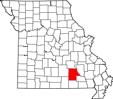 | |
| Villages | ||
| Townships |
| |
| Unincorporated communities | ||
| Ghost towns |
| |
| Footnotes | ‡This populated place also has portions in an adjacent county or counties | |
Municipalities and communities of Texas County, Missouri, United States | ||
|---|---|---|
| Cities | 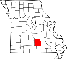 | |
| Villages | ||
| Townships |
| |
| Unincorporated communities | ||
| Footnotes | ‡This populated place also has portions in an adjacent county or counties | |